Kirksville Topo Map Illinois
To zoom in, hover over the map of Kirksville
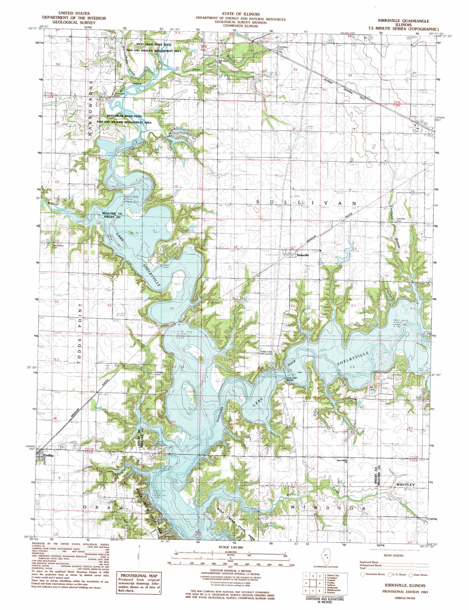
USGS Topo Quad 39088e6 - 1:24,000 scale
| Topo Map Name: | Kirksville |
| USGS Topo Quad ID: | 39088e6 |
| Print Size: | ca. 21 1/4" wide x 27" high |
| Southeast Coordinates: | 39.5° N latitude / 88.625° W longitude |
| Map Center Coordinates: | 39.5625° N latitude / 88.6875° W longitude |
| U.S. State: | IL |
| Filename: | o39088e6.jpg |
| Download Map JPG Image: | Kirksville topo map 1:24,000 scale |
| Map Type: | Topographic |
| Topo Series: | 7.5´ |
| Map Scale: | 1:24,000 |
| Source of Map Images: | United States Geological Survey (USGS) |
| Alternate Map Versions: |
Kirksville IL 1983, updated 1983 Download PDF Buy paper map Kirksville IL 1999, updated 2003 Download PDF Buy paper map Kirksville IL 2012 Download PDF Buy paper map Kirksville IL 2015 Download PDF Buy paper map |
1:24,000 Topo Quads surrounding Kirksville
Decatur |
Long Creek |
La Place |
Hammond |
Atwood |
Macon East |
Dalton City |
Lovington |
Cadwell |
Arthur |
Obed |
Findlay |
Kirksville |
Sullivan |
Cooksmill |
Tower Hill |
Shelbyville |
Middlesworth |
Windsor |
Mattoon West |
Lakewood |
Fancher |
Stewardson West |
Stewardson East |
Neoga |
> Back to 39088e1 at 1:100,000 scale
> Back to 39088a1 at 1:250,000 scale
> Back to U.S. Topo Maps home
Kirksville topo map: Gazetteer
Kirksville: Bridges
Coal Shaft Bridge elevation 183m 600′Cook Bridge (historical) elevation 183m 600′
Countyline Bridge elevation 183m 600′
Findlay Bridge elevation 183m 600′
Howell Bridge (historical) elevation 183m 600′
Kirksville: Dams
Elim Lake Dam elevation 187m 613′Elm Springs Park Lake Number 4 Dam elevation 195m 639′
Emil Lake Dam elevation 197m 646′
Kirksville: Parks
West Okaw River State Fish and Wildlife Management Area elevation 185m 606′Whitley Creek Recreation Area elevation 192m 629′
Wilborn Creek Recreation Area elevation 196m 643′
Kirksville: Populated Places
Kirksville elevation 206m 675′Kirksville: Reservoirs
Elim Lake elevation 187m 613′Elm Springs Park Lake Number 4 elevation 195m 639′
Emil Lake elevation 197m 646′
Kirksville: Streams
Camfield Branch elevation 183m 600′Dunn Branch elevation 185m 606′
Marrowbone Creek elevation 185m 606′
West Okaw River elevation 183m 600′
Wilborn Creek elevation 183m 600′
Wolf Creek elevation 183m 600′
Kirksville digital topo map on disk
Buy this Kirksville topo map showing relief, roads, GPS coordinates and other geographical features, as a high-resolution digital map file on DVD:
Northern Illinois, Northern Indiana & Southwestern Michigan
Buy digital topo maps: Northern Illinois, Northern Indiana & Southwestern Michigan