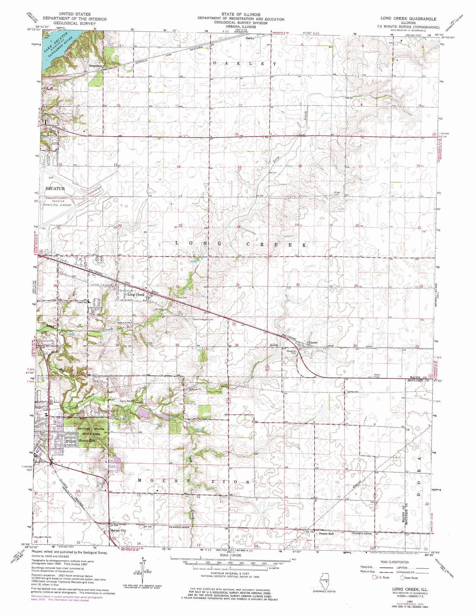
Long Creek Topo Map Illinois
To zoom in, hover over the map of Long Creek
USGS Topo Quad 39088g7 - 1:24,000 scale
| Topo Map Name: | Long Creek |
| USGS Topo Quad ID: | 39088g7 |
| Print Size: | ca. 21 1/4" wide x 27" high |
| Southeast Coordinates: | 39.75° N latitude / 88.75° W longitude |
| Map Center Coordinates: | 39.8125° N latitude / 88.8125° W longitude |
| U.S. State: | IL |
| Filename: | o39088g7.jpg |
| Download Map JPG Image: | Long Creek topo map 1:24,000 scale |
| Map Type: | Topographic |
| Topo Series: | 7.5´ |
| Map Scale: | 1:24,000 |
| Source of Map Images: | United States Geological Survey (USGS) |
| Alternate Map Versions: |
Long Creek IL 1967, updated 1968 Download PDF Buy paper map Long Creek IL 1967, updated 1976 Download PDF Buy paper map Long Creek IL 1998, updated 2002 Download PDF Buy paper map Long Creek IL 2012 Download PDF Buy paper map Long Creek IL 2015 Download PDF Buy paper map |
1:24,000 Topo Quads surrounding Long Creek
Kenney |
Maroa |
Weldon West |
Weldon East |
Monticello |
Warrensburg |
Forsyth |
Argenta |
Cerro Gordo |
Bement |
Harristown |
Decatur |
Long Creek |
La Place |
Hammond |
Macon West |
Macon East |
Dalton City |
Lovington |
Cadwell |
Assumption |
Obed |
Findlay |
Kirksville |
Sullivan |
> Back to 39088e1 at 1:100,000 scale
> Back to 39088a1 at 1:250,000 scale
> Back to U.S. Topo Maps home
Long Creek topo map: Gazetteer
Long Creek: Airports
Corman Acres Airport elevation 220m 721′Decatur Airport elevation 205m 672′
Long Creek: Parks
Bois Du Sangamon Nature Preserve elevation 198m 649′Fort Daniel Conservation Area elevation 200m 656′
Spitler Woods Nature Preserve elevation 197m 646′
Spitler Woods State Park elevation 196m 643′
Long Creek: Populated Places
Casner elevation 215m 705′Hervey City elevation 213m 698′
Long Creek elevation 204m 669′
Mount Zion elevation 211m 692′
Prairie Hall elevation 215m 705′
Sangamon elevation 208m 682′
Long Creek: Streams
Big Creek elevation 190m 623′Long Creek digital topo map on disk
Buy this Long Creek topo map showing relief, roads, GPS coordinates and other geographical features, as a high-resolution digital map file on DVD:
Northern Illinois, Northern Indiana & Southwestern Michigan
Buy digital topo maps: Northern Illinois, Northern Indiana & Southwestern Michigan