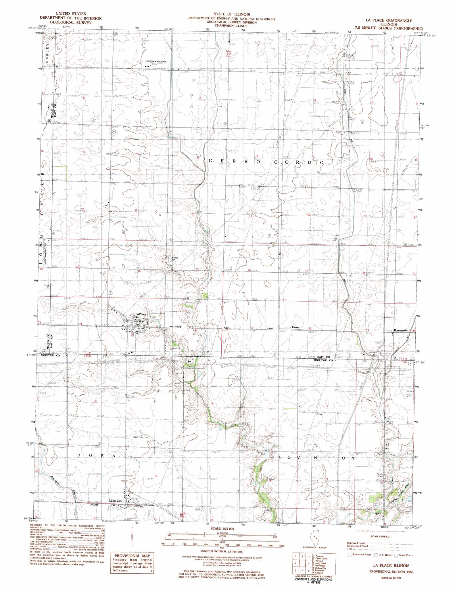
La Place Topo Map Illinois
To zoom in, hover over the map of La Place
USGS Topo Quad 39088g6 - 1:24,000 scale
| Topo Map Name: | La Place |
| USGS Topo Quad ID: | 39088g6 |
| Print Size: | ca. 21 1/4" wide x 27" high |
| Southeast Coordinates: | 39.75° N latitude / 88.625° W longitude |
| Map Center Coordinates: | 39.8125° N latitude / 88.6875° W longitude |
| U.S. State: | IL |
| Filename: | o39088g6.jpg |
| Download Map JPG Image: | La Place topo map 1:24,000 scale |
| Map Type: | Topographic |
| Topo Series: | 7.5´ |
| Map Scale: | 1:24,000 |
| Source of Map Images: | United States Geological Survey (USGS) |
| Alternate Map Versions: |
La Place IL 1983, updated 1983 Download PDF Buy paper map La Place IL 1999, updated 2003 Download PDF Buy paper map La Place IL 2012 Download PDF Buy paper map La Place IL 2015 Download PDF Buy paper map |
1:24,000 Topo Quads surrounding La Place
Maroa |
Weldon West |
Weldon East |
Monticello |
Seymour |
Forsyth |
Argenta |
Cerro Gordo |
Bement |
Ivesdale |
Decatur |
Long Creek |
La Place |
Hammond |
Atwood |
Macon East |
Dalton City |
Lovington |
Cadwell |
Arthur |
Obed |
Findlay |
Kirksville |
Sullivan |
Cooksmill |
> Back to 39088e1 at 1:100,000 scale
> Back to 39088a1 at 1:250,000 scale
> Back to U.S. Topo Maps home
La Place topo map: Gazetteer
La Place: Airports
Dawson Farms Airport elevation 203m 666′Henry Airport elevation 224m 734′
White Landing Strip elevation 216m 708′
La Place: Canals
Ditch Number 3 elevation 207m 679′Hammond Mutual Ditch elevation 198m 649′
La Place: Populated Places
Burrowsville elevation 205m 672′Lake City elevation 210m 688′
LaPlace elevation 213m 698′
Lintner elevation 208m 682′
La Place: Post Offices
La Place Post Office elevation 214m 702′La Place digital topo map on disk
Buy this La Place topo map showing relief, roads, GPS coordinates and other geographical features, as a high-resolution digital map file on DVD:
Northern Illinois, Northern Indiana & Southwestern Michigan
Buy digital topo maps: Northern Illinois, Northern Indiana & Southwestern Michigan