Bald Knob Topo Map Illinois
To zoom in, hover over the map of Bald Knob
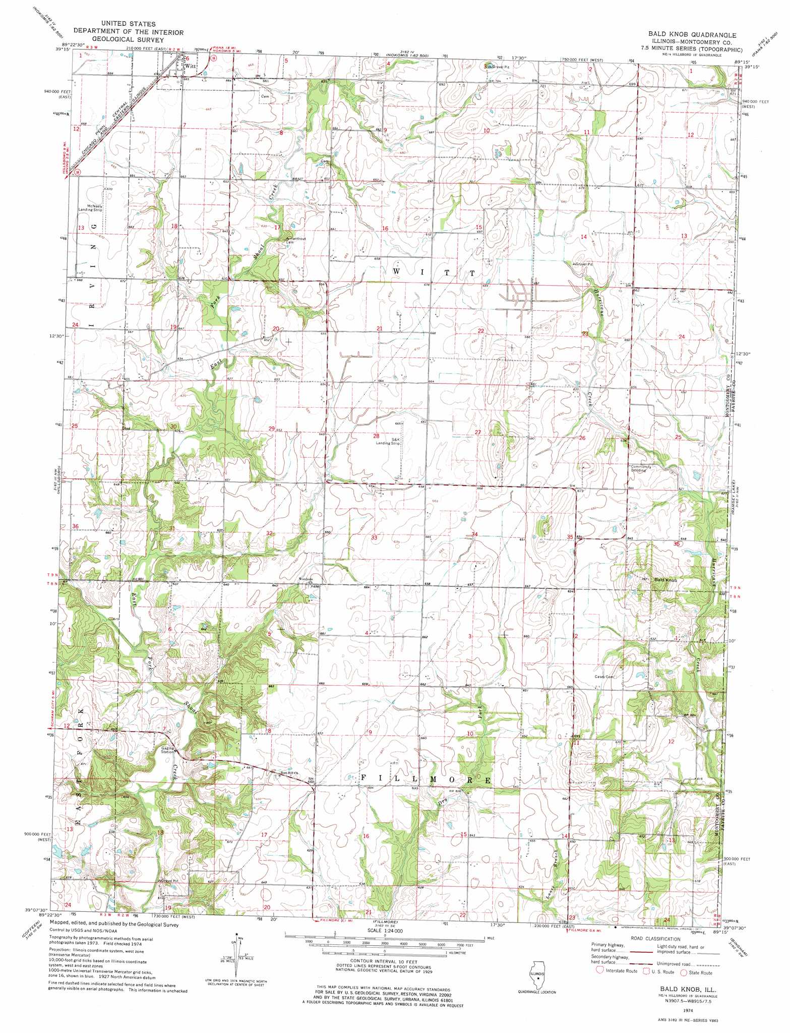
USGS Topo Quad 39089b3 - 1:24,000 scale
| Topo Map Name: | Bald Knob |
| USGS Topo Quad ID: | 39089b3 |
| Print Size: | ca. 21 1/4" wide x 27" high |
| Southeast Coordinates: | 39.125° N latitude / 89.25° W longitude |
| Map Center Coordinates: | 39.1875° N latitude / 89.3125° W longitude |
| U.S. State: | IL |
| Filename: | o39089b3.jpg |
| Download Map JPG Image: | Bald Knob topo map 1:24,000 scale |
| Map Type: | Topographic |
| Topo Series: | 7.5´ |
| Map Scale: | 1:24,000 |
| Source of Map Images: | United States Geological Survey (USGS) |
| Alternate Map Versions: |
Bald Knob IL 1974, updated 1977 Download PDF Buy paper map Bald Knob IL 1998, updated 2002 Download PDF Buy paper map Bald Knob IL 2012 Download PDF Buy paper map Bald Knob IL 2015 Download PDF Buy paper map |
1:24,000 Topo Quads surrounding Bald Knob
Raymond Ne |
Morrisonville |
Clarksdale |
Owaneco |
Pana |
Raymond |
Nokomis Sw |
Nokomis |
Ohlman |
Oconee |
Butler |
Hillsboro |
Bald Knob |
Ramsey Lake |
Ramsey |
Sorento North |
Coffeen |
Fillmore |
Bingham |
Vera |
Sorento South |
Greenville |
Mulberry Grove |
Hagarstown |
Vandalia |
> Back to 39089a1 at 1:100,000 scale
> Back to 39088a1 at 1:250,000 scale
> Back to U.S. Topo Maps home
Bald Knob topo map: Gazetteer
Bald Knob: Airports
McNeely Landing Strip elevation 204m 669′OK Flying Club Incorporated Airport elevation 202m 662′
Bald Knob: Summits
Bald Knob elevation 232m 761′Bald Knob digital topo map on disk
Buy this Bald Knob topo map showing relief, roads, GPS coordinates and other geographical features, as a high-resolution digital map file on DVD:
Northern Illinois, Northern Indiana & Southwestern Michigan
Buy digital topo maps: Northern Illinois, Northern Indiana & Southwestern Michigan