Raymond Ne Topo Map Illinois
To zoom in, hover over the map of Raymond Ne
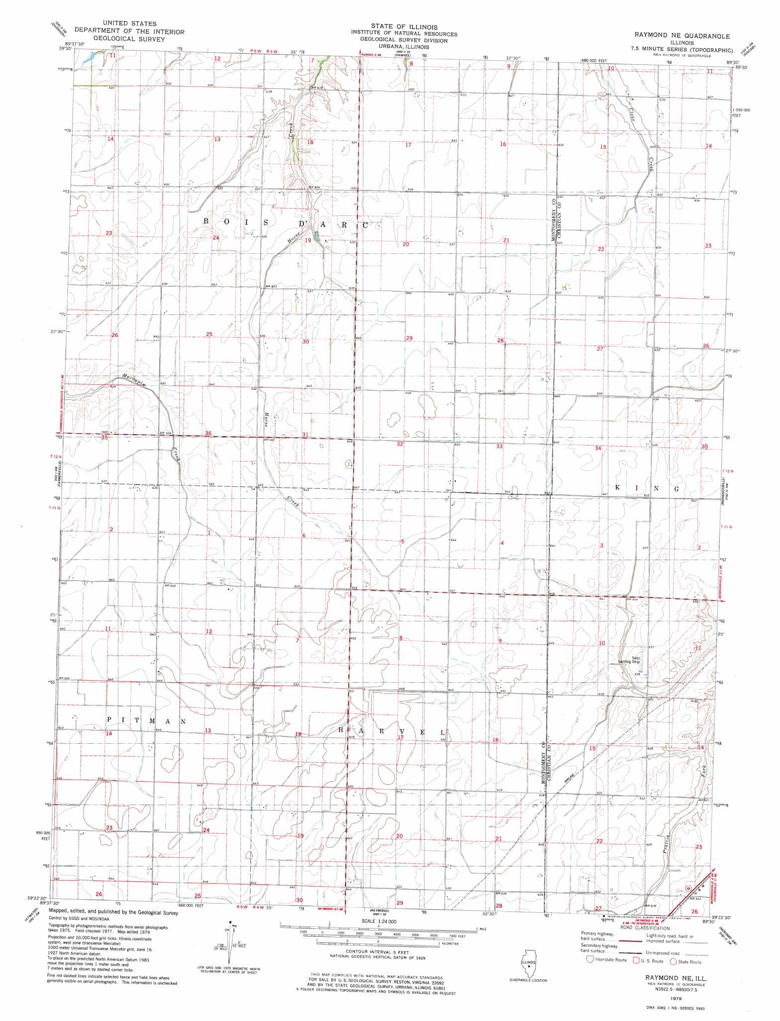
USGS Topo Quad 39089d5 - 1:24,000 scale
| Topo Map Name: | Raymond Ne |
| USGS Topo Quad ID: | 39089d5 |
| Print Size: | ca. 21 1/4" wide x 27" high |
| Southeast Coordinates: | 39.375° N latitude / 89.5° W longitude |
| Map Center Coordinates: | 39.4375° N latitude / 89.5625° W longitude |
| U.S. State: | IL |
| Filename: | o39089d5.jpg |
| Download Map JPG Image: | Raymond Ne topo map 1:24,000 scale |
| Map Type: | Topographic |
| Topo Series: | 7.5´ |
| Map Scale: | 1:24,000 |
| Source of Map Images: | United States Geological Survey (USGS) |
| Alternate Map Versions: |
Raymond NE IL 1998, updated 2002 Download PDF Buy paper map Raymond NE IL 2012 Download PDF Buy paper map Raymond NE IL 2015 Download PDF Buy paper map |
1:24,000 Topo Quads surrounding Raymond Ne
Loami |
Chatham |
New City |
Edinburg |
Grove City |
Virden North |
Divernon |
Pawnee |
Kincaid |
Taylorville |
Virden South |
Farmersville |
Raymond Ne |
Morrisonville |
Clarksdale |
Carlinville East |
Atwater |
Raymond |
Nokomis Sw |
Nokomis |
Gillespie North |
Litchfield |
Butler |
Hillsboro |
Bald Knob |
> Back to 39089a1 at 1:100,000 scale
> Back to 39088a1 at 1:250,000 scale
> Back to U.S. Topo Maps home
Raymond Ne digital topo map on disk
Buy this Raymond Ne topo map showing relief, roads, GPS coordinates and other geographical features, as a high-resolution digital map file on DVD:
Northern Illinois, Northern Indiana & Southwestern Michigan
Buy digital topo maps: Northern Illinois, Northern Indiana & Southwestern Michigan