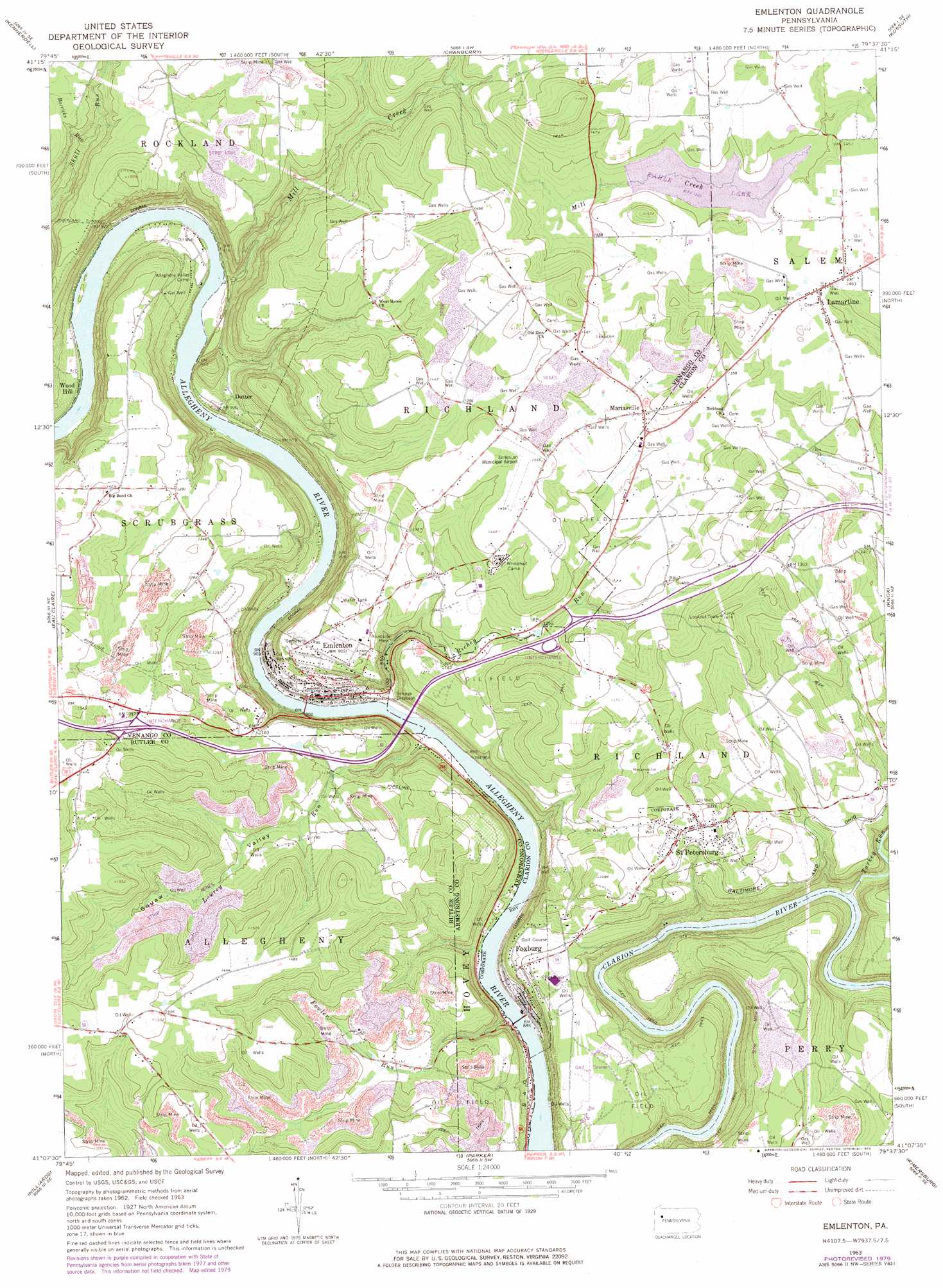
Emlenton Topo Map Pennsylvania
To zoom in, hover over the map of Emlenton
USGS Topo Quad 41079b6 - 1:24,000 scale
| Topo Map Name: | Emlenton |
| USGS Topo Quad ID: | 41079b6 |
| Print Size: | ca. 21 1/4" wide x 27" high |
| Southeast Coordinates: | 41.125° N latitude / 79.625° W longitude |
| Map Center Coordinates: | 41.1875° N latitude / 79.6875° W longitude |
| U.S. State: | PA |
| Filename: | o41079b6.jpg |
| Download Map JPG Image: | Emlenton topo map 1:24,000 scale |
| Map Type: | Topographic |
| Topo Series: | 7.5´ |
| Map Scale: | 1:24,000 |
| Source of Map Images: | United States Geological Survey (USGS) |
| Alternate Map Versions: |
Emlenton PA 1963, updated 1965 Download PDF Buy paper map Emlenton PA 1963, updated 1971 Download PDF Buy paper map Emlenton PA 1963, updated 1973 Download PDF Buy paper map Emlenton PA 1963, updated 1979 Download PDF Buy paper map Emlenton PA 2010 Download PDF Buy paper map Emlenton PA 2013 Download PDF Buy paper map Emlenton PA 2016 Download PDF Buy paper map |
1:24,000 Topo Quads surrounding Emlenton
Utica |
Franklin |
Oil City |
President |
Tionesta |
Polk |
Kennerdell |
Cranberry |
Kossuth |
Fryburg |
Barkeyville |
Eau Claire |
Emlenton |
Knox |
Clarion |
West Sunbury |
Hilliards |
Parker |
Rimersburg |
Sligo |
Mount Chestnut |
East Butler |
Chicora |
East Brady |
Templeton |
> Back to 41079a1 at 1:100,000 scale
> Back to 41078a1 at 1:250,000 scale
> Back to U.S. Topo Maps home
Emlenton topo map: Gazetteer
Emlenton: Airports
Emlenton Municipal Airport elevation 432m 1417′Hunts Cove Airport elevation 276m 905′
Emlenton: Dams
Kahle Lake Dam elevation 420m 1377′Emlenton: Populated Places
Dotter elevation 278m 912′Emlenton elevation 278m 912′
Foxburg elevation 304m 997′
Lamartine elevation 432m 1417′
Mariasville elevation 413m 1354′
Saint Petersburg elevation 427m 1400′
Wood Hill elevation 279m 915′
Emlenton: Reservoirs
Kahle Lake elevation 420m 1377′Emlenton: Streams
Barricks Run elevation 344m 1128′Fowler Run elevation 259m 849′
Lowrey Run elevation 261m 856′
Mill Creek elevation 266m 872′
Richey Run elevation 259m 849′
Turkey Run elevation 275m 902′
Emlenton: Summits
Alum Rock elevation 362m 1187′Emlenton: Valleys
Squaw Valley elevation 267m 875′Emlenton digital topo map on disk
Buy this Emlenton topo map showing relief, roads, GPS coordinates and other geographical features, as a high-resolution digital map file on DVD:
 map DVD")