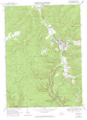
Sheffield Topo Map Pennsylvania
To zoom in, hover over the map of Sheffield
USGS Topo Quad 41079f1 - 1:24,000 scale
| Topo Map Name: | Sheffield |
| USGS Topo Quad ID: | 41079f1 |
| Print Size: | ca. 21 1/4" wide x 27" high |
| Southeast Coordinates: | 41.625° N latitude / 79° W longitude |
| Map Center Coordinates: | 41.6875° N latitude / 79.0625° W longitude |
| U.S. State: | PA |
| Filename: | o41079f1.jpg |
| Download Map JPG Image: | Sheffield topo map 1:24,000 scale |
| Map Type: | Topographic |
| Topo Series: | 7.5´ |
| Map Scale: | 1:24,000 |
| Source of Map Images: | United States Geological Survey (USGS) |
| Alternate Map Versions: |
Sheffield PA 1966, updated 1969 Download PDF Buy paper map Sheffield PA 1966, updated 1973 Download PDF Buy paper map Sheffield PA 2011 Download PDF Buy paper map Sheffield PA 2013 Download PDF Buy paper map Sheffield PA 2016 Download PDF Buy paper map |
| FStopo: | US Forest Service topo Sheffield is available: Download FStopo PDF Download FStopo TIF |
1:24,000 Topo Quads surrounding Sheffield
> Back to 41079e1 at 1:100,000 scale
> Back to 41078a1 at 1:250,000 scale
> Back to U.S. Topo Maps home
Sheffield topo map: Gazetteer
Sheffield: Airports
Cherry Grove Airport elevation 602m 1975′Sheffield: Forests
Allegheny National Forest elevation 570m 1870′Sheffield: Populated Places
Barnes elevation 407m 1335′Donaldson elevation 409m 1341′
Henrys Mills elevation 394m 1292′
Hoover elevation 407m 1335′
Milltown elevation 411m 1348′
Old Sheffield elevation 410m 1345′
Saybrook elevation 410m 1345′
Sheffield elevation 409m 1341′
Shelander Hollow elevation 422m 1384′
Tiona elevation 416m 1364′
Sheffield: Reservoirs
Deer Lick Reservoir elevation 454m 1489′Sheffield: Streams
Deer Lick Run elevation 411m 1348′Dodge Run elevation 399m 1309′
Duck Eddy Run elevation 394m 1292′
Dunham Run elevation 408m 1338′
East Branch Tionesta Creek elevation 406m 1332′
Flat Run elevation 419m 1374′
Fourmile Run elevation 408m 1338′
Lacey Run elevation 474m 1555′
Little Arnot Run elevation 418m 1371′
Martin Run elevation 412m 1351′
Mead Run elevation 385m 1263′
Messenger Run elevation 391m 1282′
Pell Run elevation 391m 1282′
Rock Run elevation 396m 1299′
Sixmile Run elevation 414m 1358′
South Branch Tionesta Creek elevation 398m 1305′
Twomile Run elevation 402m 1318′
West Branch Tionesta Creek elevation 396m 1299′
Sheffield: Summits
Bull Hill elevation 612m 2007′Sheffield: Trails
North Country Trail elevation 437m 1433′Sheffield digital topo map on disk
Buy this Sheffield topo map showing relief, roads, GPS coordinates and other geographical features, as a high-resolution digital map file on DVD:


