Hart Lake Topo Map Oregon
To zoom in, hover over the map of Hart Lake
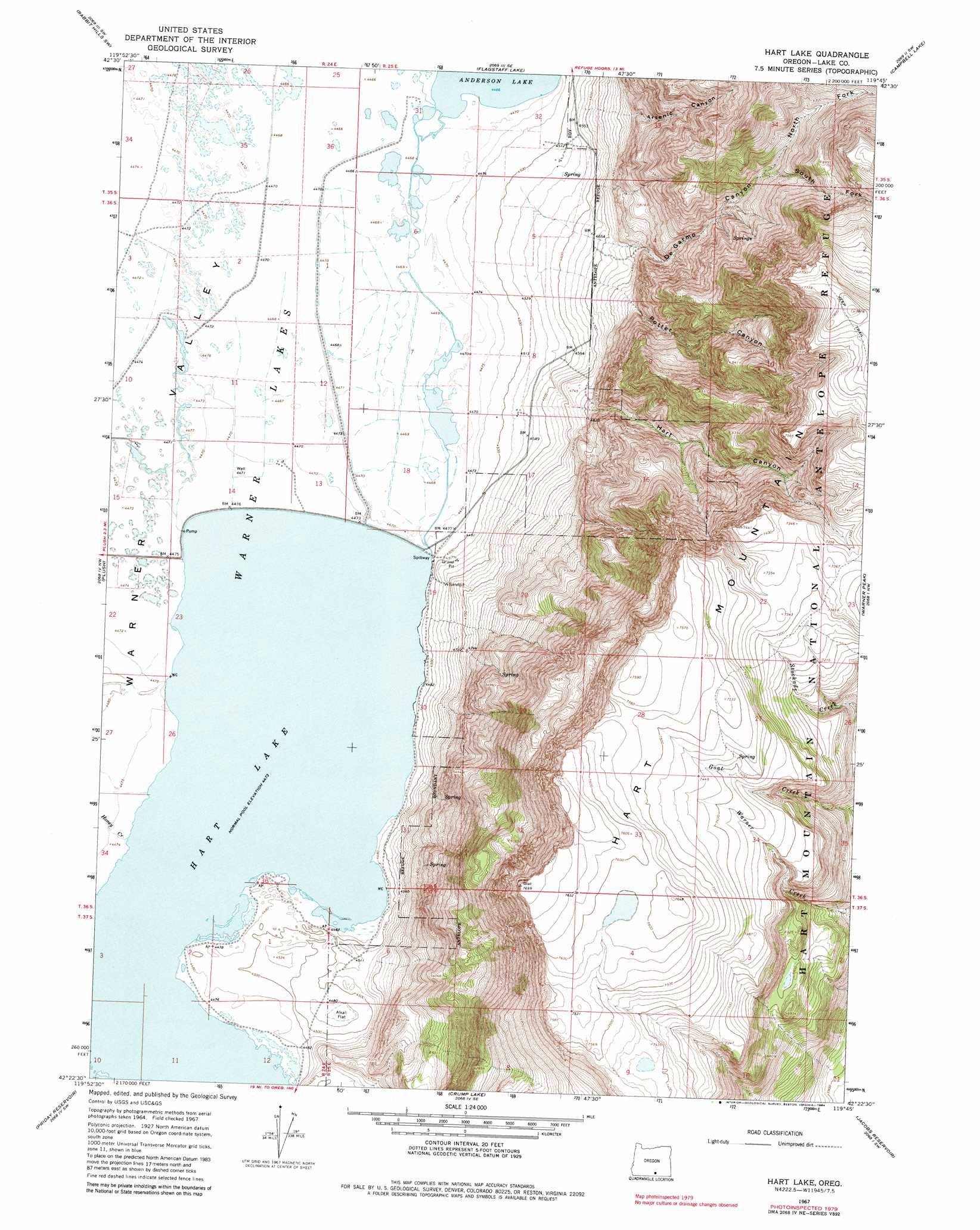
USGS Topo Quad 42119d7 - 1:24,000 scale
| Topo Map Name: | Hart Lake |
| USGS Topo Quad ID: | 42119d7 |
| Print Size: | ca. 21 1/4" wide x 27" high |
| Southeast Coordinates: | 42.375° N latitude / 119.75° W longitude |
| Map Center Coordinates: | 42.4375° N latitude / 119.8125° W longitude |
| U.S. State: | OR |
| Filename: | o42119d7.jpg |
| Download Map JPG Image: | Hart Lake topo map 1:24,000 scale |
| Map Type: | Topographic |
| Topo Series: | 7.5´ |
| Map Scale: | 1:24,000 |
| Source of Map Images: | United States Geological Survey (USGS) |
| Alternate Map Versions: |
Hart Lake OR 1967, updated 1969 Download PDF Buy paper map Hart Lake OR 1967, updated 1984 Download PDF Buy paper map Hart Lake OR 1967, updated 1984 Download PDF Buy paper map Hart Lake OR 2011 Download PDF Buy paper map Hart Lake OR 2014 Download PDF Buy paper map |
1:24,000 Topo Quads surrounding Hart Lake
Commodore Ridge |
Rabbit Hills Nw |
Rabbit Hills Ne |
Bluejoint Lake West |
Bluejoint Lake East |
Cooper Draw |
Rabbit Hills Sw |
Flagstaff Lake |
Campbell Lake |
Flook Lake |
Drake Peak Ne |
Plush |
Hart Lake |
Warner Peak |
Swede Knoll |
Drake Peak |
Priday Reservoir |
Crump Lake |
Jacobs Reservoir |
Alger Lake |
Sage Hen Butte |
Adel |
Calderwood Reservoir |
Mud Lake Reservoir |
Guano Lake |
> Back to 42119a1 at 1:100,000 scale
> Back to 42118a1 at 1:250,000 scale
> Back to U.S. Topo Maps home
Hart Lake topo map: Gazetteer
Hart Lake: Dams
Hart Lake Dam elevation 1365m 4478′Hart Lake: Flats
Alkali Flat elevation 1365m 4478′Hart Lake: Lakes
Warner Lakes elevation 1364m 4475′Hart Lake: Reservoirs
Hart Lake elevation 1365m 4478′Vinyard Lake elevation 1363m 4471′
Hart Lake: Streams
Givens Slough elevation 1364m 4475′Honey Creek elevation 1365m 4478′
Norton Creek elevation 1460m 4790′
Hart Lake: Summits
Hart Mountain elevation 2330m 7644′Hart Lake: Valleys
Arsenic Canyon elevation 1376m 4514′De Garmo Canyon elevation 1373m 4504′
Hart Canyon elevation 1396m 4580′
North Fork DeGarmo Canyon elevation 1786m 5859′
Potter Canyon elevation 1384m 4540′
South Fork DeGarmo Canyon elevation 1779m 5836′
Hart Lake digital topo map on disk
Buy this Hart Lake topo map showing relief, roads, GPS coordinates and other geographical features, as a high-resolution digital map file on DVD: