Plush Topo Map Oregon
To zoom in, hover over the map of Plush
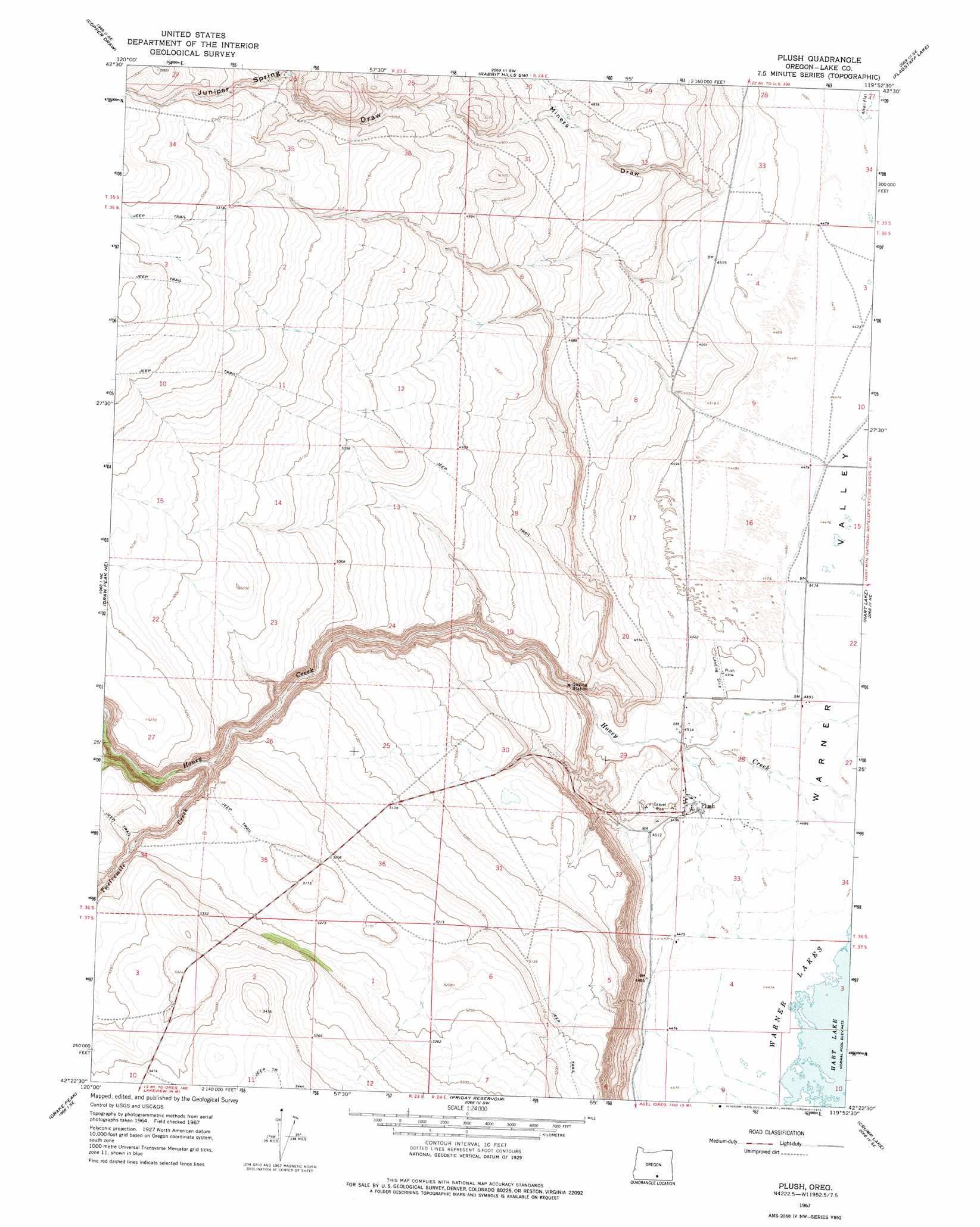
USGS Topo Quad 42119d8 - 1:24,000 scale
| Topo Map Name: | Plush |
| USGS Topo Quad ID: | 42119d8 |
| Print Size: | ca. 21 1/4" wide x 27" high |
| Southeast Coordinates: | 42.375° N latitude / 119.875° W longitude |
| Map Center Coordinates: | 42.4375° N latitude / 119.9375° W longitude |
| U.S. State: | OR |
| Filename: | o42119d8.jpg |
| Download Map JPG Image: | Plush topo map 1:24,000 scale |
| Map Type: | Topographic |
| Topo Series: | 7.5´ |
| Map Scale: | 1:24,000 |
| Source of Map Images: | United States Geological Survey (USGS) |
| Alternate Map Versions: |
Plush OR 1967, updated 1969 Download PDF Buy paper map Plush OR 1967, updated 1975 Download PDF Buy paper map Plush OR 1967, updated 1975 Download PDF Buy paper map Plush OR 2011 Download PDF Buy paper map Plush OR 2014 Download PDF Buy paper map |
1:24,000 Topo Quads surrounding Plush
Lake Abert North |
Commodore Ridge |
Rabbit Hills Nw |
Rabbit Hills Ne |
Bluejoint Lake West |
Lake Abert South |
Cooper Draw |
Rabbit Hills Sw |
Flagstaff Lake |
Campbell Lake |
Little Honey Creek |
Drake Peak Ne |
Plush |
Hart Lake |
Warner Peak |
Crook Peak |
Drake Peak |
Priday Reservoir |
Crump Lake |
Jacobs Reservoir |
Horse Prairie |
Sage Hen Butte |
Adel |
Calderwood Reservoir |
Mud Lake Reservoir |
> Back to 42119a1 at 1:100,000 scale
> Back to 42118a1 at 1:250,000 scale
> Back to U.S. Topo Maps home
Plush topo map: Gazetteer
Plush: Parks
Egan County Park elevation 1374m 4507′Plush: Populated Places
Plush elevation 1375m 4511′Plush: Post Offices
Plush Post Office elevation 1375m 4511′Plush: Streams
Twelvemile Creek elevation 1502m 4927′Plush: Valleys
Juniper Spring Draw elevation 1452m 4763′Miners Draw elevation 1376m 4514′
Plush digital topo map on disk
Buy this Plush topo map showing relief, roads, GPS coordinates and other geographical features, as a high-resolution digital map file on DVD: