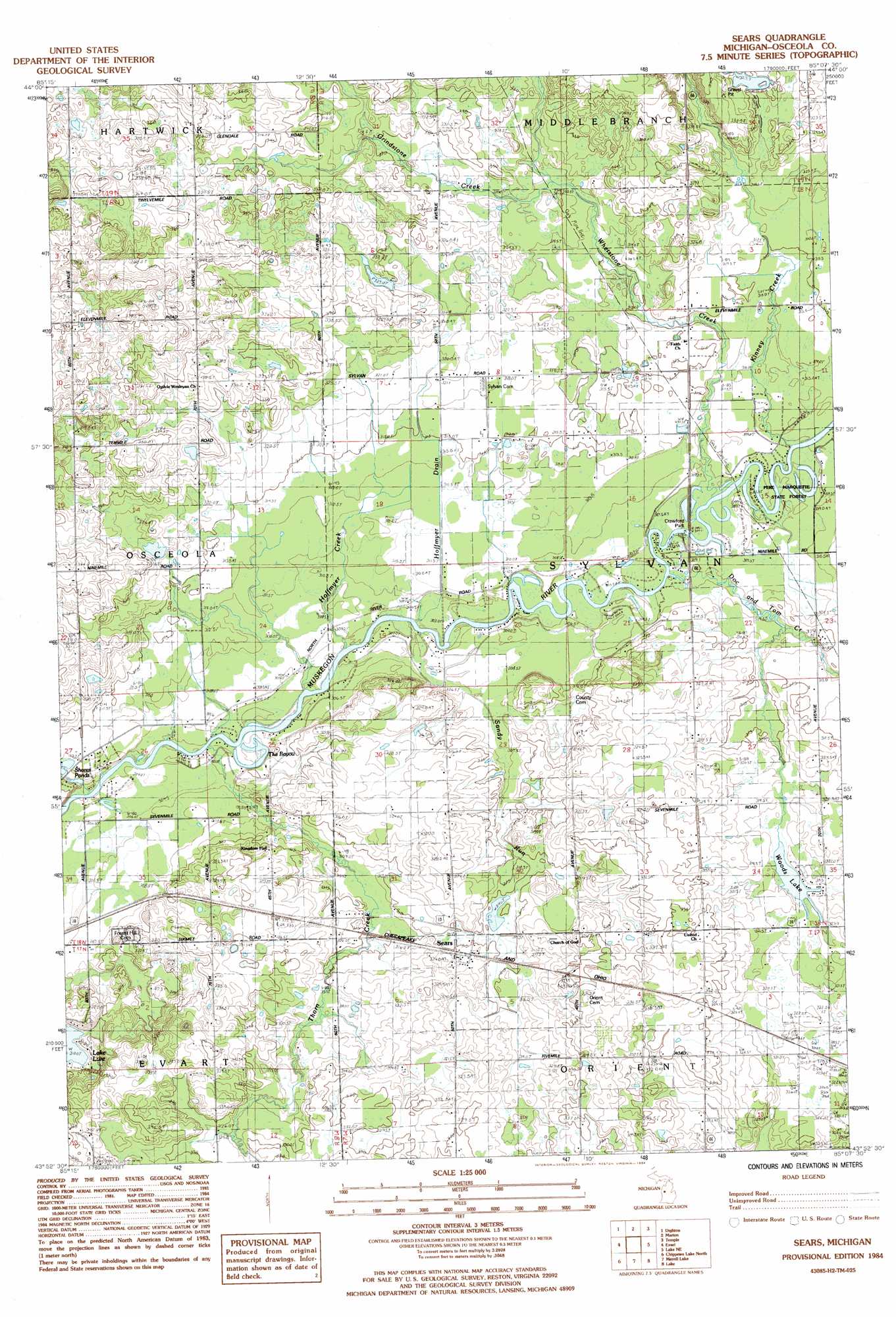
Sears Topo Map Michigan
To zoom in, hover over the map of Sears
USGS Topo Quad 43085h2 - 1:25,000 scale
| Topo Map Name: | Sears |
| USGS Topo Quad ID: | 43085h2 |
| Print Size: | ca. 21 1/4" wide x 27" high |
| Southeast Coordinates: | 43.875° N latitude / 85.125° W longitude |
| Map Center Coordinates: | 43.9375° N latitude / 85.1875° W longitude |
| U.S. State: | MI |
| Filename: | l43085h2.jpg |
| Download Map JPG Image: | Sears topo map 1:25,000 scale |
| Map Type: | Topographic |
| Topo Series: | 7.5´ |
| Map Scale: | 1:25,000 |
| Source of Map Images: | United States Geological Survey (USGS) |
| Alternate Map Versions: |
Sears MI 1984, updated 1984 Download PDF Buy paper map |
1:24,000 Topo Quads surrounding Sears
Cadillac South |
Lucas |
Mcbain |
Falmouth |
Moddersville |
Le Roy |
Dighton |
Marion |
Temple |
Prestle Creek |
Slaybaugh Corner |
Evart |
Sears |
Lake Ne |
Lake George |
Hersey |
Chippewa Lake North |
Merrill Lake |
Lake |
Woods |
Big Rapids |
Chippewa Lake South |
Mecosta Nw |
Sherman City |
Weidman |
> Back to 43085e1 at 1:100,000 scale
> Back to 43084a1 at 1:250,000 scale
> Back to U.S. Topo Maps home
Sears topo map: Gazetteer
Sears: Canals
Hoffmyer Drain elevation 311m 1020′Sears: Lakes
Shores Pond elevation 310m 1017′The Bayou elevation 301m 987′
Woods Lake elevation 315m 1033′
Sears: Parks
Crawford Park elevation 306m 1003′Sears: Populated Places
Sears elevation 318m 1043′Sears: Post Offices
Sears Post Office elevation 319m 1046′Sears: Streams
Chippewa Creek elevation 303m 994′Doc and Tom Creek elevation 305m 1000′
Grindstone Creek elevation 320m 1049′
Hoffmyer Creek elevation 302m 990′
Kinney Creek elevation 306m 1003′
Sandy Run elevation 303m 994′
Thorn Creek elevation 303m 994′
Whetstone Creek elevation 304m 997′
Sears digital topo map on disk
Buy this Sears topo map showing relief, roads, GPS coordinates and other geographical features, as a high-resolution digital map file on DVD: