Lucas Topo Map Michigan
To zoom in, hover over the map of Lucas
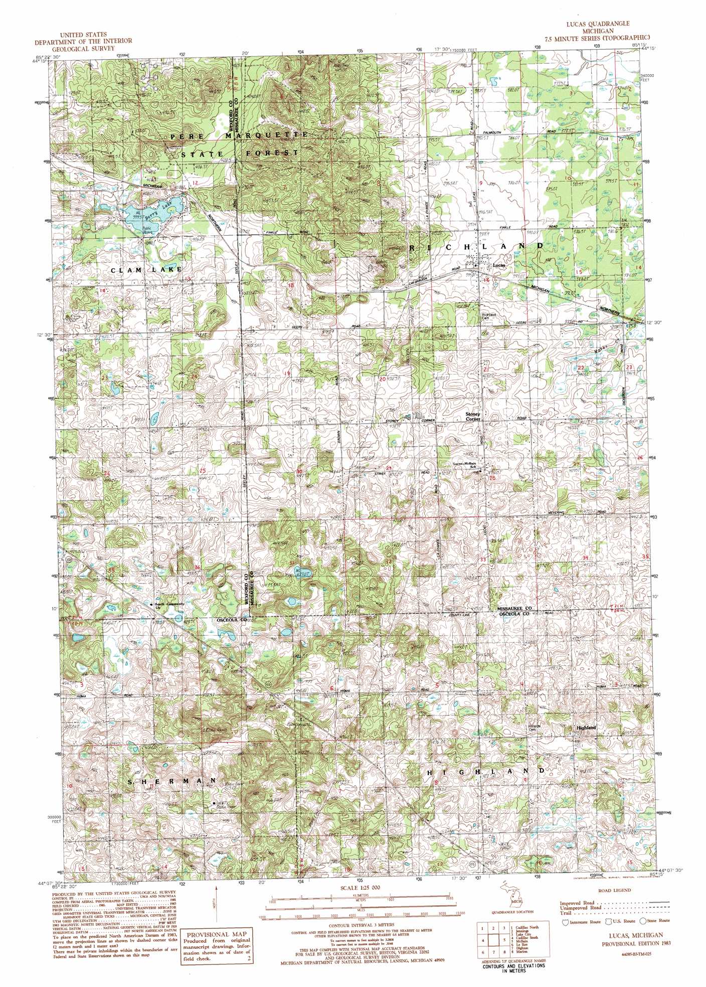
USGS Topo Quad 44085b3 - 1:25,000 scale
| Topo Map Name: | Lucas |
| USGS Topo Quad ID: | 44085b3 |
| Print Size: | ca. 21 1/4" wide x 27" high |
| Southeast Coordinates: | 44.125° N latitude / 85.25° W longitude |
| Map Center Coordinates: | 44.1875° N latitude / 85.3125° W longitude |
| U.S. State: | MI |
| Filename: | l44085b3.jpg |
| Download Map JPG Image: | Lucas topo map 1:25,000 scale |
| Map Type: | Topographic |
| Topo Series: | 7.5´ |
| Map Scale: | 1:25,000 |
| Source of Map Images: | United States Geological Survey (USGS) |
| Alternate Map Versions: |
Lucas MI 1983, updated 1984 Download PDF Buy paper map |
1:24,000 Topo Quads surrounding Lucas
Mesick Ne |
Manton |
Arlene |
Morey |
Stittsville |
Boon |
Cadillac North |
Jennings |
Lake City |
Dinca |
Luther Ne |
Cadillac South |
Lucas |
Mcbain |
Falmouth |
Luther Se |
Le Roy |
Dighton |
Marion |
Temple |
Reed City North |
Slaybaugh Corner |
Evart |
Sears |
Lake Ne |
> Back to 44085a1 at 1:100,000 scale
> Back to 44084a1 at 1:250,000 scale
> Back to U.S. Topo Maps home
Lucas topo map: Gazetteer
Lucas: Lakes
Berry Lake elevation 400m 1312′Lucas: Populated Places
Highland elevation 411m 1348′Lucas elevation 394m 1292′
Stoney Corner elevation 413m 1354′
Lucas: Post Offices
Elton Post Office (historical) elevation 426m 1397′Lucas Post Office (historical) elevation 394m 1292′
Lucas digital topo map on disk
Buy this Lucas topo map showing relief, roads, GPS coordinates and other geographical features, as a high-resolution digital map file on DVD: