Oelrichs Ne Topo Map South Dakota
To zoom in, hover over the map of Oelrichs Ne
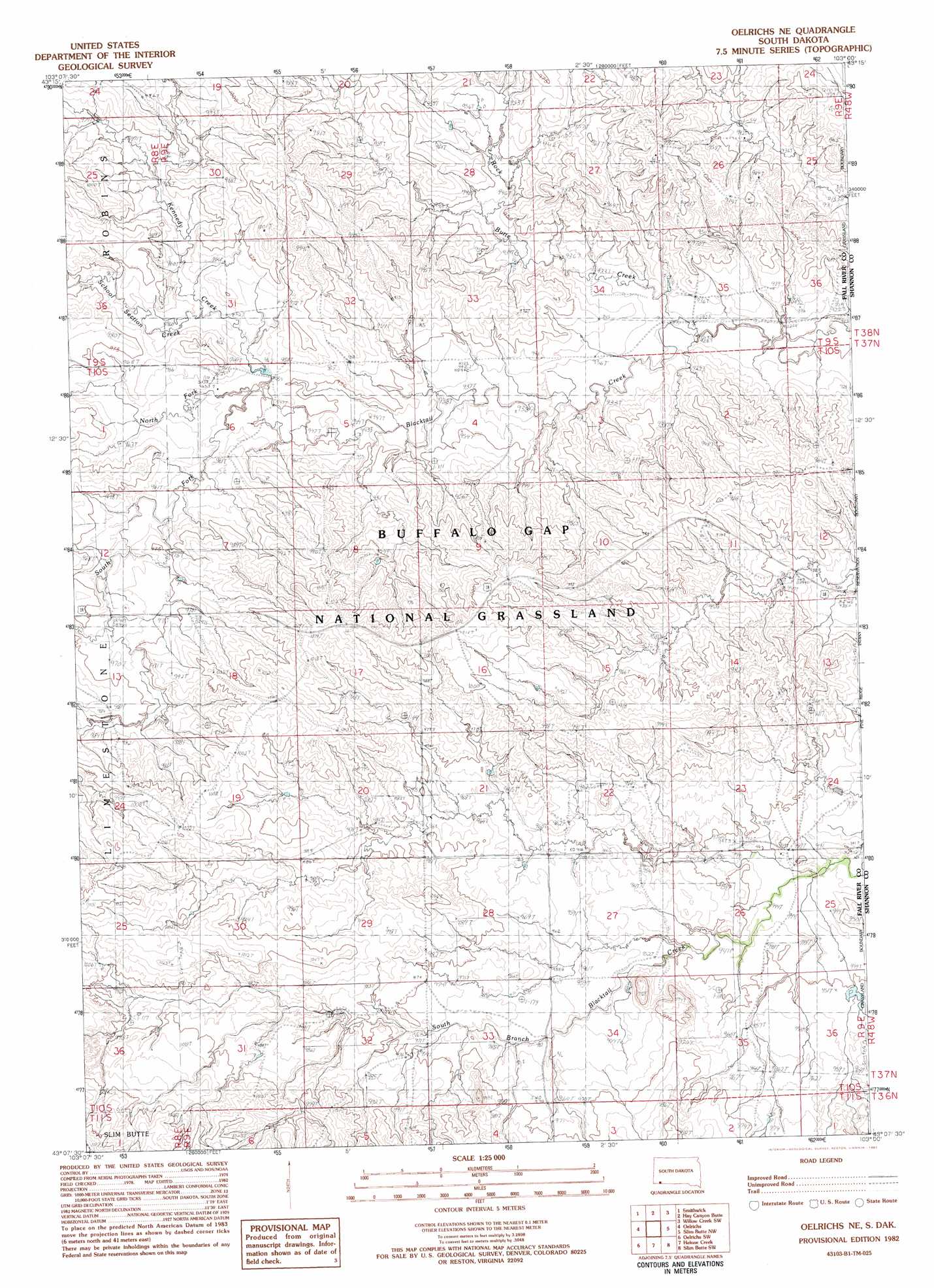
USGS Topo Quad 43103b1 - 1:25,000 scale
| Topo Map Name: | Oelrichs Ne |
| USGS Topo Quad ID: | 43103b1 |
| Print Size: | ca. 21 1/4" wide x 27" high |
| Southeast Coordinates: | 43.125° N latitude / 103° W longitude |
| Map Center Coordinates: | 43.1875° N latitude / 103.0625° W longitude |
| U.S. State: | SD |
| Filename: | l43103b1.jpg |
| Download Map JPG Image: | Oelrichs Ne topo map 1:25,000 scale |
| Map Type: | Topographic |
| Topo Series: | 7.5´ |
| Map Scale: | 1:25,000 |
| Source of Map Images: | United States Geological Survey (USGS) |
| Alternate Map Versions: | |
| FStopo: | US Forest Service topo Oelrichs NE is available: Download FStopo PDF Download FStopo TIF |
1:24,000 Topo Quads surrounding Oelrichs Ne
Buffalo Gap |
Smithwick Nw |
Smithwick Ne |
Willow Creek Nw |
Willow Creek Ne |
Hot Springs Se |
Smithwick |
Hay Canyon Butte |
Willow Creek Sw |
Willow Creek |
Lone Well Creek East |
Oelrichs |
Oelrichs Ne |
Slim Butte Nw |
Slim Butte Ne |
Black Banks Creek East |
Oelrichs Sw |
Heinne Creek |
Slim Butte Sw |
Slim Butte |
Lone Tree Ranch |
Wayside |
Bohemian Creek |
Isinglass Buttes |
Chadron Ne |
> Back to 43103a1 at 1:100,000 scale
> Back to 43102a1 at 1:250,000 scale
> Back to U.S. Topo Maps home
Oelrichs Ne topo map: Gazetteer
Oelrichs Ne: Arroyos
Middle Kneebone Draw elevation 935m 3067′West Kneebone Draw elevation 930m 3051′
Oelrichs Ne: Dams
Burgess Big Dam elevation 950m 3116′Oelrichs Ne: Streams
Kennedy Creek elevation 954m 3129′North Fork Blacktail Creek elevation 951m 3120′
Rock Butte Creek elevation 926m 3038′
School Section Creek elevation 955m 3133′
Oelrichs Ne digital topo map on disk
Buy this Oelrichs Ne topo map showing relief, roads, GPS coordinates and other geographical features, as a high-resolution digital map file on DVD:
Eastern Wyoming & Western South Dakota
Buy digital topo maps: Eastern Wyoming & Western South Dakota