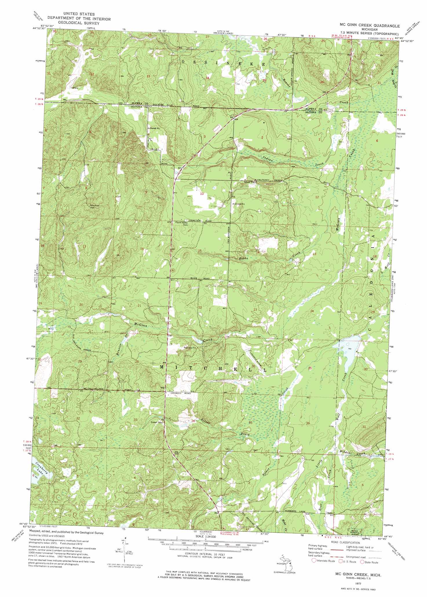
Mcginn Creek Topo Map Michigan
To zoom in, hover over the map of Mcginn Creek
USGS Topo Quad 44083g7 - 1:24,000 scale
| Topo Map Name: | Mcginn Creek |
| USGS Topo Quad ID: | 44083g7 |
| Print Size: | ca. 21 1/4" wide x 27" high |
| Southeast Coordinates: | 44.75° N latitude / 83.75° W longitude |
| Map Center Coordinates: | 44.8125° N latitude / 83.8125° W longitude |
| U.S. State: | MI |
| Filename: | o44083g7.jpg |
| Download Map JPG Image: | Mcginn Creek topo map 1:24,000 scale |
| Map Type: | Topographic |
| Topo Series: | 7.5´ |
| Map Scale: | 1:24,000 |
| Source of Map Images: | United States Geological Survey (USGS) |
| Alternate Map Versions: |
McGinn Creek MI 1972, updated 1975 Download PDF Buy paper map McGinn Creek MI 2012 Download PDF Buy paper map McGinn Creek MI 2014 Download PDF Buy paper map McGinn Creek MI 2016 Download PDF Buy paper map |
| FStopo: | US Forest Service topo McGinn Creek is available: Download FStopo PDF Download FStopo TIF |
1:24,000 Topo Quads surrounding Mcginn Creek
Atlanta Se |
Hillman |
Jewett Creek |
Lachine |
Lake Winyah |
Avery |
Rust |
Beaver Lake |
Evans Creek |
Big Ravine Creek |
Comins |
Mccollum Lake |
Mcginn Creek |
Hubbard Lake Sw |
Hubbard Lake |
Fairview |
Mckinley |
Curran |
Bucks Pond |
Barton City |
Mack Lake |
Goodar |
Alcona Dam Pond |
Glennie |
Sprinkler Creek |
> Back to 44083e1 at 1:100,000 scale
> Back to 44082a1 at 1:250,000 scale
> Back to U.S. Topo Maps home
Mcginn Creek topo map: Gazetteer
Mcginn Creek: Lakes
Cranberry Lake elevation 294m 964′Mcginn Creek: Post Offices
McGinn Post Office (historical) elevation 268m 879′Ponca Post Office (historical) elevation 262m 859′
Mcginn Creek: Streams
Bear Creek elevation 235m 770′Beaver Creek elevation 222m 728′
Bruster Creek elevation 253m 830′
Indian Creek elevation 225m 738′
Little Wolf Creek elevation 222m 728′
McGinn Creek elevation 222m 728′
Mohr Creek elevation 245m 803′
Robbs Creek elevation 226m 741′
Silver Brook elevation 237m 777′
Silver Creek elevation 232m 761′
Wildcat Creek elevation 235m 770′
Mcginn Creek digital topo map on disk
Buy this Mcginn Creek topo map showing relief, roads, GPS coordinates and other geographical features, as a high-resolution digital map file on DVD:
 map DVD")