Laskie Draw Topo Map Wyoming
To zoom in, hover over the map of Laskie Draw
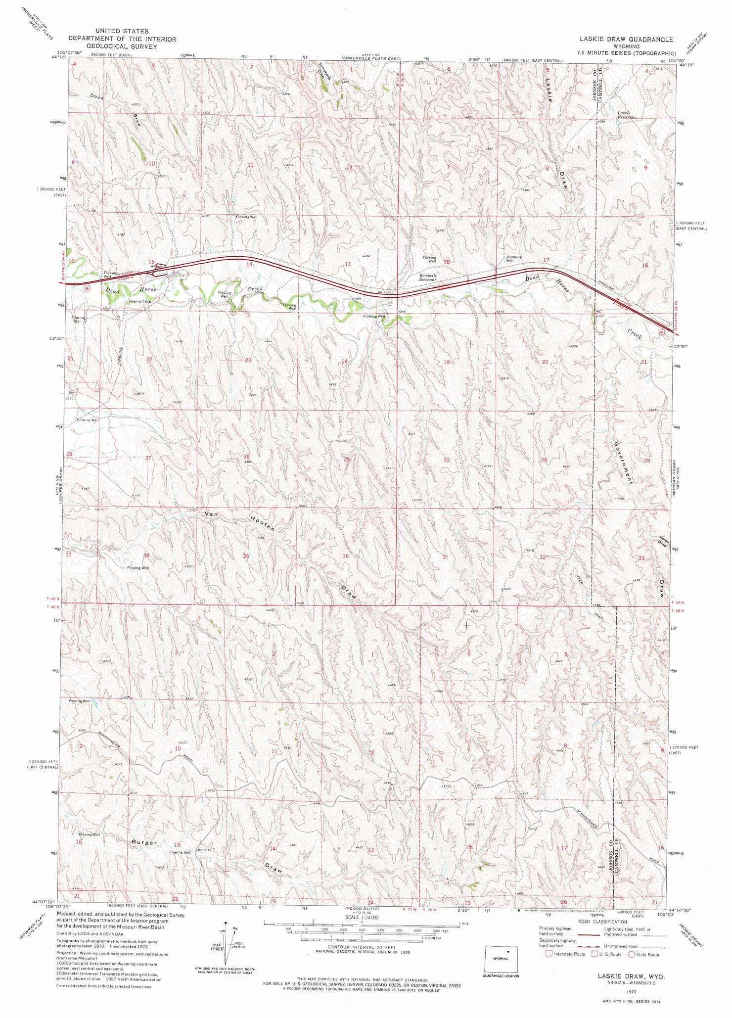
USGS Topo Quad 44106b1 - 1:24,000 scale
| Topo Map Name: | Laskie Draw |
| USGS Topo Quad ID: | 44106b1 |
| Print Size: | ca. 21 1/4" wide x 27" high |
| Southeast Coordinates: | 44.125° N latitude / 106° W longitude |
| Map Center Coordinates: | 44.1875° N latitude / 106.0625° W longitude |
| U.S. State: | WY |
| Filename: | o44106b1.jpg |
| Download Map JPG Image: | Laskie Draw topo map 1:24,000 scale |
| Map Type: | Topographic |
| Topo Series: | 7.5´ |
| Map Scale: | 1:24,000 |
| Source of Map Images: | United States Geological Survey (USGS) |
| Alternate Map Versions: |
Laskie Draw WY 1972, updated 1975 Download PDF Buy paper map Laskie Draw WY 2012 Download PDF Buy paper map Laskie Draw WY 2015 Download PDF Buy paper map |
1:24,000 Topo Quads surrounding Laskie Draw
Floate Draw |
Mitchell Draw |
Livingston Draw |
Echeta |
Twentymile Butte |
Bear Draw |
Somerville Flats West |
Somerville Flats East |
Carr Draw |
Jeffers Draw |
Ploessers Draw |
Juniper Draw |
Laskie Draw |
Morgan Draw |
Scott Dam |
Boon |
Bowman Flat |
Negro Butte |
Bogie Draw |
Double Tanks |
Provence Ranch |
Hoe Ranch |
The Nipple |
Fats Draw |
Wags Pinnacle |
> Back to 44106a1 at 1:100,000 scale
> Back to 44106a1 at 1:250,000 scale
> Back to U.S. Topo Maps home
Laskie Draw topo map: Gazetteer
Laskie Draw: Reservoirs
Bombsite Reservoir elevation 1259m 4130′California Reservoir elevation 1405m 4609′
Laskie Reservoir elevation 1323m 4340′
Laskie Draw: Valleys
Government Draw elevation 1256m 4120′Karen Draw elevation 1307m 4288′
Laskie Draw elevation 1259m 4130′
Laskie Draw: Wells
Vomburg Well elevation 1268m 4160′Laskie Draw digital topo map on disk
Buy this Laskie Draw topo map showing relief, roads, GPS coordinates and other geographical features, as a high-resolution digital map file on DVD:
Eastern Wyoming & Western South Dakota
Buy digital topo maps: Eastern Wyoming & Western South Dakota