Arrowwood Point Topo Map Oregon
To zoom in, hover over the map of Arrowwood Point
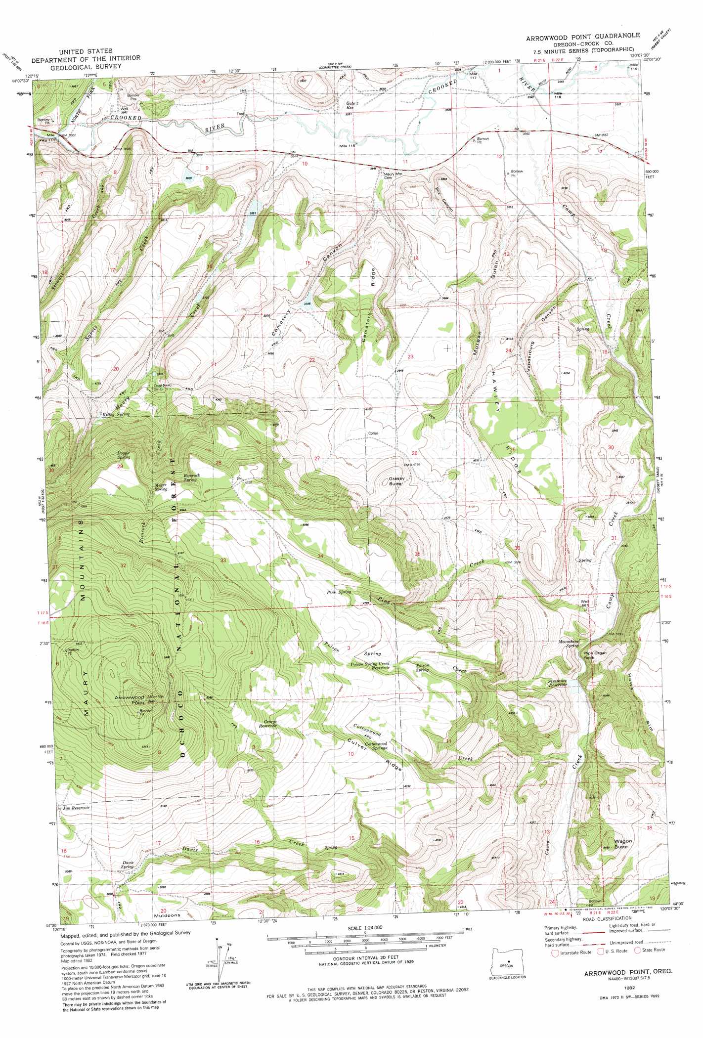
USGS Topo Quad 44120a2 - 1:24,000 scale
| Topo Map Name: | Arrowwood Point |
| USGS Topo Quad ID: | 44120a2 |
| Print Size: | ca. 21 1/4" wide x 27" high |
| Southeast Coordinates: | 44° N latitude / 120.125° W longitude |
| Map Center Coordinates: | 44.0625° N latitude / 120.1875° W longitude |
| U.S. State: | OR |
| Filename: | o44120a2.jpg |
| Download Map JPG Image: | Arrowwood Point topo map 1:24,000 scale |
| Map Type: | Topographic |
| Topo Series: | 7.5´ |
| Map Scale: | 1:24,000 |
| Source of Map Images: | United States Geological Survey (USGS) |
| Alternate Map Versions: |
Arrowwood Point OR 1982, updated 1982 Download PDF Buy paper map Arrowwood Point OR 1992, updated 1997 Download PDF Buy paper map Arrowwood Point OR 2011 Download PDF Buy paper map Arrowwood Point OR 2014 Download PDF Buy paper map |
| FStopo: | US Forest Service topo Arrowwood Point is available: Download FStopo PDF Download FStopo TIF |
1:24,000 Topo Quads surrounding Arrowwood Point
Gerow Butte |
Lookout Mountain |
Williams Prairie |
Keys Creek |
Little Summit Prairie |
Post |
Prairie Hill |
Committee Creek |
Rabbit Valley |
Paulina |
Mule Deer Ridge |
Drake Butte |
Arrowwood Point |
Liggett Table |
Maupin Butte |
Pringle Flat |
Logan Butte |
Gerry Mountain |
Sand Hollow |
Hardin Ranch |
Imperial Valley North |
Hampton Butte |
Long Barn |
G. I. Ranch |
Ibex Butte |
> Back to 44120a1 at 1:100,000 scale
> Back to 44120a1 at 1:250,000 scale
> Back to U.S. Topo Maps home
Arrowwood Point topo map: Gazetteer
Arrowwood Point: Dams
Mainline Dam Number 1 elevation 1114m 3654′Mainline Dam Number 2 elevation 1104m 3622′
Mainline Dam Number 3 elevation 1143m 3750′
Arrowwood Point: Post Offices
Mowry Post Office (historical) elevation 1186m 3891′Arrowwood Point: Reservoirs
Mainline Reservoir Number 1 elevation 1114m 3654′Mainline Reservoir Number 2 elevation 1104m 3622′
Mainline Reservoir Number 3 elevation 1143m 3750′
Arrowwood Point: Streams
Camp Creek elevation 1080m 3543′Cemetery Creek elevation 1075m 3526′
Gone Creek (historical) elevation 1076m 3530′
Maury Creek elevation 1072m 3517′
North Fork Crooked River elevation 1061m 3480′
Poison Creek elevation 1163m 3815′
Stewart Creek elevation 1069m 3507′
Arrowwood Point: Summits
Arrowwood Point elevation 1813m 5948′Arrowwood Point digital topo map on disk
Buy this Arrowwood Point topo map showing relief, roads, GPS coordinates and other geographical features, as a high-resolution digital map file on DVD: