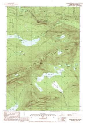
Barren Mountain East Topo Map Maine
To zoom in, hover over the map of Barren Mountain East
USGS Topo Quad 45069d3 - 1:24,000 scale
| Topo Map Name: | Barren Mountain East |
| USGS Topo Quad ID: | 45069d3 |
| Print Size: | ca. 21 1/4" wide x 27" high |
| Southeast Coordinates: | 45.375° N latitude / 69.25° W longitude |
| Map Center Coordinates: | 45.4375° N latitude / 69.3125° W longitude |
| U.S. State: | ME |
| Filename: | o45069d3.jpg |
| Download Map JPG Image: | Barren Mountain East topo map 1:24,000 scale |
| Map Type: | Topographic |
| Topo Series: | 7.5´ |
| Map Scale: | 1:24,000 |
| Source of Map Images: | United States Geological Survey (USGS) |
| Alternate Map Versions: |
Barren Mountain East ME 1978, updated 1981 Download PDF Buy paper map Barren Mountain East ME 1988, updated 1988 Download PDF Buy paper map Barren Mountain East ME 1988, updated 1988 Download PDF Buy paper map Barren Mountain East ME 2011 Download PDF Buy paper map Barren Mountain East ME 2014 Download PDF Buy paper map |
1:24,000 Topo Quads surrounding Barren Mountain East
> Back to 45069a1 at 1:100,000 scale
> Back to 45068a1 at 1:250,000 scale
> Back to U.S. Topo Maps home
Barren Mountain East topo map: Gazetteer
Barren Mountain East: Bays
Duck Cove elevation 163m 534′Barren Mountain East: Channels
First Narrows elevation 342m 1122′Second Narrows elevation 340m 1115′
Barren Mountain East: Cliffs
The Jaws elevation 279m 915′Barren Mountain East: Falls
Billings Falls elevation 333m 1092′Buttermilk Falls elevation 317m 1040′
Hays Brook Falls elevation 217m 711′
Screw Auger Falls elevation 279m 915′
Stair Falls elevation 347m 1138′
Barren Mountain East: Gaps
The Notch elevation 398m 1305′Barren Mountain East: Lakes
Beaver Pond elevation 313m 1026′Big Wilder Pond elevation 391m 1282′
Boot Pond elevation 324m 1062′
Camp Pond elevation 308m 1010′
Cloud Pond elevation 731m 2398′
Dam Pond elevation 322m 1056′
East Chairback Pond elevation 461m 1512′
Indian Pond elevation 322m 1056′
Little Wilder Pond elevation 388m 1272′
Lost Pond elevation 327m 1072′
Lower Deadwater elevation 362m 1187′
Lucia Pond elevation 324m 1062′
Mud Pond elevation 260m 853′
Pugwash Pond elevation 204m 669′
Rays Mill Pond elevation 327m 1072′
Sampson Pond elevation 322m 1056′
South Pond elevation 273m 895′
West Chairback Pond elevation 541m 1774′
Barren Mountain East: Parks
The Hermitage Preserve elevation 200m 656′Barren Mountain East: Slopes
Hammond Street Pitch elevation 254m 833′Barren Mountain East: Streams
Bear Brook elevation 341m 1118′Cloud Pond Brook elevation 164m 538′
Gulf Hagas Brook elevation 217m 711′
Hay Brook elevation 195m 639′
Henderson Brook elevation 198m 649′
Barren Mountain East: Summits
Barren Mountain elevation 742m 2434′Benson Mountain elevation 559m 1833′
Chairback Mountain elevation 606m 1988′
Columbus Mountain elevation 707m 2319′
Fourth Mountain elevation 714m 2342′
Roaring Brook Mountain elevation 523m 1715′
Third Mountain elevation 610m 2001′
Barren Mountain East: Swamps
Caribou Bog elevation 328m 1076′Barren Mountain East: Trails
Gulf Hagas Trail elevation 335m 1099′Barren Mountain East digital topo map on disk
Buy this Barren Mountain East topo map showing relief, roads, GPS coordinates and other geographical features, as a high-resolution digital map file on DVD:
Maine, New Hampshire, Rhode Island & Eastern Massachusetts
Buy digital topo maps: Maine, New Hampshire, Rhode Island & Eastern Massachusetts


