Timber Topo Map Oregon
To zoom in, hover over the map of Timber
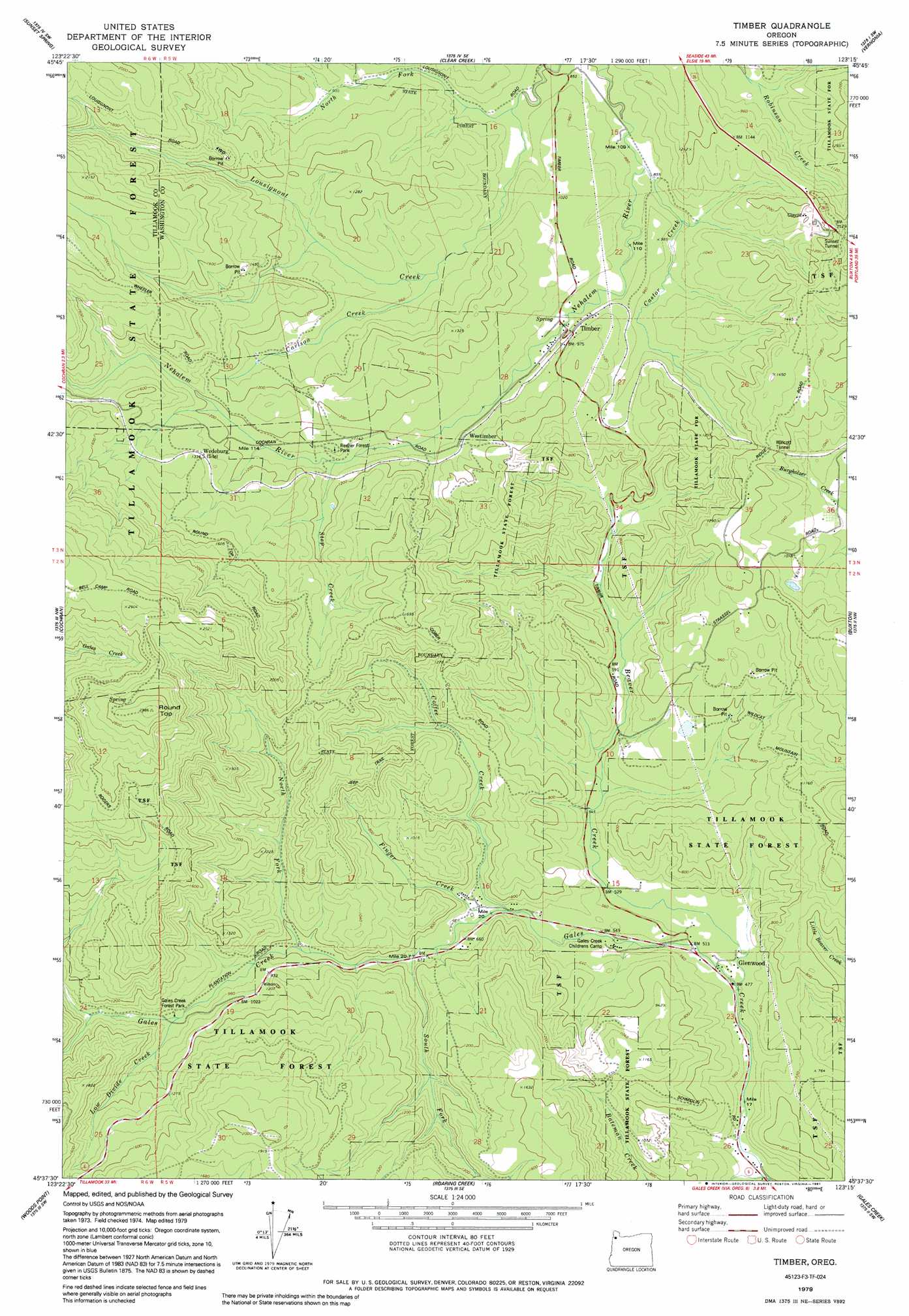
USGS Topo Quad 45123f3 - 1:24,000 scale
| Topo Map Name: | Timber |
| USGS Topo Quad ID: | 45123f3 |
| Print Size: | ca. 21 1/4" wide x 27" high |
| Southeast Coordinates: | 45.625° N latitude / 123.25° W longitude |
| Map Center Coordinates: | 45.6875° N latitude / 123.3125° W longitude |
| U.S. State: | OR |
| Filename: | o45123f3.jpg |
| Download Map JPG Image: | Timber topo map 1:24,000 scale |
| Map Type: | Topographic |
| Topo Series: | 7.5´ |
| Map Scale: | 1:24,000 |
| Source of Map Images: | United States Geological Survey (USGS) |
| Alternate Map Versions: |
Timber OR 1979, updated 1991 Download PDF Buy paper map Timber OR 2011 Download PDF Buy paper map Timber OR 2014 Download PDF Buy paper map |
1:24,000 Topo Quads surrounding Timber
Vinemaple |
Sager Creek |
Birkenfeld |
Pittsburg |
Baker Point |
Elsie |
Sunset Spring |
Clear Creek |
Vernonia |
Bacona |
Rogers Peak |
Cochran |
Timber |
Buxton |
Meacham Corner |
Jordan Creek |
Wood Point |
Roaring Creek |
Gales Creek |
Forest Grove |
Trask |
Gobblers Knob |
Turner Creek |
Gaston |
Laurelwood |
> Back to 45123e1 at 1:100,000 scale
> Back to 45122a1 at 1:250,000 scale
> Back to U.S. Topo Maps home
Timber topo map: Gazetteer
Timber: Dams
Bauer Dam elevation 247m 810′Timber: Parks
Gales Creek Campground elevation 280m 918′Reehers Camp elevation 346m 1135′
Timber: Populated Places
Glenwood elevation 151m 495′Timber elevation 311m 1020′
Timber: Post Offices
Burnt Woods Post Office (historical) elevation 180m 590′Fir Post Office (historical) elevation 210m 688′
Glenwood Post Office elevation 151m 495′
Timber Post Office elevation 311m 1020′
Westimber Post Office (historical) elevation 331m 1085′
Timber: Reservoirs
Bauer Reservoir elevation 247m 810′Timber: Springs
Hudleson Spring elevation 317m 1040′Timber: Streams
Beaver Creek elevation 146m 479′Carlson Creek elevation 290m 951′
Castor Creek elevation 258m 846′
Coffee Creek elevation 185m 606′
Finger Creek elevation 190m 623′
Low Divide Creek elevation 277m 908′
North Fork Gales Creek elevation 233m 764′
North Fork Lousignont Creek elevation 252m 826′
South Fork Gales Creek elevation 208m 682′
Step Creek elevation 327m 1072′
Timber: Summits
Round Top elevation 905m 2969′Timber: Tunnels
Sunset Tunnel elevation 420m 1377′Walcott Tunnel elevation 386m 1266′
Timber digital topo map on disk
Buy this Timber topo map showing relief, roads, GPS coordinates and other geographical features, as a high-resolution digital map file on DVD: