Freeman Creek Topo Map Montana
To zoom in, hover over the map of Freeman Creek
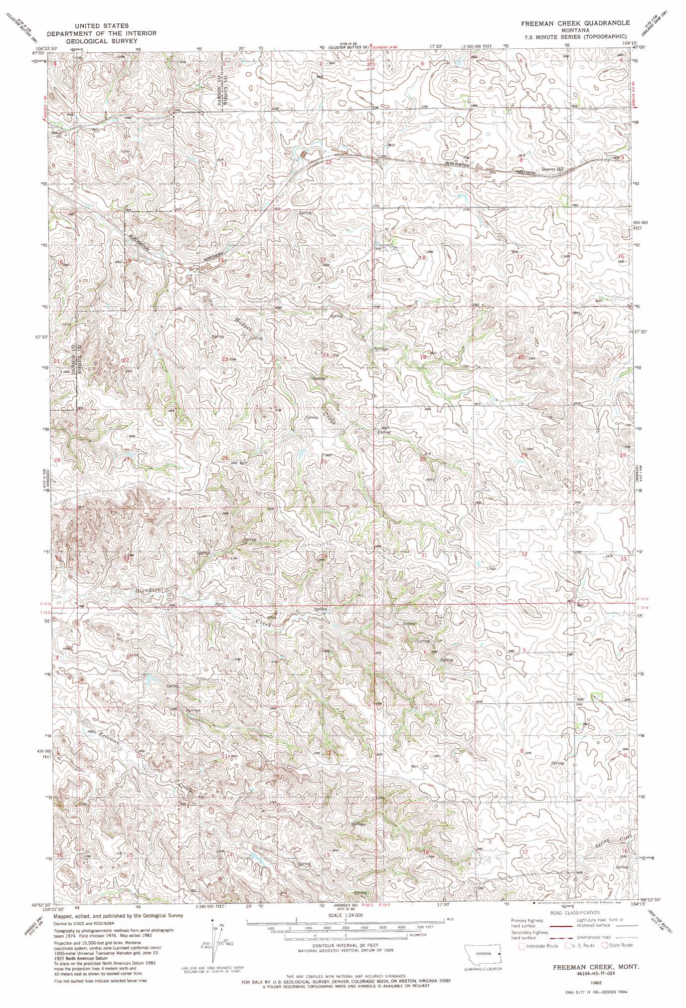
USGS Topo Quad 46104h3 - 1:24,000 scale
| Topo Map Name: | Freeman Creek |
| USGS Topo Quad ID: | 46104h3 |
| Print Size: | ca. 21 1/4" wide x 27" high |
| Southeast Coordinates: | 46.875° N latitude / 104.25° W longitude |
| Map Center Coordinates: | 46.9375° N latitude / 104.3125° W longitude |
| U.S. State: | MT |
| Filename: | o46104h3.jpg |
| Download Map JPG Image: | Freeman Creek topo map 1:24,000 scale |
| Map Type: | Topographic |
| Topo Series: | 7.5´ |
| Map Scale: | 1:24,000 |
| Source of Map Images: | United States Geological Survey (USGS) |
| Alternate Map Versions: |
Freeman Creek MT 1982, updated 1982 Download PDF Buy paper map Freeman Creek MT 2011 Download PDF Buy paper map Freeman Creek MT 2014 Download PDF Buy paper map |
1:24,000 Topo Quads surrounding Freeman Creek
Belle Prairie |
Cluster Buttes Nw |
Cluster Buttes |
Odland Dam Nw |
Odland Dam Ne |
Allard |
Cluster Buttes Sw |
Cluster Buttes Se |
Odland Dam Sw |
Odland Dam |
Twin Forks Reservoir |
Hodges |
Freeman Creek |
Wibaux |
Beach West |
Graveyard Hill |
Hodges Sw |
Hodges Se |
Red Top Butte |
Duck Creek |
Ayer Spring Ne |
Rocking Chair Butte |
Cap Rock |
Carlyle Nw |
Carlyle |
> Back to 46104e1 at 1:100,000 scale
> Back to 46104a1 at 1:250,000 scale
> Back to U.S. Topo Maps home
Freeman Creek topo map: Gazetteer
Freeman Creek: Wells
13N59E06DDAB01 Well elevation 886m 2906′14N58E02AD__01 Well elevation 844m 2769′
Freeman Creek digital topo map on disk
Buy this Freeman Creek topo map showing relief, roads, GPS coordinates and other geographical features, as a high-resolution digital map file on DVD:
Eastern Montana & Western North Dakota
Buy digital topo maps: Eastern Montana & Western North Dakota