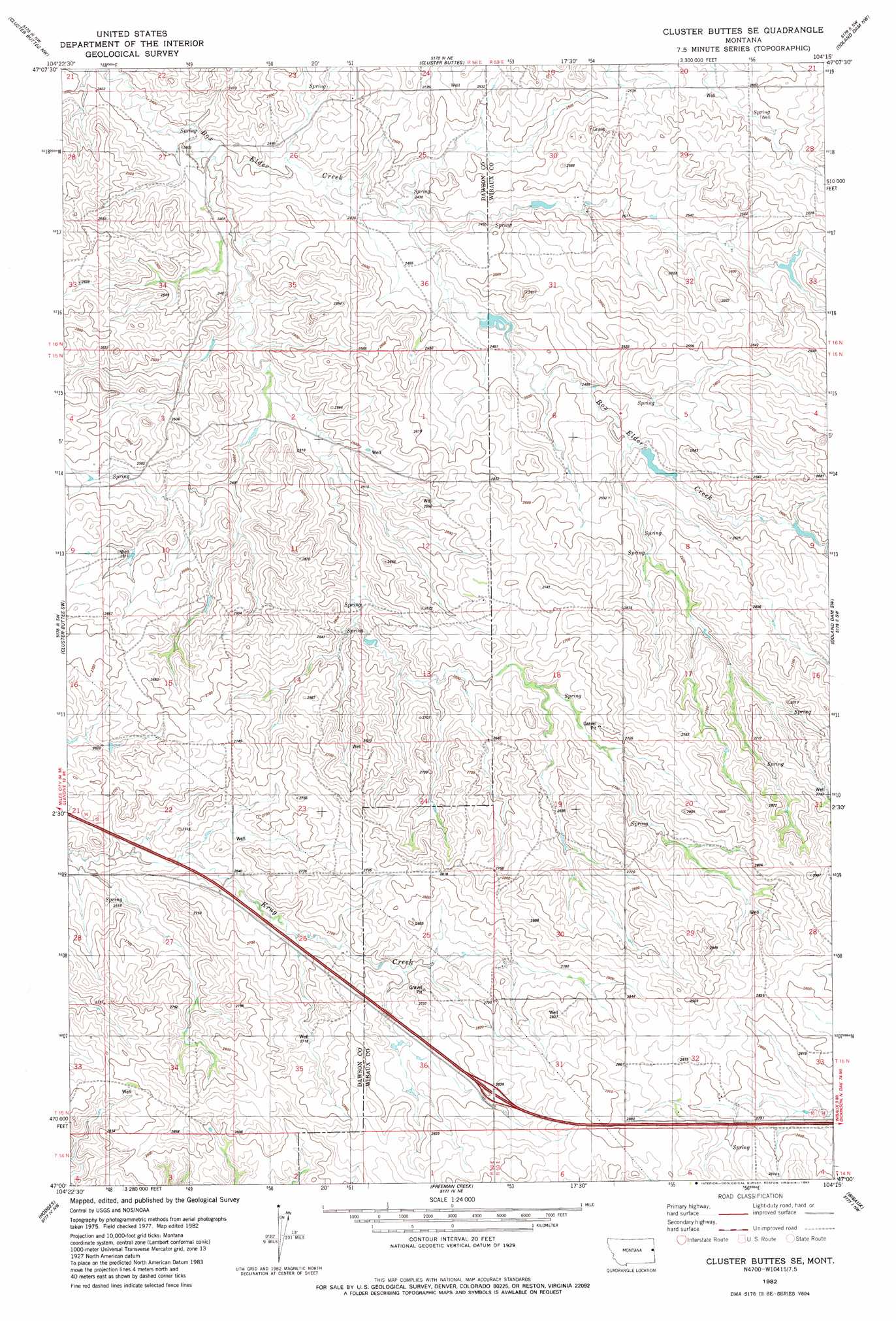
Cluster Buttes Se Topo Map Montana
To zoom in, hover over the map of Cluster Buttes Se
USGS Topo Quad 47104a3 - 1:24,000 scale
| Topo Map Name: | Cluster Buttes Se |
| USGS Topo Quad ID: | 47104a3 |
| Print Size: | ca. 21 1/4" wide x 27" high |
| Southeast Coordinates: | 47° N latitude / 104.25° W longitude |
| Map Center Coordinates: | 47.0625° N latitude / 104.3125° W longitude |
| U.S. State: | MT |
| Filename: | o47104a3.jpg |
| Download Map JPG Image: | Cluster Buttes Se topo map 1:24,000 scale |
| Map Type: | Topographic |
| Topo Series: | 7.5´ |
| Map Scale: | 1:24,000 |
| Source of Map Images: | United States Geological Survey (USGS) |
| Alternate Map Versions: |
Cluster Buttes SE MT 1982, updated 1983 Download PDF Buy paper map Cluster Buttes SE MT 2011 Download PDF Buy paper map Cluster Buttes SE MT 2014 Download PDF Buy paper map |
1:24,000 Topo Quads surrounding Cluster Buttes Se
Intake |
Savage Sw |
Savage Se |
Parson Creek |
Skaar |
Belle Prairie |
Cluster Buttes Nw |
Cluster Buttes |
Odland Dam Nw |
Odland Dam Ne |
Allard |
Cluster Buttes Sw |
Cluster Buttes Se |
Odland Dam Sw |
Odland Dam |
Twin Forks Reservoir |
Hodges |
Freeman Creek |
Wibaux |
Beach West |
Graveyard Hill |
Hodges Sw |
Hodges Se |
Red Top Butte |
Duck Creek |
> Back to 47104a1 at 1:100,000 scale
> Back to 47104a1 at 1:250,000 scale
> Back to U.S. Topo Maps home
Cluster Buttes Se topo map: Gazetteer
Cluster Buttes Se: Crossings
Interchange 236 elevation 855m 2805′Cluster Buttes Se: Dams
John Job Dam elevation 792m 2598′Cluster Buttes Se: Wells
13N58E36BBC_01 Well elevation 853m 2798′15N58E33AC__01 Well elevation 843m 2765′
15N59E07AAAA01 Well elevation 780m 2559′
15N59E32CCAD01 Well elevation 871m 2857′
16N58E26AAAA01 Well elevation 764m 2506′
16N59E29ABA_01 Well elevation 791m 2595′
Cluster Buttes Se digital topo map on disk
Buy this Cluster Buttes Se topo map showing relief, roads, GPS coordinates and other geographical features, as a high-resolution digital map file on DVD:
Eastern Montana & Western North Dakota
Buy digital topo maps: Eastern Montana & Western North Dakota