Hodges Topo Map Montana
To zoom in, hover over the map of Hodges
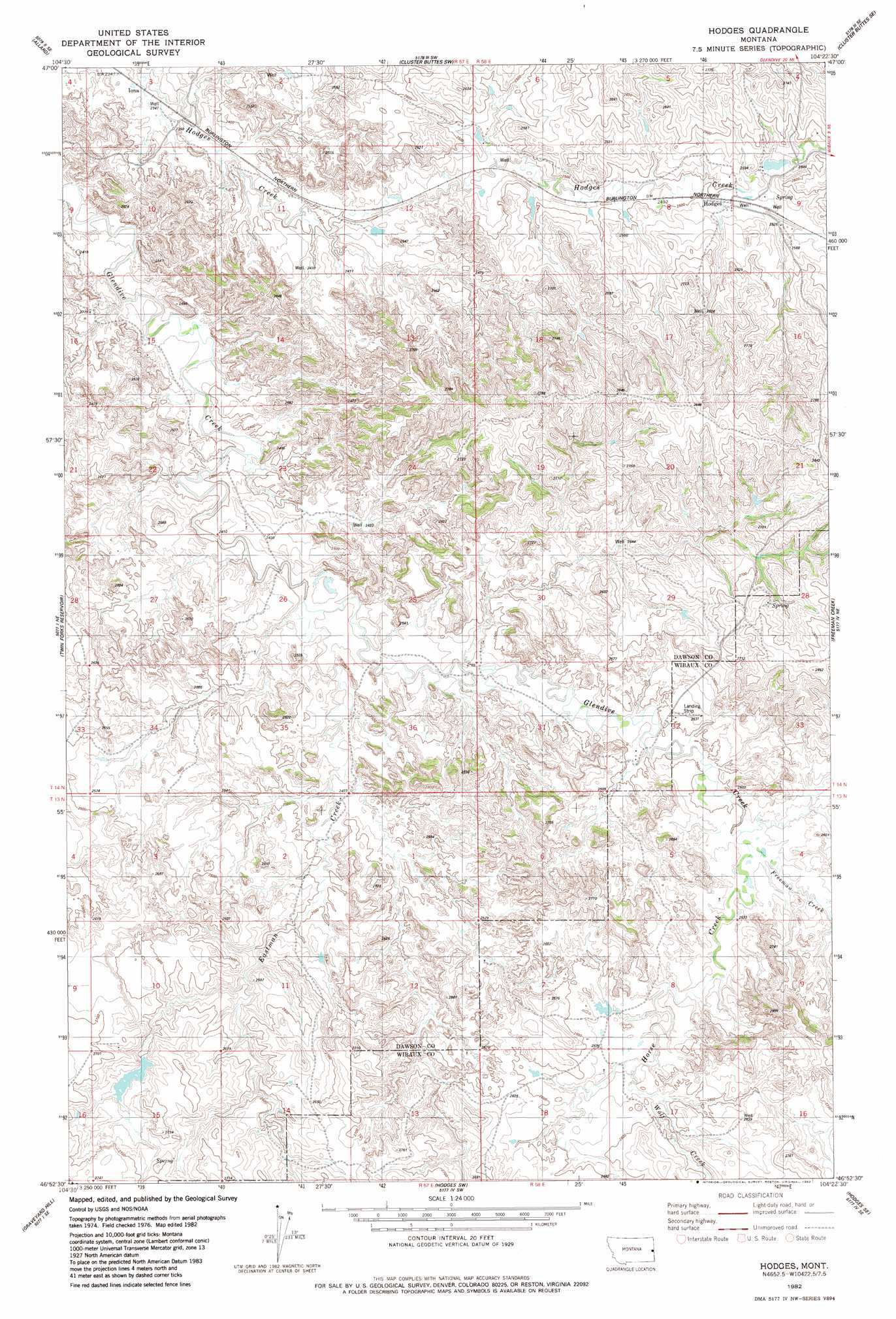
USGS Topo Quad 46104h4 - 1:24,000 scale
| Topo Map Name: | Hodges |
| USGS Topo Quad ID: | 46104h4 |
| Print Size: | ca. 21 1/4" wide x 27" high |
| Southeast Coordinates: | 46.875° N latitude / 104.375° W longitude |
| Map Center Coordinates: | 46.9375° N latitude / 104.4375° W longitude |
| U.S. State: | MT |
| Filename: | o46104h4.jpg |
| Download Map JPG Image: | Hodges topo map 1:24,000 scale |
| Map Type: | Topographic |
| Topo Series: | 7.5´ |
| Map Scale: | 1:24,000 |
| Source of Map Images: | United States Geological Survey (USGS) |
| Alternate Map Versions: |
Hodges MT 1982, updated 1982 Download PDF Buy paper map Hodges MT 2011 Download PDF Buy paper map Hodges MT 2014 Download PDF Buy paper map |
1:24,000 Topo Quads surrounding Hodges
Stipek |
Belle Prairie |
Cluster Buttes Nw |
Cluster Buttes |
Odland Dam Nw |
Glendive |
Allard |
Cluster Buttes Sw |
Cluster Buttes Se |
Odland Dam Sw |
Upper Magpie Reservoir |
Twin Forks Reservoir |
Hodges |
Freeman Creek |
Wibaux |
Graveyard Hill Sw |
Graveyard Hill |
Hodges Sw |
Hodges Se |
Red Top Butte |
Dorothy Draw |
Ayer Spring Ne |
Rocking Chair Butte |
Cap Rock |
Carlyle Nw |
> Back to 46104e1 at 1:100,000 scale
> Back to 46104a1 at 1:250,000 scale
> Back to U.S. Topo Maps home
Hodges topo map: Gazetteer
Hodges: Dams
Jonas Number 6 Dam elevation 798m 2618′Hodges: Populated Places
Hodges elevation 763m 2503′Hodges: Post Offices
Hodges Post Office (historical) elevation 758m 2486′Hodges: Streams
Eastman Creek elevation 730m 2395′Freeman Creek elevation 762m 2500′
Horse Creek elevation 764m 2506′
South Fork Horse Creek elevation 772m 2532′
Wolf Creek elevation 774m 2539′
Hodges: Wells
14N57E15B___01 Well elevation 716m 2349′14N58E09BBDA01 Well elevation 763m 2503′
Hodges digital topo map on disk
Buy this Hodges topo map showing relief, roads, GPS coordinates and other geographical features, as a high-resolution digital map file on DVD:
Eastern Montana & Western North Dakota
Buy digital topo maps: Eastern Montana & Western North Dakota