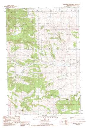
Horsethief Coulee W. Topo Map Montana
To zoom in, hover over the map of Horsethief Coulee W.
USGS Topo Quad 47109a2 - 1:24,000 scale
| Topo Map Name: | Horsethief Coulee W. |
| USGS Topo Quad ID: | 47109a2 |
| Print Size: | ca. 21 1/4" wide x 27" high |
| Southeast Coordinates: | 47° N latitude / 109.125° W longitude |
| Map Center Coordinates: | 47.0625° N latitude / 109.1875° W longitude |
| U.S. State: | MT |
| Filename: | o47109a2.jpg |
| Download Map JPG Image: | Horsethief Coulee W. topo map 1:24,000 scale |
| Map Type: | Topographic |
| Topo Series: | 7.5´ |
| Map Scale: | 1:24,000 |
| Source of Map Images: | United States Geological Survey (USGS) |
| Alternate Map Versions: |
Horsethief Coulee West MT 1985, updated 1986 Download PDF Buy paper map Horsethief Coulee West MT 2011 Download PDF Buy paper map Horsethief Coulee West MT 2014 Download PDF Buy paper map |
1:24,000 Topo Quads surrounding Horsethief Coulee W.
> Back to 47109a1 at 1:100,000 scale
> Back to 47108a1 at 1:250,000 scale
> Back to U.S. Topo Maps home
Horsethief Coulee W. topo map: Gazetteer
Horsethief Coulee W.: Mines
Big Six Mine elevation 1622m 5321′Whiskey Gulch Mine elevation 1603m 5259′
Whisky Gulch Mine elevation 1588m 5209′
Horsethief Coulee W.: Populated Places
Cheadle (historical) elevation 1240m 4068′Nelson (historical) elevation 1599m 5246′
Skaggs (historical) elevation 1298m 4258′
Horsethief Coulee W.: Post Offices
Cheadle Post Office (historical) elevation 1240m 4068′Horsethief Coulee W.: Streams
Parr Creek elevation 1232m 4041′Whisky Creek elevation 1313m 4307′
Horsethief Coulee W.: Summits
Flat Mountain elevation 1670m 5479′Horsethief Coulee W.: Valleys
Whisky Gulch elevation 1323m 4340′Horsethief Coulee W.: Wells
15N19E12DA__01 Well elevation 1412m 4632′15N20E03CCCB01 Well elevation 1329m 4360′
15N20E09ABDA01 Well elevation 1345m 4412′
15N20E09ADCB01 Well elevation 1353m 4438′
15N20E14CAAA01 Well elevation 1238m 4061′
Horsethief Coulee W. digital topo map on disk
Buy this Horsethief Coulee W. topo map showing relief, roads, GPS coordinates and other geographical features, as a high-resolution digital map file on DVD:


