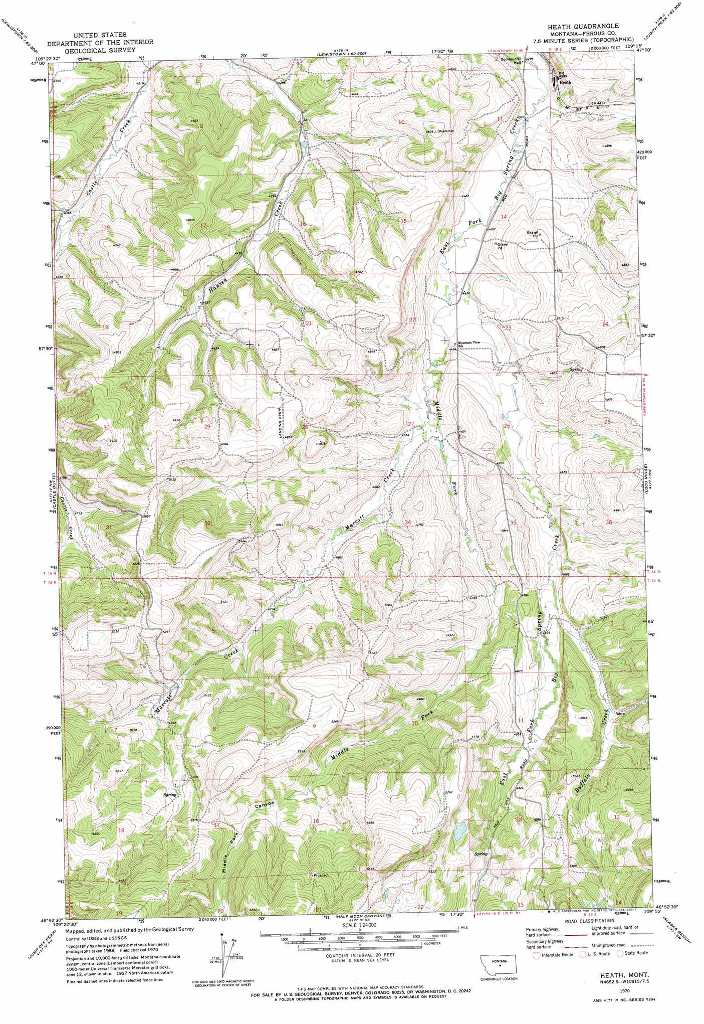
Heath Topo Map Montana
To zoom in, hover over the map of Heath
USGS Topo Quad 46109h3 - 1:24,000 scale
| Topo Map Name: | Heath |
| USGS Topo Quad ID: | 46109h3 |
| Print Size: | ca. 21 1/4" wide x 27" high |
| Southeast Coordinates: | 46.875° N latitude / 109.25° W longitude |
| Map Center Coordinates: | 46.9375° N latitude / 109.3125° W longitude |
| U.S. State: | MT |
| Filename: | o46109h3.jpg |
| Download Map JPG Image: | Heath topo map 1:24,000 scale |
| Map Type: | Topographic |
| Topo Series: | 7.5´ |
| Map Scale: | 1:24,000 |
| Source of Map Images: | United States Geological Survey (USGS) |
| Alternate Map Versions: |
Heath MT 1970, updated 1973 Download PDF Buy paper map Heath MT 1995, updated 1997 Download PDF Buy paper map Heath MT 2011 Download PDF Buy paper map Heath MT 2014 Download PDF Buy paper map |
| FStopo: | US Forest Service topo Heath is available: Download FStopo PDF Download FStopo TIF |
1:24,000 Topo Quads surrounding Heath
Spring Creek Junction |
Brooks |
New Year |
Judith Peak |
Lewis Peak |
Glengarry |
Lewistown |
Pike Creek |
Horsethief Coulee W. |
Horsethief Coulee E. |
West Fork Beaver Creek |
Castle Butte |
Heath |
Loco Ridge |
Forestgrove |
Crystal Lake |
Jump Off Peak |
Half Moon Canyon |
Alaska Bench |
South Bench |
Yaple Bench |
Snow Saucer Coulee |
Green Ashly Gulch |
Patterson Canyon |
Sahara Hill |
> Back to 46109e1 at 1:100,000 scale
> Back to 46108a1 at 1:250,000 scale
> Back to U.S. Topo Maps home
Heath topo map: Gazetteer
Heath: Dams
East Fork Dam elevation 1340m 4396′Hanson Creek Dam elevation 1285m 4215′
Heath: Populated Places
Heath elevation 1346m 4416′Heath: Post Offices
Alger Post Office (historical) elevation 1347m 4419′Heath Post Office (historical) elevation 1346m 4416′
Heath: Streams
Buffalo Creek elevation 1415m 4642′Marcott Creek elevation 1372m 4501′
Middle Fork Big Spring Creek elevation 1349m 4425′
Spring Branch elevation 1323m 4340′
Heath: Valleys
Middle Fork Canyon elevation 1349m 4425′Heath: Wells
14N19E13CCB_01 Well elevation 1389m 4557′14N19E23BBA_01 Well elevation 1350m 4429′
14N19E23CCD_01 Well elevation 1374m 4507′
Heath digital topo map on disk
Buy this Heath topo map showing relief, roads, GPS coordinates and other geographical features, as a high-resolution digital map file on DVD: