Macafee Hill Topo Map Washington
To zoom in, hover over the map of Macafee Hill
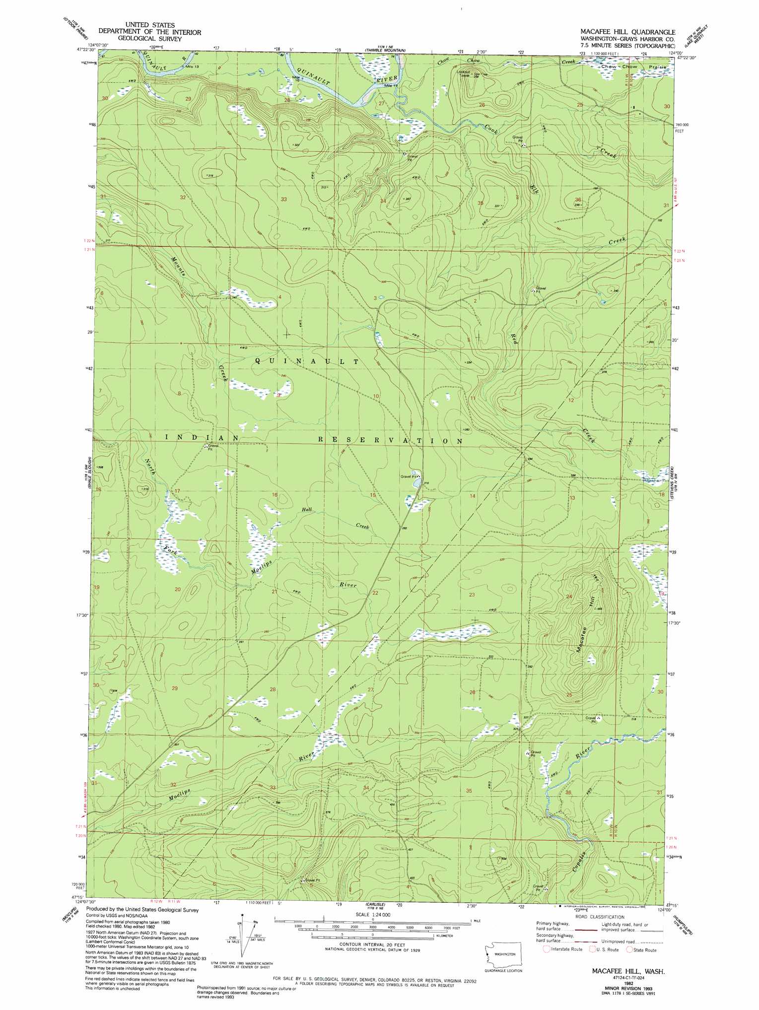
USGS Topo Quad 47124c1 - 1:24,000 scale
| Topo Map Name: | Macafee Hill |
| USGS Topo Quad ID: | 47124c1 |
| Print Size: | ca. 21 1/4" wide x 27" high |
| Southeast Coordinates: | 47.25° N latitude / 124° W longitude |
| Map Center Coordinates: | 47.3125° N latitude / 124.0625° W longitude |
| U.S. State: | WA |
| Filename: | o47124c1.jpg |
| Download Map JPG Image: | Macafee Hill topo map 1:24,000 scale |
| Map Type: | Topographic |
| Topo Series: | 7.5´ |
| Map Scale: | 1:24,000 |
| Source of Map Images: | United States Geological Survey (USGS) |
| Alternate Map Versions: |
Macafee Hill WA 1982, updated 1982 Download PDF Buy paper map Macafee Hill WA 1982, updated 1993 Download PDF Buy paper map Macafee Hill WA 2011 Download PDF Buy paper map Macafee Hill WA 2014 Download PDF Buy paper map |
1:24,000 Topo Quads surrounding Macafee Hill
Queets |
Salmon River West |
Salmon River East |
Matheny Ridge |
Finley Creek |
Tunnel Island |
O'Took Prairie |
Thimble Mountain |
Quinault Lake West |
Quinault Lake East |
Taholah |
Shale Slough |
Macafee Hill |
Stevens Creek |
Burnt Hill |
Moclips |
Carlisle |
Humptulips |
Railroad Camp |
|
Copalis Beach |
Copalis Crossing |
New London |
Aberdeen Gardens |
> Back to 47124a1 at 1:100,000 scale
> Back to 47124a1 at 1:250,000 scale
> Back to U.S. Topo Maps home
Macafee Hill topo map: Gazetteer
Macafee Hill: Flats
Chow Chow Prairie elevation 61m 200′Macafee Hill: Streams
Chow Chow Creek elevation 25m 82′Cook Creek elevation 26m 85′
Elk Creek elevation 31m 101′
Hall Creek elevation 78m 255′
Red Creek elevation 37m 121′
Macafee Hill: Summits
Macafee Hill elevation 199m 652′Macafee Hill digital topo map on disk
Buy this Macafee Hill topo map showing relief, roads, GPS coordinates and other geographical features, as a high-resolution digital map file on DVD: