Werner Peak Topo Map Montana
To zoom in, hover over the map of Werner Peak
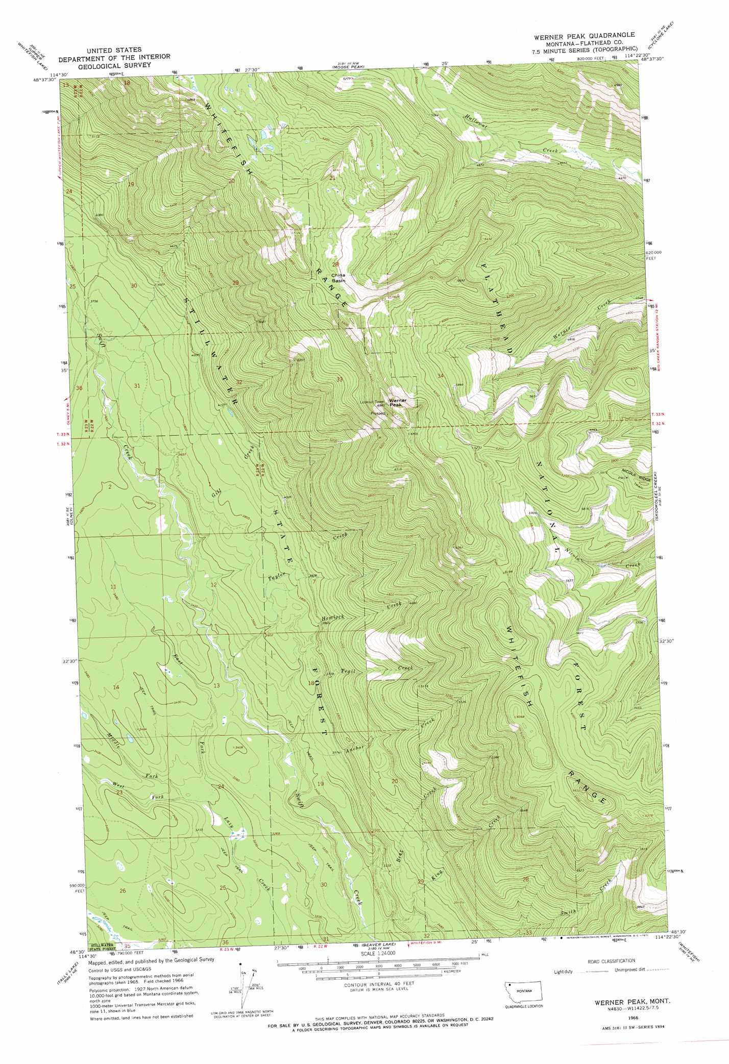
USGS Topo Quad 48114e4 - 1:24,000 scale
| Topo Map Name: | Werner Peak |
| USGS Topo Quad ID: | 48114e4 |
| Print Size: | ca. 21 1/4" wide x 27" high |
| Southeast Coordinates: | 48.5° N latitude / 114.375° W longitude |
| Map Center Coordinates: | 48.5625° N latitude / 114.4375° W longitude |
| U.S. State: | MT |
| Filename: | o48114e4.jpg |
| Download Map JPG Image: | Werner Peak topo map 1:24,000 scale |
| Map Type: | Topographic |
| Topo Series: | 7.5´ |
| Map Scale: | 1:24,000 |
| Source of Map Images: | United States Geological Survey (USGS) |
| Alternate Map Versions: |
Werner Peak MT 1966, updated 1971 Download PDF Buy paper map Werner Peak MT 1994, updated 1997 Download PDF Buy paper map Werner Peak MT 2011 Download PDF Buy paper map Werner Peak MT 2014 Download PDF Buy paper map |
| FStopo: | US Forest Service topo Werner Peak is available: Download FStopo PDF Download FStopo TIF |
1:24,000 Topo Quads surrounding Werner Peak
Mount Thompson-Seton |
Red Meadow Lake |
Whale Buttes |
Polebridge |
Quartz Ridge |
Bull Lake |
Upper Whitefish Lake |
Moose Peak |
Cyclone Lake |
Demers Ridge |
Radnor |
Olney |
Werner Peak |
Skookoleel Creek |
Huckleberry Mountain |
Johnson Peak |
Tally Lake |
Beaver Lake |
Whitefish |
Columbia Falls North |
Ashley Mountain |
Lost Creek Divide |
Rhodes |
Rose Crossing |
Columbia Falls South |
> Back to 48114e1 at 1:100,000 scale
> Back to 48114a1 at 1:250,000 scale
> Back to U.S. Topo Maps home
Werner Peak topo map: Gazetteer
Werner Peak: Basins
China Basin elevation 1995m 6545′Werner Peak: Streams
Anchor Creek elevation 988m 3241′Bear Creek elevation 947m 3106′
East Fork Lazy Creek elevation 962m 3156′
Gill Creek elevation 1054m 3458′
Hemlock Creek elevation 988m 3241′
King Creek elevation 945m 3100′
Middle Fork Lazy Creek elevation 987m 3238′
Taylor Creek elevation 1013m 3323′
Trail Creek elevation 1034m 3392′
West Fork Lazy Creek elevation 987m 3238′
Werner Peak: Summits
Werner Peak elevation 2115m 6938′Werner Peak: Trails
Whitefish Divide-Smokey Range National Recreation Trail elevation 1921m 6302′Werner Peak digital topo map on disk
Buy this Werner Peak topo map showing relief, roads, GPS coordinates and other geographical features, as a high-resolution digital map file on DVD: