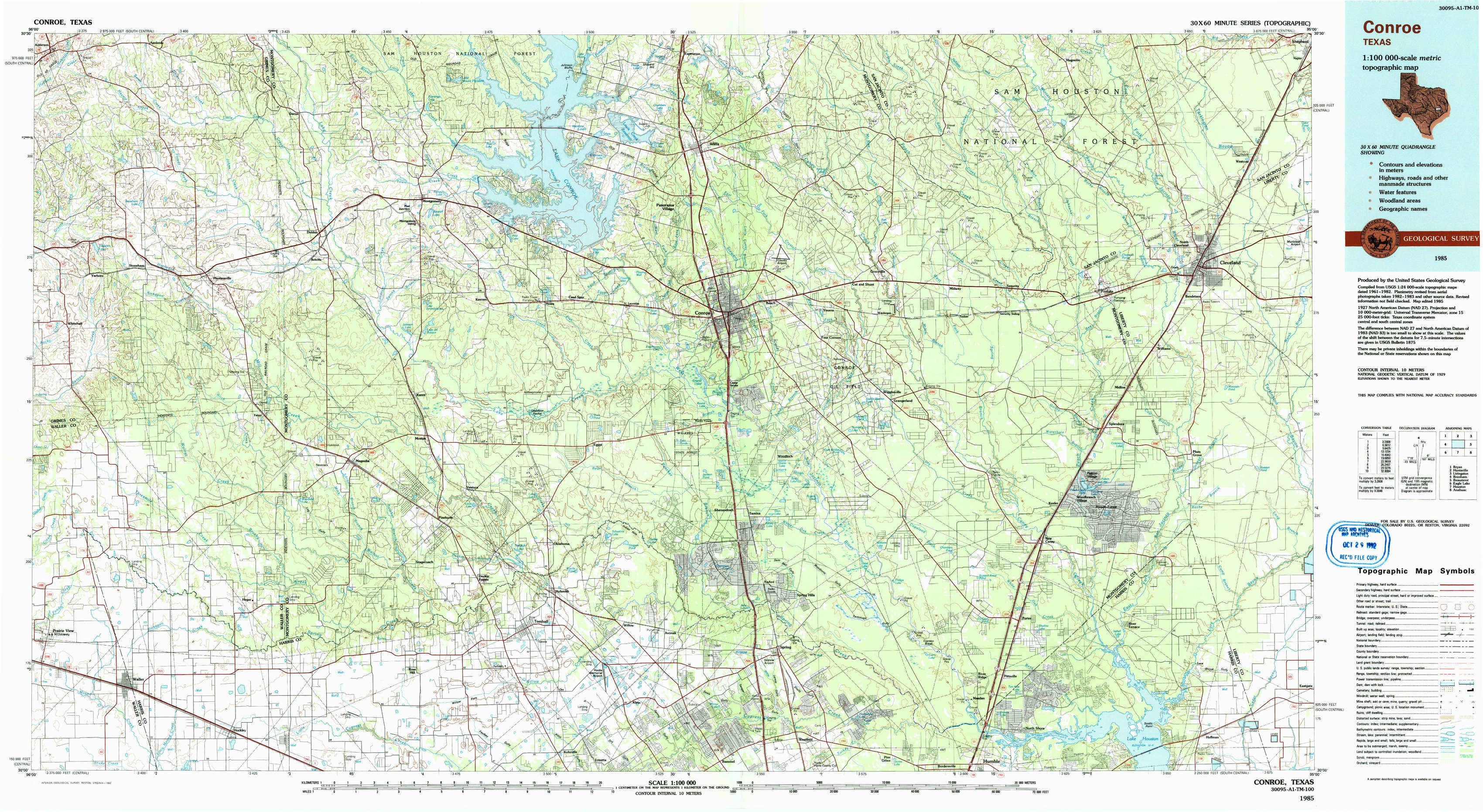
Conroe Topo Map Texas
To zoom in, hover over the map of Conroe
USGS Topo Map 30095a1 - 1:100,000 scale
| Topo Map Name: | Conroe |
| USGS Topo Quad ID: | 30095a1 |
| Print Size: | ca. 39" wide x 24" high |
| Southeast Coordinates: | 30° N latitude / 95° W longitude |
| Map Center Coordinates: | 30.25° N latitude / 95.5° W longitude |
| U.S. State: | TX |
| Filename: | 30095a1.jpg |
| Download Map JPG Image: | Conroe topo map 1:100,000 scale |
| Map Type: | Topographic |
| Topo Series: | 30´x60´ |
| Map Scale: | 1:100,000 |
| Source of Map Images: | United States Geological Survey (USGS) |
| Alternate Map Versions: |
Conroe TX 1985, updated 1985 Download PDF Buy paper map Conroe TX 1985, updated 1992 Download PDF Buy paper map |
1:100,000 Topos surrounding Conroe
Bryan |
Huntsville |
Livingston |
Brenham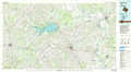 |
Conroe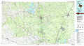 |
Beaumont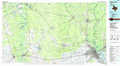 |
Eagle Lake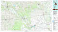 |
Houston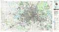 |
Anahuac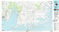 |
> Back to 30094a1 at 1:250,000 scale
> Back to U.S. Topo Maps home
1:24,000 Topo Quads covered by the spatial extent of this 100k map (Conroe)
|
Anderson 
|
Dacus 
|
Montgomery 
|
Shepard Hill 
|
Willis 
|
Conroe Ne 
|
Bear Creek 
|
Westcott 
|
|
Stoneham 
|
Plantersville 
|
Keenan 
|
Cowl Spur 
|
Conroe 
|
Cut And Shoot 
|
Fostoria 
|
Cleveland 
|
|
Waller Nw 
|
Magnolia West 
|
Magnolia East 
|
Oklahoma 
|
Tamina 
|
Outlaw Pond 
|
Splendora 
|
Plum Grove 
|
|
Waller 
|
Hockley 
|
Rose Hill 
|
Tomball 
|
Spring 
|
Maedan 
|
Moonshine Hill 
|
Huffman 
|