Cotton Valley Topo Map Louisiana
To zoom in, hover over the map of Cotton Valley
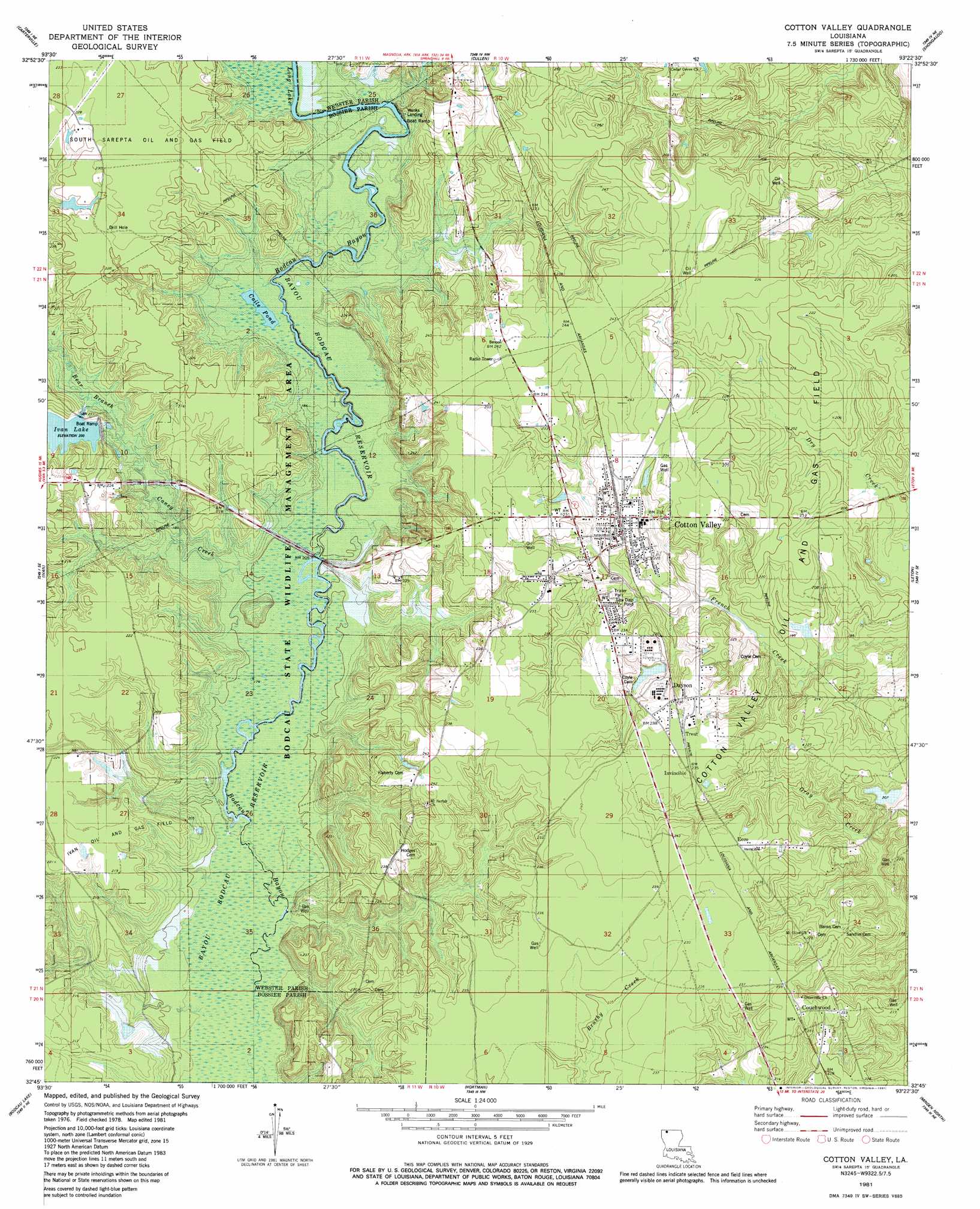
USGS Topo Quad 32093g4 - 1:24,000 scale
| Topo Map Name: | Cotton Valley |
| USGS Topo Quad ID: | 32093g4 |
| Print Size: | ca. 21 1/4" wide x 27" high |
| Southeast Coordinates: | 32.75° N latitude / 93.375° W longitude |
| Map Center Coordinates: | 32.8125° N latitude / 93.4375° W longitude |
| U.S. State: | LA |
| Filename: | o32093g4.jpg |
| Download Map JPG Image: | Cotton Valley topo map 1:24,000 scale |
| Map Type: | Topographic |
| Topo Series: | 7.5´ |
| Map Scale: | 1:24,000 |
| Source of Map Images: | United States Geological Survey (USGS) |
| Alternate Map Versions: |
Cotton Valley LA 1981, updated 1981 Download PDF Buy paper map Cotton Valley LA 2012 Download PDF Buy paper map Cotton Valley LA 2015 Download PDF Buy paper map |
1:24,000 Topo Quads surrounding Cotton Valley
Bradley |
Bradley Se |
Taylor |
Walkerville |
Emerson |
Plain Dealing |
Carterville |
Cullen |
Shongaloo |
Haynesville West |
Hughes |
Ivan |
Cotton Valley |
Leton |
Blackburn |
Benton |
Bodcau Lake |
Hortman |
Minden North |
Langston |
Bossier City |
Eastwood |
Doyline |
Minden South |
Ada |
> Back to 32093e1 at 1:100,000 scale
> Back to 32092a1 at 1:250,000 scale
> Back to U.S. Topo Maps home
Cotton Valley topo map: Gazetteer
Cotton Valley: Dams
Ivan Lake Dam elevation 58m 190′Woodly Pond Dam elevation 64m 209′
Cotton Valley: Lakes
Coile Pond elevation 55m 180′Cotton Valley: Parks
Bodcau State Wildlife Management Area elevation 55m 180′Cotton Valley: Populated Places
Connells (historical) elevation 73m 239′Cotton Valley elevation 68m 223′
Couchwood elevation 72m 236′
Dayson elevation 64m 209′
Ecco elevation 72m 236′
Invincible elevation 71m 232′
Placid (historical) elevation 72m 236′
Treat elevation 73m 239′
Cotton Valley: Reservoirs
Ivan Lake elevation 59m 193′Cotton Valley: Streams
Bear Branch elevation 57m 187′Caney Creek elevation 54m 177′
Cotton Valley: Swamps
Long Lake elevation 57m 187′Cotton Valley digital topo map on disk
Buy this Cotton Valley topo map showing relief, roads, GPS coordinates and other geographical features, as a high-resolution digital map file on DVD: