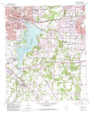
Kennedale Topo Map Texas
To zoom in, hover over the map of Kennedale
USGS Topo Quad 32097f2 - 1:24,000 scale
| Topo Map Name: | Kennedale |
| USGS Topo Quad ID: | 32097f2 |
| Print Size: | ca. 21 1/4" wide x 27" high |
| Southeast Coordinates: | 32.625° N latitude / 97.125° W longitude |
| Map Center Coordinates: | 32.6875° N latitude / 97.1875° W longitude |
| U.S. State: | TX |
| Filename: | o32097f2.jpg |
| Download Map JPG Image: | Kennedale topo map 1:24,000 scale |
| Map Type: | Topographic |
| Topo Series: | 7.5´ |
| Map Scale: | 1:24,000 |
| Source of Map Images: | United States Geological Survey (USGS) |
| Alternate Map Versions: |
Kennedale TX 1959, updated 1960 Download PDF Buy paper map Kennedale TX 1959, updated 1969 Download PDF Buy paper map Kennedale TX 1959, updated 1974 Download PDF Buy paper map Kennedale TX 1959, updated 1982 Download PDF Buy paper map Kennedale TX 1995, updated 2002 Download PDF Buy paper map Kennedale TX 2010 Download PDF Buy paper map Kennedale TX 2012 Download PDF Buy paper map Kennedale TX 2016 Download PDF Buy paper map |
1:24,000 Topo Quads surrounding Kennedale
> Back to 32097e1 at 1:100,000 scale
> Back to 32096a1 at 1:250,000 scale
> Back to U.S. Topo Maps home
Kennedale topo map: Gazetteer
Kennedale: Airports
Action Aero Airport elevation 208m 682′Birk Airport elevation 213m 698′
Coker Hill Heliport elevation 199m 652′
Kennedale: Crossings
Interchange 442A elevation 191m 626′Interchange 442B elevation 180m 590′
Interchange 443 elevation 192m 629′
Interchange 444 elevation 192m 629′
Interchange 445 elevation 188m 616′
Interchange 447 elevation 173m 567′
Interchange 448 elevation 175m 574′
Interchange 449 elevation 204m 669′
Overland Hills Shopping Center elevation 192m 629′
Kennedale: Dams
Arlington Dam elevation 167m 547′Lake Greenbriar Dam elevation 173m 567′
Rush Creek Lake Dam elevation 143m 469′
Kennedale: Parks
Allan Saxe Field elevation 196m 643′Arlington Martin High School Stadium elevation 181m 593′
Bicentennial Park elevation 170m 557′
Bowman Springs Park elevation 170m 557′
Bunche Park elevation 180m 590′
Clarence Foster Park elevation 157m 515′
Clay Gould Ballpark elevation 196m 643′
Duncan Robinson Park elevation 183m 600′
Emerald Hills Memorial Park elevation 200m 656′
Fielder Park elevation 190m 623′
Handley Field elevation 189m 620′
Handley Park elevation 192m 629′
Harold Patterson Sports Center elevation 207m 679′
Jake Langston Park elevation 163m 534′
Lucas Triple L Park elevation 185m 606′
Maverick Stadium - University of Texas Arlington elevation 200m 656′
Owl Stadium elevation 152m 498′
Pappy Elkins Park elevation 171m 561′
Richard Simpson Park elevation 168m 551′
Rosedale Park elevation 191m 626′
Sandy Lane Park elevation 169m 554′
Stop Six Park elevation 188m 616′
Thora Hart Park elevation 199m 652′
Veteran Park elevation 162m 531′
Wildcat Stadium elevation 197m 646′
Willian McDonald Park elevation 178m 583′
Woodland Park elevation 173m 567′
Kennedale: Populated Places
Dalworthington Gardens elevation 174m 570′Handley elevation 180m 590′
Johnsons Station elevation 205m 672′
Kennedale elevation 192m 629′
Lindberg elevation 181m 593′
Pantego elevation 174m 570′
Sublett elevation 196m 643′
Tate Springs elevation 185m 606′
University Park Village elevation 197m 646′
Kennedale: Post Offices
Oakwood Post Office elevation 172m 564′Pantego Post Office elevation 171m 561′
Kennedale: Reservoirs
Lake Arlington elevation 168m 551′Lake Greenbriar elevation 173m 567′
Rush Creek Lake elevation 143m 469′
Kennedale: Springs
Mary Le Bone Spring elevation 203m 666′Kennedale: Streams
Elm Branch elevation 176m 577′Kee Branch elevation 161m 528′
Rush Creek elevation 143m 469′
Wildcat Branch elevation 168m 551′
Kennedale: Summits
Murray Hill elevation 209m 685′Kennedale: Trails
Veterans Park Trail elevation 165m 541′Village Creek Historical Area Trail elevation 147m 482′
Kennedale digital topo map on disk
Buy this Kennedale topo map showing relief, roads, GPS coordinates and other geographical features, as a high-resolution digital map file on DVD:


