Mantee Topo Map Mississippi
To zoom in, hover over the map of Mantee
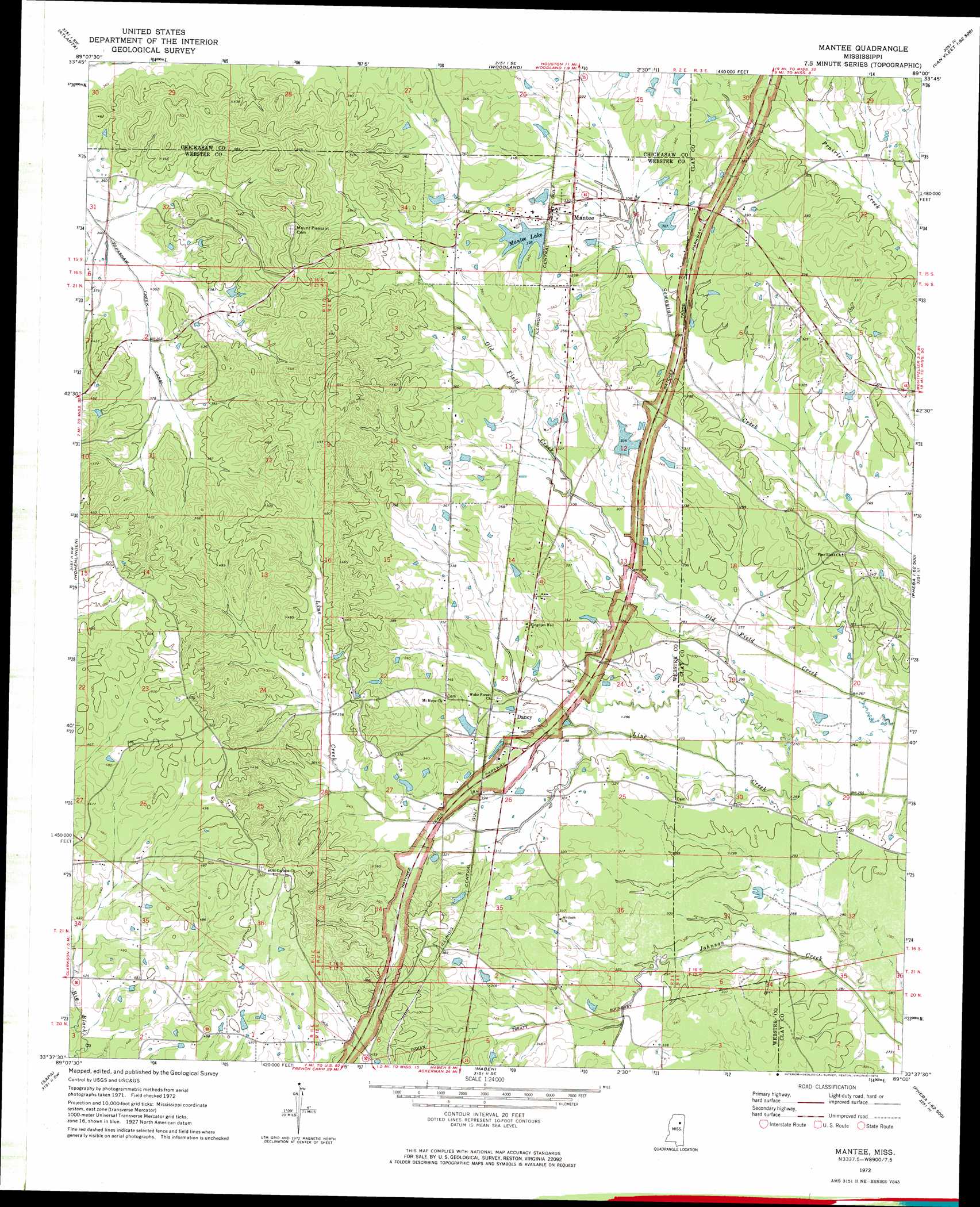
USGS Topo Quad 33089f1 - 1:24,000 scale
| Topo Map Name: | Mantee |
| USGS Topo Quad ID: | 33089f1 |
| Print Size: | ca. 21 1/4" wide x 27" high |
| Southeast Coordinates: | 33.625° N latitude / 89° W longitude |
| Map Center Coordinates: | 33.6875° N latitude / 89.0625° W longitude |
| U.S. State: | MS |
| Filename: | o33089f1.jpg |
| Download Map JPG Image: | Mantee topo map 1:24,000 scale |
| Map Type: | Topographic |
| Topo Series: | 7.5´ |
| Map Scale: | 1:24,000 |
| Source of Map Images: | United States Geological Survey (USGS) |
| Alternate Map Versions: |
Mantee MS 1972, updated 1974 Download PDF Buy paper map Mantee MS 2012 Download PDF Buy paper map Mantee MS 2015 Download PDF Buy paper map |
1:24,000 Topo Quads surrounding Mantee
Bruce |
Vardaman |
Houston West |
Houston East |
Buena Vista |
Calhoun City |
Atlanta |
Woodland |
Sparta |
Trebloc |
Bellefontaine |
Hohenlinden |
Mantee |
Montpelier |
Palo Alto |
Eupora |
Sapa |
Maben |
Pheba |
Cedar Bluff |
Tomnolen |
Reform |
Double Springs |
Longview |
Starkville |
> Back to 33089e1 at 1:100,000 scale
> Back to 33088a1 at 1:250,000 scale
> Back to U.S. Topo Maps home
Mantee topo map: Gazetteer
Mantee: Dams
Harrington Lake Dam elevation 104m 341′Mantee Lake Dam elevation 101m 331′
Mantee: Populated Places
Dancy elevation 98m 321′Mantee elevation 103m 337′
Mantee: Post Offices
Talley Post Office (historical) elevation 92m 301′Mantee: Reservoirs
Mantee Lake elevation 101m 331′Mantee: Ridges
Choctaw Ridge elevation 134m 439′Mantee digital topo map on disk
Buy this Mantee topo map showing relief, roads, GPS coordinates and other geographical features, as a high-resolution digital map file on DVD: