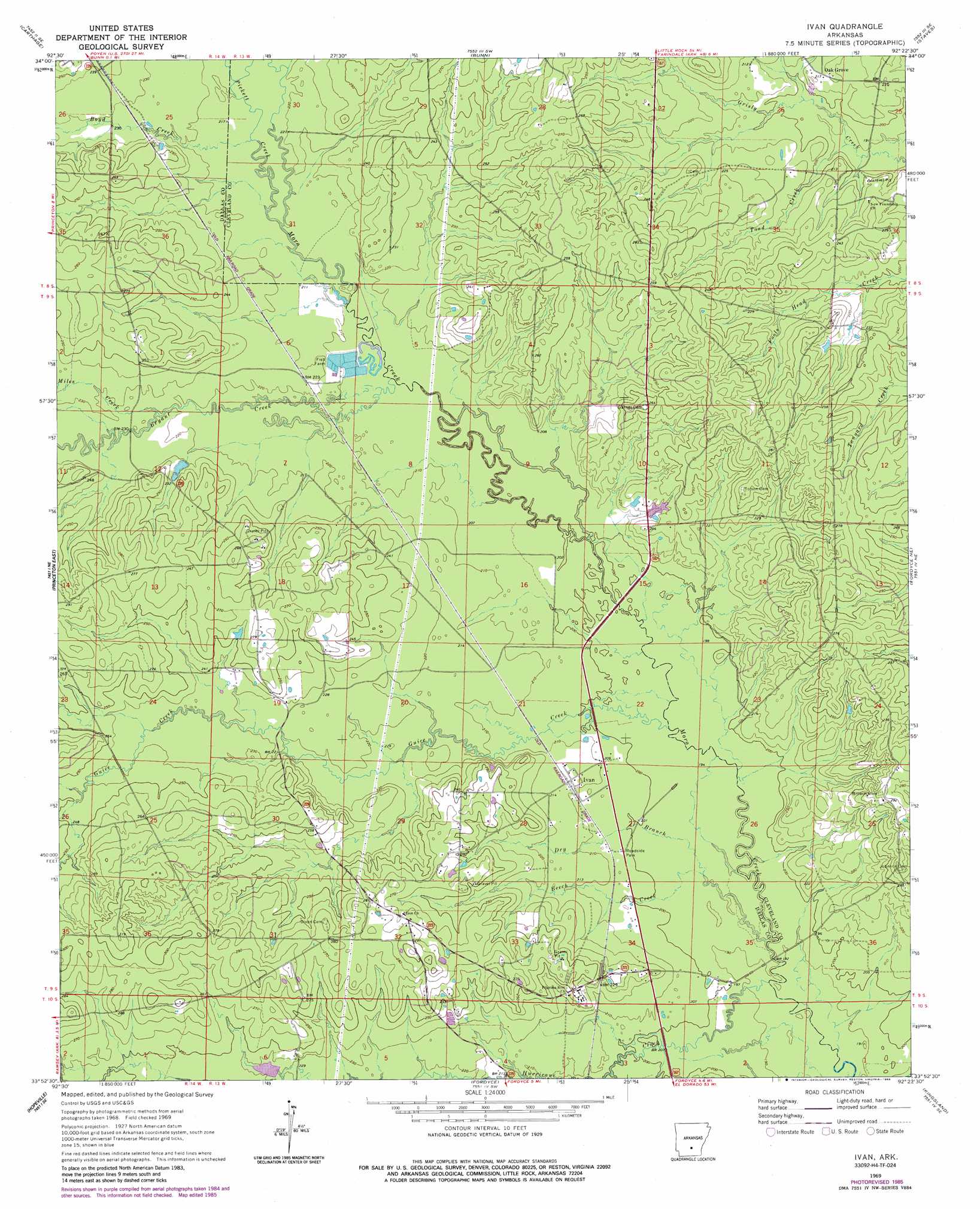
Ivan Topo Map Arkansas
To zoom in, hover over the map of Ivan
USGS Topo Quad 33092h4 - 1:24,000 scale
| Topo Map Name: | Ivan |
| USGS Topo Quad ID: | 33092h4 |
| Print Size: | ca. 21 1/4" wide x 27" high |
| Southeast Coordinates: | 33.875° N latitude / 92.375° W longitude |
| Map Center Coordinates: | 33.9375° N latitude / 92.4375° W longitude |
| U.S. State: | AR |
| Filename: | o33092h4.jpg |
| Download Map JPG Image: | Ivan topo map 1:24,000 scale |
| Map Type: | Topographic |
| Topo Series: | 7.5´ |
| Map Scale: | 1:24,000 |
| Source of Map Images: | United States Geological Survey (USGS) |
| Alternate Map Versions: |
Ivan AR 1969, updated 1972 Download PDF Buy paper map Ivan AR 1969, updated 1986 Download PDF Buy paper map Ivan AR 2011 Download PDF Buy paper map Ivan AR 2014 Download PDF Buy paper map |
1:24,000 Topo Quads surrounding Ivan
Willow |
Leola |
Millerville |
Grapevine |
Pine Bluff Nw |
Tulip |
Carthage |
Bunn |
Staves |
Kedron |
Princeton West |
Princeton East |
Ivan |
Fordyce Ne |
Rison |
Holly Springs |
Hopeville |
Fordyce |
Kingsland |
New Edinburg |
Eagle Mills |
Bearden |
Chambersville |
Tinsman |
Mckinney |
> Back to 33092e1 at 1:100,000 scale
> Back to 33092a1 at 1:250,000 scale
> Back to U.S. Topo Maps home
Ivan topo map: Gazetteer
Ivan: Populated Places
Como (historical) elevation 63m 206′Ivan elevation 65m 213′
Oak Grove elevation 67m 219′
Trigg (historical) elevation 73m 239′
Ivan: Post Offices
Ivan Post Office elevation 64m 209′Ivan: Streams
Beech Creek elevation 62m 203′Boyd Creek elevation 66m 216′
Bryant Creek elevation 64m 209′
Dry Branch elevation 59m 193′
Guice Creek elevation 62m 203′
Hurricane Creek elevation 59m 193′
Lawrence Moro Creek elevation 69m 226′
Miles Creek elevation 74m 242′
Pickett Creek elevation 66m 216′
Simmons Creek elevation 62m 203′
Toad Creek elevation 59m 193′
Ivan digital topo map on disk
Buy this Ivan topo map showing relief, roads, GPS coordinates and other geographical features, as a high-resolution digital map file on DVD: