Naples Topo Map Texas
To zoom in, hover over the map of Naples
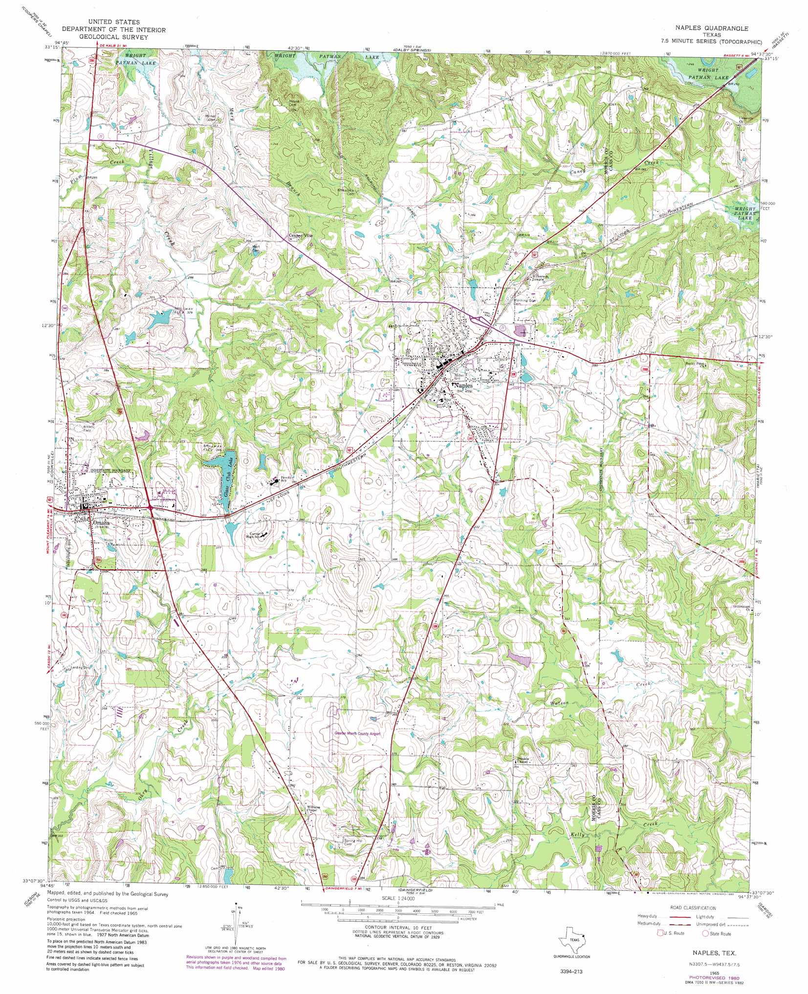
USGS Topo Quad 33094b6 - 1:24,000 scale
| Topo Map Name: | Naples |
| USGS Topo Quad ID: | 33094b6 |
| Print Size: | ca. 21 1/4" wide x 27" high |
| Southeast Coordinates: | 33.125° N latitude / 94.625° W longitude |
| Map Center Coordinates: | 33.1875° N latitude / 94.6875° W longitude |
| U.S. State: | TX |
| Filename: | o33094b6.jpg |
| Download Map JPG Image: | Naples topo map 1:24,000 scale |
| Map Type: | Topographic |
| Topo Series: | 7.5´ |
| Map Scale: | 1:24,000 |
| Source of Map Images: | United States Geological Survey (USGS) |
| Alternate Map Versions: |
Naples TX 1965, updated 1967 Download PDF Buy paper map Naples TX 1965, updated 1980 Download PDF Buy paper map Naples TX 2010 Download PDF Buy paper map Naples TX 2012 Download PDF Buy paper map Naples TX 2016 Download PDF Buy paper map |
1:24,000 Topo Quads surrounding Naples
Boxelder |
Lydia |
Hodgson |
Malta |
New Boston |
Wilkinson |
Coopers Chapel |
Dalby Springs |
Bassett |
Corley |
Mount Pleasant |
Cookville |
Naples |
Marietta |
Bryans Mill |
Harvard |
Cason |
Daingerfield |
Sardis |
Carterville |
Pittsburg |
Lafayette |
Lone Star |
Avinger |
Cunningham Creek |
> Back to 33094a1 at 1:100,000 scale
> Back to 33094a1 at 1:250,000 scale
> Back to U.S. Topo Maps home
Naples topo map: Gazetteer
Naples: Airports
David Granberry Memorial Hospital Heliport elevation 126m 413′Greater Morris County Airport elevation 113m 370′
Naples: Dams
Glass Club Dam elevation 107m 351′Jerry Pratt Dam elevation 110m 360′
Justiss Farms Lake Dam elevation 96m 314′
R E Moore Lake Dam elevation 100m 328′
Naples: Populated Places
Naples elevation 124m 406′Omaha elevation 122m 400′
Naples: Reservoirs
Glass Club Lake elevation 107m 351′Jerry Pratt Lake elevation 110m 360′
Justiss Farms Lake elevation 96m 314′
R E Moore Lake elevation 100m 328′
Naples: Streams
Plum Creek elevation 82m 269′Naples digital topo map on disk
Buy this Naples topo map showing relief, roads, GPS coordinates and other geographical features, as a high-resolution digital map file on DVD: