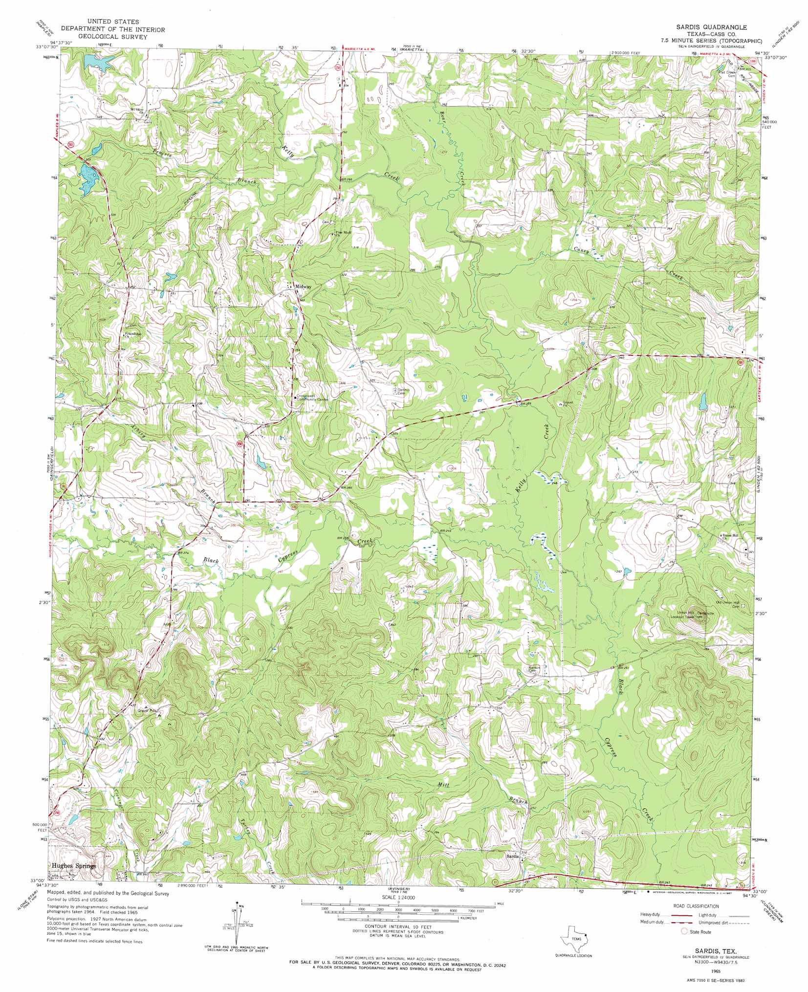
Sardis Topo Map Texas
To zoom in, hover over the map of Sardis
USGS Topo Quad 33094a5 - 1:24,000 scale
| Topo Map Name: | Sardis |
| USGS Topo Quad ID: | 33094a5 |
| Print Size: | ca. 21 1/4" wide x 27" high |
| Southeast Coordinates: | 33° N latitude / 94.5° W longitude |
| Map Center Coordinates: | 33.0625° N latitude / 94.5625° W longitude |
| U.S. State: | TX |
| Filename: | o33094a5.jpg |
| Download Map JPG Image: | Sardis topo map 1:24,000 scale |
| Map Type: | Topographic |
| Topo Series: | 7.5´ |
| Map Scale: | 1:24,000 |
| Source of Map Images: | United States Geological Survey (USGS) |
| Alternate Map Versions: |
Sardis TX 1965, updated 1967 Download PDF Buy paper map Sardis TX 2010 Download PDF Buy paper map Sardis TX 2012 Download PDF Buy paper map Sardis TX 2016 Download PDF Buy paper map |
1:24,000 Topo Quads surrounding Sardis
Coopers Chapel |
Dalby Springs |
Bassett |
Corley |
Maud |
Cookville |
Naples |
Marietta |
Bryans Mill |
Douglassville |
Cason |
Daingerfield |
Sardis |
Carterville |
Linden |
Lafayette |
Lone Star |
Avinger |
Cunningham Creek |
Lanier |
Coffeeville |
Ore City |
Lassater |
Kellyville |
Jefferson |
> Back to 33094a1 at 1:100,000 scale
> Back to 33094a1 at 1:250,000 scale
> Back to U.S. Topo Maps home
Sardis topo map: Gazetteer
Sardis: Dams
Coker Lake Dam elevation 92m 301′Sardis: Populated Places
Crossroads Community Centery elevation 102m 334′Midway elevation 114m 374′
Sardis elevation 95m 311′
Sardis: Reservoirs
Coker Lake elevation 92m 301′Sardis: Streams
Arbery Branch elevation 79m 259′Bear Creek elevation 77m 252′
Caney Creek elevation 76m 249′
Kelly Creek elevation 73m 239′
Mill Branch elevation 71m 232′
Prairie Branch elevation 85m 278′
Sardis digital topo map on disk
Buy this Sardis topo map showing relief, roads, GPS coordinates and other geographical features, as a high-resolution digital map file on DVD: