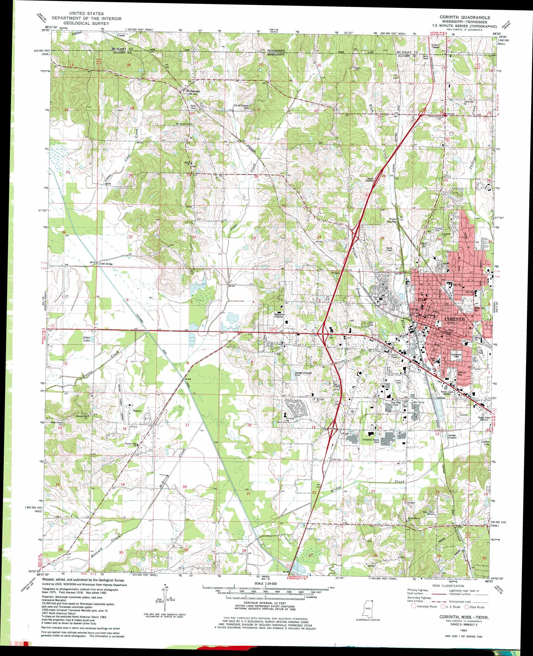
Corinth Topo Map Mississippi
To zoom in, hover over the map of Corinth
USGS Topo Quad 34088h5 - 1:24,000 scale
| Topo Map Name: | Corinth |
| USGS Topo Quad ID: | 34088h5 |
| Print Size: | ca. 21 1/4" wide x 27" high |
| Southeast Coordinates: | 34.875° N latitude / 88.5° W longitude |
| Map Center Coordinates: | 34.9375° N latitude / 88.5625° W longitude |
| U.S. States: | MS, TN |
| Filename: | o34088h5.jpg |
| Download Map JPG Image: | Corinth topo map 1:24,000 scale |
| Map Type: | Topographic |
| Topo Series: | 7.5´ |
| Map Scale: | 1:24,000 |
| Source of Map Images: | United States Geological Survey (USGS) |
| Alternate Map Versions: |
Corinth MS 1982, updated 1983 Download PDF Buy paper map Corinth MS 1982, updated 1983 Download PDF Buy paper map Corinth MS 2010 Download PDF Buy paper map Corinth MS 2012 Download PDF Buy paper map Corinth MS 2015 Download PDF Buy paper map |
1:24,000 Topo Quads surrounding Corinth
Hornsby |
Rose Creek |
Purdy |
Stantonville |
Pittsburg Landing |
Pocahontas |
Chewalla |
Guys |
Michie |
Counce |
Chalybeate |
Kossuth North |
Corinth |
Kendrick |
Doskie |
Peoples |
Kossuth South |
Rienzi |
Glens |
Burnsville |
Dumas |
Jumpertown |
Booneville |
Altitude |
Paden |
> Back to 34088e1 at 1:100,000 scale
> Back to 34088a1 at 1:250,000 scale
> Back to U.S. Topo Maps home
Corinth topo map: Gazetteer
Corinth: Bridges
Polk Levee Bridge elevation 120m 393′Smith Bridge elevation 119m 390′
Corinth: Canals
Tuscumbia River Canal elevation 120m 393′Corinth: Lakes
Buffalo Hole elevation 117m 383′Jobes Lake elevation 135m 442′
Jobes Lake elevation 124m 406′
Corinth: Parks
Corinth City Park elevation 138m 452′Johns Street Park elevation 137m 449′
Corinth: Populated Places
Corinth elevation 134m 439′Ruslor Junction elevation 137m 449′
Wenasoga elevation 144m 472′
West Corinth elevation 146m 479′
Corinth: Reservoirs
Weedon Lake elevation 130m 426′Corinth: Streams
Bridge Creek elevation 122m 400′Bridge Creek elevation 122m 400′
Cane Creek elevation 119m 390′
Cane Creek elevation 119m 390′
Eastes Creek elevation 119m 390′
Elam Creek elevation 130m 426′
Elam Creek elevation 130m 426′
Kossuth Creek elevation 128m 419′
Little Cane Creek elevation 117m 383′
McElroy Creek elevation 119m 390′
Turner Creek elevation 124m 406′
Corinth: Summits
College Hill elevation 147m 482′Corinth digital topo map on disk
Buy this Corinth topo map showing relief, roads, GPS coordinates and other geographical features, as a high-resolution digital map file on DVD: