Cerro Verde Topo Map New Mexico
To zoom in, hover over the map of Cerro Verde
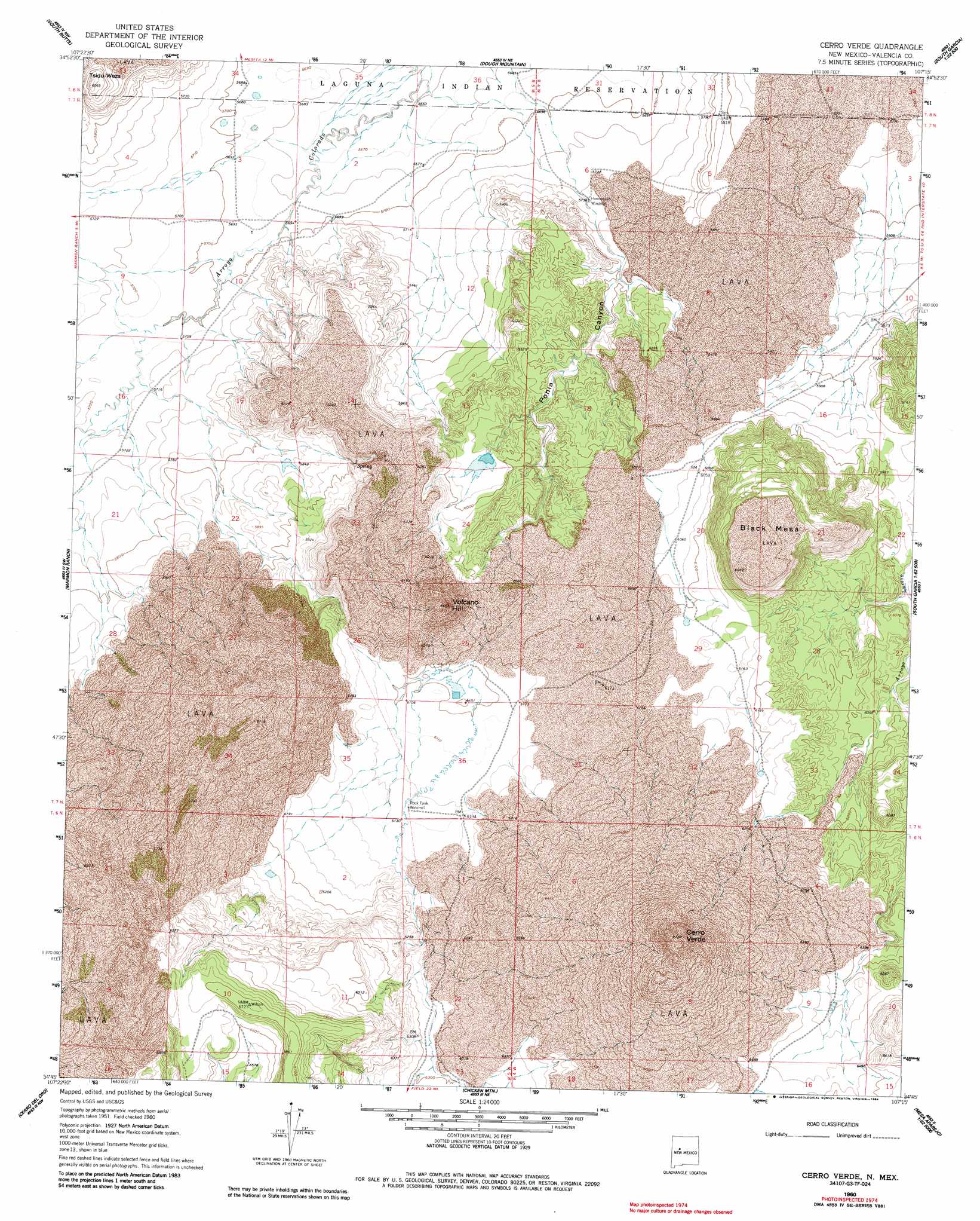
USGS Topo Quad 34107g3 - 1:24,000 scale
| Topo Map Name: | Cerro Verde |
| USGS Topo Quad ID: | 34107g3 |
| Print Size: | ca. 21 1/4" wide x 27" high |
| Southeast Coordinates: | 34.75° N latitude / 107.25° W longitude |
| Map Center Coordinates: | 34.8125° N latitude / 107.3125° W longitude |
| U.S. State: | NM |
| Filename: | o34107g3.jpg |
| Download Map JPG Image: | Cerro Verde topo map 1:24,000 scale |
| Map Type: | Topographic |
| Topo Series: | 7.5´ |
| Map Scale: | 1:24,000 |
| Source of Map Images: | United States Geological Survey (USGS) |
| Alternate Map Versions: |
Cerro Verde NM 1960, updated 1963 Download PDF Buy paper map Cerro Verde NM 1960, updated 1984 Download PDF Buy paper map Cerro Verde NM 2010 Download PDF Buy paper map Cerro Verde NM 2013 Download PDF Buy paper map Cerro Verde NM 2017 Download PDF Buy paper map |
1:24,000 Topo Quads surrounding Cerro Verde
Cubero |
Laguna |
Mesita |
Mesa Gigante |
Canoncito School |
Acoma Pueblo |
South Butte |
Dough Mountain |
Correo |
South Garcia |
East Mesa |
Marmon Ranch |
Cerro Verde |
White Ridge |
South Garcia Se |
Broom Mountain |
Cerro Del Oro |
Chicken Mountain |
Mesa Gallina |
Mesas Mojinas |
Pueblo Viejo Mesa |
Field Ranch |
Puerto De Los Cavadores |
Mesa Sarca |
Comanche Ranch |
> Back to 34107e1 at 1:100,000 scale
> Back to 34106a1 at 1:250,000 scale
> Back to U.S. Topo Maps home
Cerro Verde topo map: Gazetteer
Cerro Verde: Mines
Brownlow Heath Deposit elevation 1921m 6302′Sonora Deposit elevation 1760m 5774′
Cerro Verde: Summits
Black Mesa elevation 1994m 6541′Cerro Verde elevation 2171m 7122′
Tsidu-Weza elevation 1848m 6062′
Volcano Hill elevation 1993m 6538′
Cerro Verde: Valleys
Ponia Canyon elevation 1750m 5741′Rock Tank Canyon elevation 1858m 6095′
Cerro Verde: Wells
Homestead Water Well elevation 1750m 5741′Place Water Well elevation 1877m 6158′
Rock Tank Water Well elevation 1868m 6128′
Cerro Verde digital topo map on disk
Buy this Cerro Verde topo map showing relief, roads, GPS coordinates and other geographical features, as a high-resolution digital map file on DVD: