Hillside Topo Map Arizona
To zoom in, hover over the map of Hillside
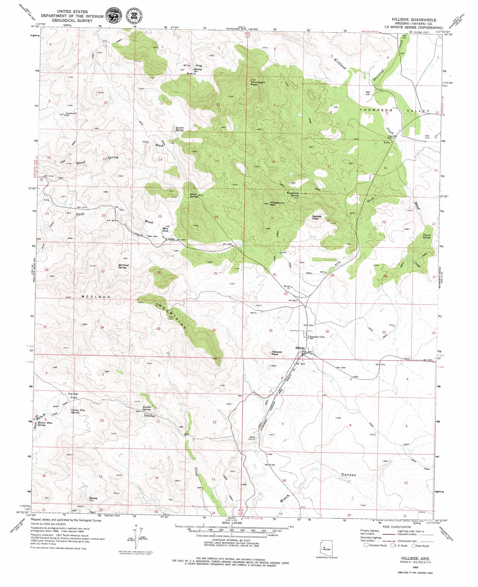
USGS Topo Quad 34112d8 - 1:24,000 scale
| Topo Map Name: | Hillside |
| USGS Topo Quad ID: | 34112d8 |
| Print Size: | ca. 21 1/4" wide x 27" high |
| Southeast Coordinates: | 34.375° N latitude / 112.875° W longitude |
| Map Center Coordinates: | 34.4375° N latitude / 112.9375° W longitude |
| U.S. State: | AZ |
| Filename: | o34112d8.jpg |
| Download Map JPG Image: | Hillside topo map 1:24,000 scale |
| Map Type: | Topographic |
| Topo Series: | 7.5´ |
| Map Scale: | 1:24,000 |
| Source of Map Images: | United States Geological Survey (USGS) |
| Alternate Map Versions: |
Hillside AZ 1969, updated 1973 Download PDF Buy paper map Hillside AZ 2011 Download PDF Buy paper map Hillside AZ 2014 Download PDF Buy paper map |
1:24,000 Topo Quads surrounding Hillside
Bozarth Mesa |
Behm Mesa |
Sheridan Mountain |
Smith Mesa |
Mount Josh |
Bagdad |
Big Shipp Mountain |
Muleshoe Ranch |
Martin Mountain |
Skull Valley |
Thorn Peak |
Malpais Mesa Ne |
Hillside |
Bismarck Mesa |
Kirkland |
Ives Peak |
Malpais Mesa |
Date |
Weaver Peak |
Peeples Valley |
Date Creek Ranch Nw |
Date Creek Ranch |
O'Neill Pass |
Congress |
Yarnell |
> Back to 34112a1 at 1:100,000 scale
> Back to 34112a1 at 1:250,000 scale
> Back to U.S. Topo Maps home
Hillside topo map: Gazetteer
Hillside: Basins
Wild Hog Basin elevation 1097m 3599′Hillside: Flats
Carter Flat elevation 1157m 3795′Hillside: Populated Places
Hillside elevation 1176m 3858′Yava elevation 1071m 3513′
Hillside: Reservoirs
Mine Tank elevation 1135m 3723′Hillside: Springs
Carter Flat Spring elevation 1146m 3759′Chartz Spring elevation 1129m 3704′
Hoover Dam Spring elevation 1113m 3651′
Kingsbury Spring elevation 1199m 3933′
Laurel Spring elevation 1146m 3759′
Lawler Spring elevation 1160m 3805′
McCloud Spring elevation 1120m 3674′
Quail Spring elevation 1173m 3848′
Hillside: Streams
Ally Wash elevation 1072m 3517′Bland Creek elevation 1068m 3503′
Eastwood Creek elevation 1054m 3458′
Hillside: Summits
Bismark Mountain elevation 1394m 4573′Hillside Peak elevation 1272m 4173′
Kingsbury Mountain elevation 1377m 4517′
McCloud Mountains elevation 1503m 4931′
Sadies Peak elevation 0m 0′
Thompson Peak elevation 1430m 4691′
Hillside: Valleys
Thompson Valley elevation 1106m 3628′Hillside: Wells
Sweetwater Well elevation 996m 3267′Hillside digital topo map on disk
Buy this Hillside topo map showing relief, roads, GPS coordinates and other geographical features, as a high-resolution digital map file on DVD: