Pine Canyon Topo Map New Mexico
To zoom in, hover over the map of Pine Canyon
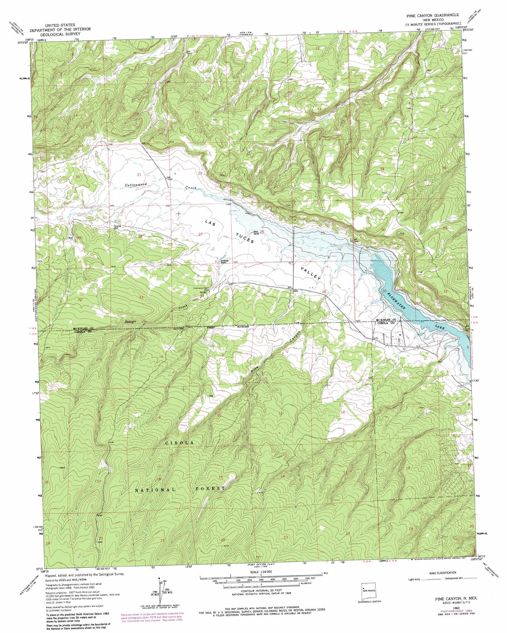
USGS Topo Quad 35108c2 - 1:24,000 scale
| Topo Map Name: | Pine Canyon |
| USGS Topo Quad ID: | 35108c2 |
| Print Size: | ca. 21 1/4" wide x 27" high |
| Southeast Coordinates: | 35.25° N latitude / 108.125° W longitude |
| Map Center Coordinates: | 35.3125° N latitude / 108.1875° W longitude |
| U.S. State: | NM |
| Filename: | o35108c2.jpg |
| Download Map JPG Image: | Pine Canyon topo map 1:24,000 scale |
| Map Type: | Topographic |
| Topo Series: | 7.5´ |
| Map Scale: | 1:24,000 |
| Source of Map Images: | United States Geological Survey (USGS) |
| Alternate Map Versions: |
Pine Canyon NM 1963, updated 1966 Download PDF Buy paper map Pine Canyon NM 1963, updated 1981 Download PDF Buy paper map Pine Canyon NM 1995, updated 1998 Download PDF Buy paper map Pine Canyon NM 2011 Download PDF Buy paper map Pine Canyon NM 2013 Download PDF Buy paper map Pine Canyon NM 2017 Download PDF Buy paper map |
| FStopo: | US Forest Service topo Pine Canyon is available: Download FStopo PDF Download FStopo TIF |
1:24,000 Topo Quads surrounding Pine Canyon
Pinedale |
Mariano Lake |
Hosta Butte |
Casamero Lake |
Borrego Pass |
Ciniza |
Continental Divide |
Thoreau |
Thoreau Ne |
Goat Mountain |
Page |
Cottonwood Canyon |
Pine Canyon |
Prewitt |
Bluewater |
Ramah |
Kettner Canyon |
Post Office Flat |
Mount Sedgwick |
Milan |
Togeye Lake |
El Morro |
Valle Largo |
Paxton Springs |
San Rafael |
> Back to 35108a1 at 1:100,000 scale
> Back to 35108a1 at 1:250,000 scale
> Back to U.S. Topo Maps home
Pine Canyon topo map: Gazetteer
Pine Canyon: Mines
Kimbler Pit elevation 2318m 7604′Pine Canyon: Reservoirs
Tuas Mesa Stock Tank elevation 2495m 8185′Tusas Mesa Tank elevation 2557m 8389′
Pine Canyon: Streams
Cottonwood Creek elevation 2250m 7381′Sawyer Creek elevation 2265m 7431′
Pine Canyon: Valleys
Pine Canyon elevation 2262m 7421′Pine Canyon: Wells
Bass Flow Water Well elevation 2262m 7421′Pine Canyon digital topo map on disk
Buy this Pine Canyon topo map showing relief, roads, GPS coordinates and other geographical features, as a high-resolution digital map file on DVD: