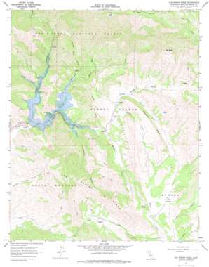
Tar Spring Ridge Topo Map California
To zoom in, hover over the map of Tar Spring Ridge
USGS Topo Quad 35120b4 - 1:24,000 scale
| Topo Map Name: | Tar Spring Ridge |
| USGS Topo Quad ID: | 35120b4 |
| Print Size: | ca. 21 1/4" wide x 27" high |
| Southeast Coordinates: | 35.125° N latitude / 120.375° W longitude |
| Map Center Coordinates: | 35.1875° N latitude / 120.4375° W longitude |
| U.S. State: | CA |
| Filename: | o35120b4.jpg |
| Download Map JPG Image: | Tar Spring Ridge topo map 1:24,000 scale |
| Map Type: | Topographic |
| Topo Series: | 7.5´ |
| Map Scale: | 1:24,000 |
| Source of Map Images: | United States Geological Survey (USGS) |
| Alternate Map Versions: |
Tar Spring Ridge CA 1967, updated 1969 Download PDF Buy paper map Tar Spring Ridge CA 1967, updated 1977 Download PDF Buy paper map Tar Spring Ridge CA 1995, updated 2000 Download PDF Buy paper map Tar Spring Ridge CA 2012 Download PDF Buy paper map Tar Spring Ridge CA 2015 Download PDF Buy paper map |
| FStopo: | US Forest Service topo Tar Spring Ridge is available: Download FStopo PDF Download FStopo TIF |
1:24,000 Topo Quads surrounding Tar Spring Ridge
> Back to 35120a1 at 1:100,000 scale
> Back to 35120a1 at 1:250,000 scale
> Back to U.S. Topo Maps home
Tar Spring Ridge topo map: Gazetteer
Tar Spring Ridge: Dams
Lopez Dam elevation 170m 557′Tar Spring Ridge: Flats
Huffs Hole elevation 558m 1830′Washington Flat elevation 264m 866′
Tar Spring Ridge: Parks
Routzhan Park elevation 168m 551′Tar Spring Ridge: Populated Places
Musick (historical) elevation 255m 836′Tar Spring Ridge: Reservoirs
Lopez Lake elevation 170m 557′Tar Spring Ridge: Ridges
Saucelito Ridge elevation 358m 1174′Tar Spring Ridge elevation 407m 1335′
Tar Spring Ridge: Springs
Cold Spring elevation 284m 931′Tar Spring Ridge: Streams
Dry Creek elevation 174m 570′Huffs Hole Creek elevation 170m 557′
Little Falls Creek elevation 195m 639′
Phoenix Creek elevation 168m 551′
Potrero Creek elevation 174m 570′
Saucelito Creek elevation 200m 656′
Vasquez Creek elevation 168m 551′
Wittenberg Creek elevation 168m 551′
Tar Spring Ridge: Summits
Big Baldy elevation 812m 2664′Tar Spring Ridge: Trails
Hi Mountain Trail elevation 657m 2155′Tar Spring Ridge: Valleys
Clapboard Canyon elevation 170m 557′Hi Valley elevation 608m 1994′
Long Canyon elevation 243m 797′
Lopez Canyon elevation 168m 551′
Tar Spring Ridge digital topo map on disk
Buy this Tar Spring Ridge topo map showing relief, roads, GPS coordinates and other geographical features, as a high-resolution digital map file on DVD:


