Hartwell Topo Map Arkansas
To zoom in, hover over the map of Hartwell
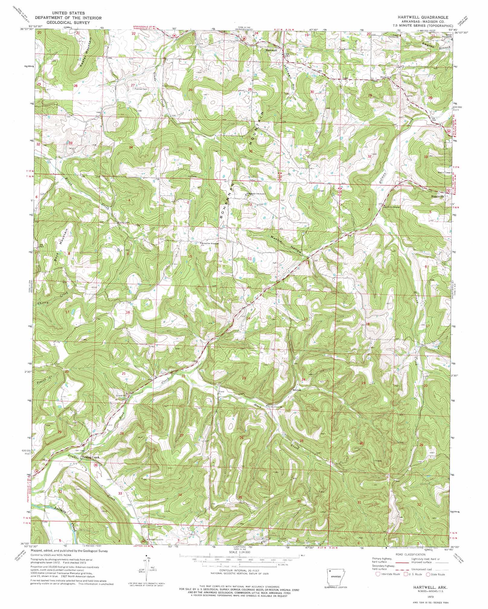
USGS Topo Quad 36093a7 - 1:24,000 scale
| Topo Map Name: | Hartwell |
| USGS Topo Quad ID: | 36093a7 |
| Print Size: | ca. 21 1/4" wide x 27" high |
| Southeast Coordinates: | 36° N latitude / 93.75° W longitude |
| Map Center Coordinates: | 36.0625° N latitude / 93.8125° W longitude |
| U.S. State: | AR |
| Filename: | o36093a7.jpg |
| Download Map JPG Image: | Hartwell topo map 1:24,000 scale |
| Map Type: | Topographic |
| Topo Series: | 7.5´ |
| Map Scale: | 1:24,000 |
| Source of Map Images: | United States Geological Survey (USGS) |
| Alternate Map Versions: |
Hartwell AR 1973, updated 1976 Download PDF Buy paper map Hartwell AR 2011 Download PDF Buy paper map Hartwell AR 2014 Download PDF Buy paper map |
1:24,000 Topo Quads surrounding Hartwell
Rogers |
War Eagle |
Sandstone Mountain |
Rockhouse |
Berryville |
Sonora |
Spring Valley |
Hindsville |
Forum |
Marble |
Elkins |
Goshen |
Hartwell |
Huntsville |
Kingston |
Sulphur City |
Durham |
Japton |
Witter |
Weathers |
Brentwood |
Delaney |
Saint Paul |
Pettigrew |
Boston |
> Back to 36093a1 at 1:100,000 scale
> Back to 36092a1 at 1:250,000 scale
> Back to U.S. Topo Maps home
Hartwell topo map: Gazetteer
Hartwell: Airports
Huntsville Airport elevation 531m 1742′Hartwell: Populated Places
Drakes Creek elevation 387m 1269′Hartwell elevation 423m 1387′
Mante (historical) elevation 498m 1633′
Roxton elevation 443m 1453′
Hartwell: Streams
Hock Creek elevation 383m 1256′Hartwell: Summits
Bohannan Mountain elevation 537m 1761′Boyd Mountain elevation 545m 1788′
Keefer Mountain elevation 513m 1683′
Hartwell: Valleys
Mantie Hollow elevation 441m 1446′Hartwell digital topo map on disk
Buy this Hartwell topo map showing relief, roads, GPS coordinates and other geographical features, as a high-resolution digital map file on DVD: