Potts Creek Topo Map Virginia
To zoom in, hover over the map of Potts Creek
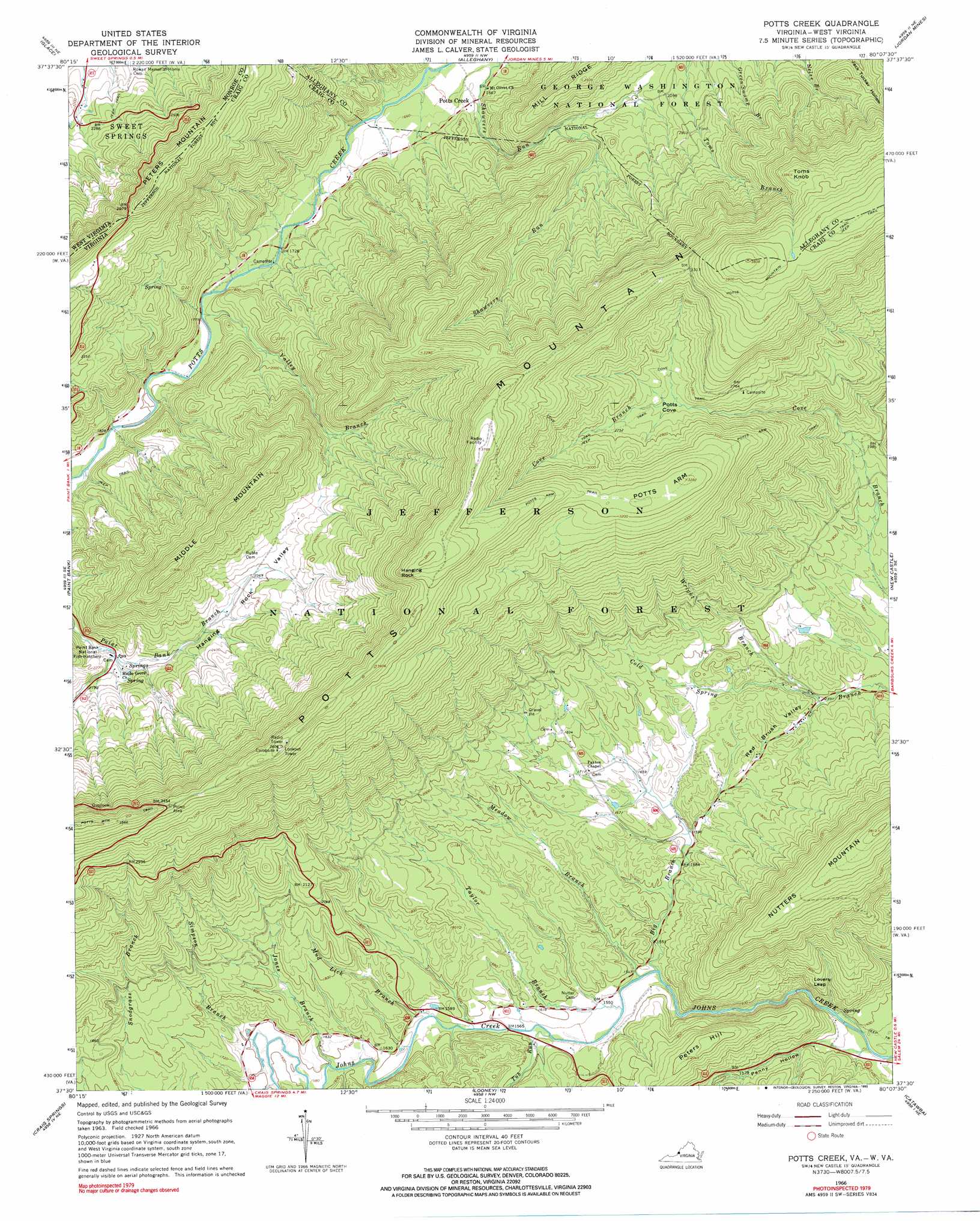
USGS Topo Quad 37080e2 - 1:24,000 scale
| Topo Map Name: | Potts Creek |
| USGS Topo Quad ID: | 37080e2 |
| Print Size: | ca. 21 1/4" wide x 27" high |
| Southeast Coordinates: | 37.5° N latitude / 80.125° W longitude |
| Map Center Coordinates: | 37.5625° N latitude / 80.1875° W longitude |
| U.S. States: | VA, WV |
| Filename: | o37080e2.jpg |
| Download Map JPG Image: | Potts Creek topo map 1:24,000 scale |
| Map Type: | Topographic |
| Topo Series: | 7.5´ |
| Map Scale: | 1:24,000 |
| Source of Map Images: | United States Geological Survey (USGS) |
| Alternate Map Versions: |
Potts Creek VA 1966, updated 1967 Download PDF Buy paper map Potts Creek VA 1966, updated 1990 Download PDF Buy paper map Potts Creek VA 2011 Download PDF Buy paper map Potts Creek VA 2013 Download PDF Buy paper map Potts Creek VA 2016 Download PDF Buy paper map |
| FStopo: | US Forest Service topo Potts Creek is available: Download FStopo PDF Download FStopo TIF |
1:24,000 Topo Quads surrounding Potts Creek
Lewisburg |
White Sulphur Springs |
Jerrys Run |
Callaghan |
Covington |
Ronceverte |
Glace |
Alleghany |
Jordan Mines |
Strom |
Gap Mills |
Paint Bank |
Potts Creek |
New Castle |
Oriskany |
Waiteville |
Craig Springs |
Looney |
Catawba |
Daleville |
Newport |
Mcdonalds Mill |
Glenvar |
Salem |
Roanoke |
> Back to 37080e1 at 1:100,000 scale
> Back to 37080a1 at 1:250,000 scale
> Back to U.S. Topo Maps home
Potts Creek topo map: Gazetteer
Potts Creek: Cliffs
Lovers Leap elevation 481m 1578′Potts Creek: Flats
Potts Cove elevation 812m 2664′Potts Creek: Populated Places
Potts Creek elevation 511m 1676′Potts Creek: Streams
Big Branch elevation 465m 1525′Jones Branch elevation 477m 1564′
Meadow Branch elevation 467m 1532′
Mud Lick Branch elevation 472m 1548′
Simpson Branch elevation 480m 1574′
Taylor Branch elevation 466m 1528′
Tub Run elevation 474m 1555′
Valley Branch elevation 535m 1755′
Wright Branch elevation 487m 1597′
Potts Creek: Summits
Hanging Rock elevation 1102m 3615′Middle Mountain elevation 961m 3152′
Nutters Mountain elevation 854m 2801′
Peters Hill elevation 614m 2014′
Potts Arm elevation 1000m 3280′
Toms Knob elevation 1031m 3382′
Potts Creek: Trails
Cove Trail elevation 853m 2798′Potts Arm Trail elevation 1015m 3330′
Potts Creek: Valleys
Hanging Rock Valley elevation 637m 2089′Penny Hollow elevation 420m 1377′
Red Brush Valley elevation 485m 1591′
Potts Creek digital topo map on disk
Buy this Potts Creek topo map showing relief, roads, GPS coordinates and other geographical features, as a high-resolution digital map file on DVD:
Western Virginia & Southern West Virginia
Buy digital topo maps: Western Virginia & Southern West Virginia