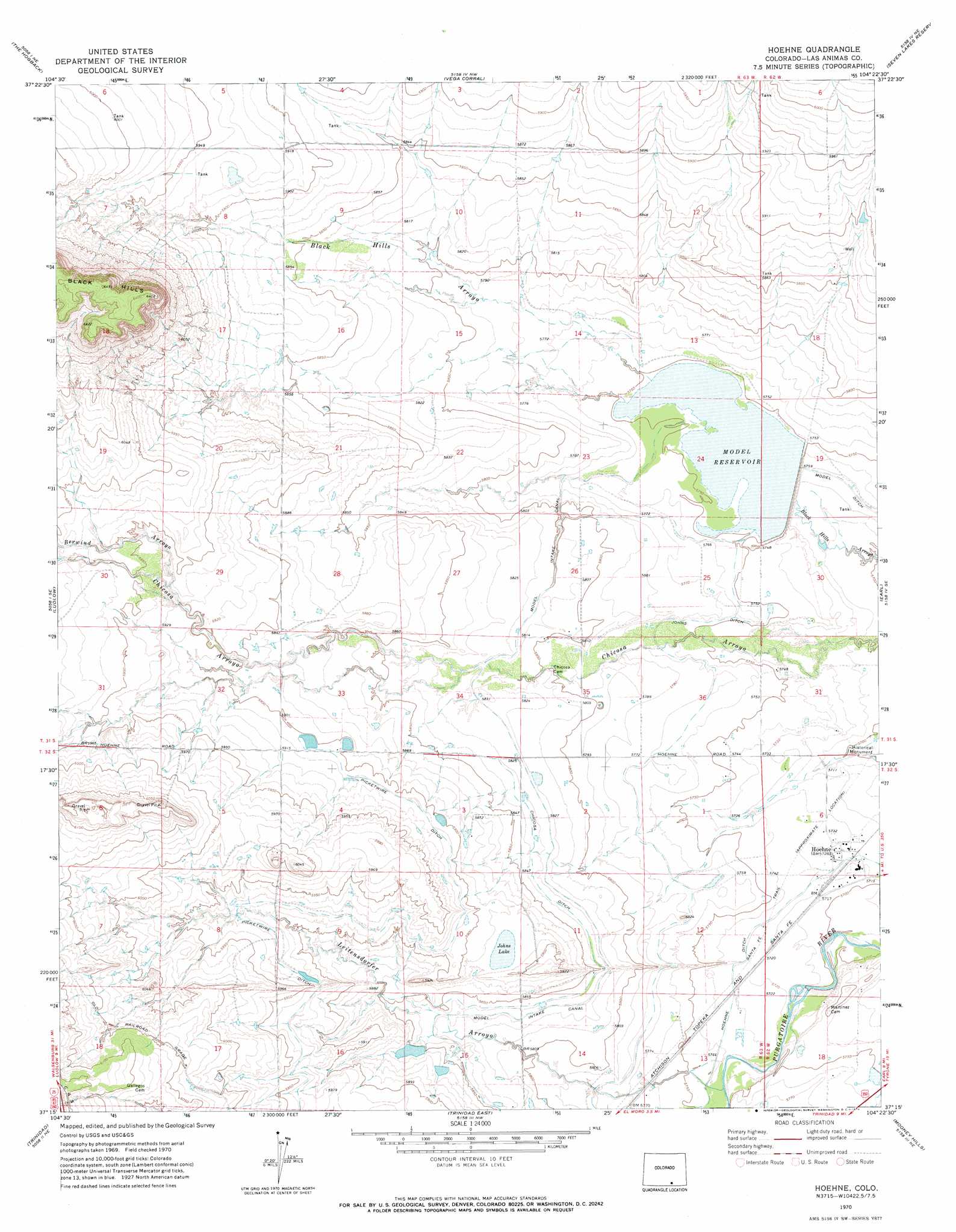
Hoehne Topo Map Colorado
To zoom in, hover over the map of Hoehne
USGS Topo Quad 37104c4 - 1:24,000 scale
| Topo Map Name: | Hoehne |
| USGS Topo Quad ID: | 37104c4 |
| Print Size: | ca. 21 1/4" wide x 27" high |
| Southeast Coordinates: | 37.25° N latitude / 104.375° W longitude |
| Map Center Coordinates: | 37.3125° N latitude / 104.4375° W longitude |
| U.S. State: | CO |
| Filename: | o37104c4.jpg |
| Download Map JPG Image: | Hoehne topo map 1:24,000 scale |
| Map Type: | Topographic |
| Topo Series: | 7.5´ |
| Map Scale: | 1:24,000 |
| Source of Map Images: | United States Geological Survey (USGS) |
| Alternate Map Versions: |
Hoehne CO 1970, updated 1974 Download PDF Buy paper map Hoehne CO 2010 Download PDF Buy paper map Hoehne CO 2013 Download PDF Buy paper map Hoehne CO 2016 Download PDF Buy paper map |
1:24,000 Topo Quads surrounding Hoehne
Pryor |
Pryor Se |
Little Dome |
Hidden Valley Ranch |
Bates Lake |
Aguilar |
The Hogback |
Vega Corral |
Seven Lakes Reservoir |
Tyrone |
Delagua |
Ludlow |
Hoehne |
Earl |
Model |
Madrid |
Trinidad West |
Trinidad East |
Mooney Hills |
Patterson Crossing |
Valdez |
Starkville |
Fishers Peak |
Barela |
Abeyta |
> Back to 37104a1 at 1:100,000 scale
> Back to 37104a1 at 1:250,000 scale
> Back to U.S. Topo Maps home
Hoehne topo map: Gazetteer
Hoehne: Canals
Chicosa Ditch elevation 1780m 5839′Hoehne Ditch elevation 1747m 5731′
Model Intake Canal elevation 1781m 5843′
Hoehne: Dams
Model Dam elevation 1754m 5754′Hoehne: Lakes
Johns Lake elevation 1795m 5889′Hoehne: Populated Places
Hoehne elevation 1747m 5731′Hoehne: Reservoirs
Model Reservoir elevation 1754m 5754′Hoehne: Streams
Berwind Arroyo elevation 1805m 5921′Leitensdorfer Arroyo elevation 1747m 5731′
Hoehne digital topo map on disk
Buy this Hoehne topo map showing relief, roads, GPS coordinates and other geographical features, as a high-resolution digital map file on DVD: