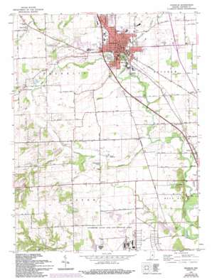
Franklin Topo Map Indiana
To zoom in, hover over the map of Franklin
USGS Topo Quad 39086d1 - 1:24,000 scale
| Topo Map Name: | Franklin |
| USGS Topo Quad ID: | 39086d1 |
| Print Size: | ca. 21 1/4" wide x 27" high |
| Southeast Coordinates: | 39.375° N latitude / 86° W longitude |
| Map Center Coordinates: | 39.4375° N latitude / 86.0625° W longitude |
| U.S. State: | IN |
| Filename: | o39086d1.jpg |
| Download Map JPG Image: | Franklin topo map 1:24,000 scale |
| Map Type: | Topographic |
| Topo Series: | 7.5´ |
| Map Scale: | 1:24,000 |
| Source of Map Images: | United States Geological Survey (USGS) |
| Alternate Map Versions: |
Franklin IN 1948 Download PDF Buy paper map Franklin IN 1961, updated 1964 Download PDF Buy paper map Franklin IN 1961, updated 1968 Download PDF Buy paper map Franklin IN 1961, updated 1981 Download PDF Buy paper map Franklin IN 1961, updated 1988 Download PDF Buy paper map Franklin IN 1961, updated 1994 Download PDF Buy paper map Franklin IN 1961, updated 1994 Download PDF Buy paper map Franklin IN 2010 Download PDF Buy paper map Franklin IN 2013 Download PDF Buy paper map Franklin IN 2016 Download PDF Buy paper map |
1:24,000 Topo Quads surrounding Franklin
> Back to 39086a1 at 1:100,000 scale
> Back to 39086a1 at 1:250,000 scale
> Back to U.S. Topo Maps home
Franklin topo map: Gazetteer
Franklin: Airports
Franklin Airport elevation 224m 734′Franklin: Canals
Hazelett Ditch elevation 219m 718′Vandivier Ditch elevation 225m 738′
Franklin: Crossings
Interchange 90 elevation 226m 741′Franklin: Dams
Atterbury Dam East elevation 206m 675′Bell Lake Dam elevation 252m 826′
Earth Dam West elevation 227m 744′
FFA Youth Center Dam Number 1 elevation 260m 853′
Pease Lake Dam elevation 216m 708′
Ray Willoughby Dam Number 1 elevation 247m 810′
Ray Willoughby Dam Number 2 North elevation 241m 790′
Saunders Lake Dam elevation 216m 708′
Franklin: Lakes
Mullendore Pond elevation 225m 738′Franklin: Parks
Allendale Camp elevation 255m 836′Atterbury State Fish and Wildlife Area elevation 233m 764′
Dame Mall elevation 223m 731′
Province Park elevation 218m 715′
Runkle Tennis Courts elevation 222m 728′
Stewart "Red" Faught Stadium elevation 222m 728′
Franklin: Populated Places
Amity elevation 210m 688′Franklin elevation 221m 725′
Hopewell elevation 237m 777′
Mount Pleasant elevation 235m 770′
Franklin: Reservoirs
Bell Lake elevation 252m 826′FFA Youth Lake elevation 260m 853′
Pisgah Lake elevation 206m 675′
Ray Willoughby Lake elevation 247m 810′
Saunders Lake elevation 216m 708′
Stone Arch Lake elevation 227m 744′
Woodridge Lake elevation 216m 708′
Franklin: Streams
Buckhart Creek elevation 210m 688′Hurricane Creek elevation 216m 708′
Moores Creek elevation 228m 748′
Ray Creek elevation 221m 725′
Tucker Creek elevation 218m 715′
Youngs Creek elevation 203m 666′
Franklin digital topo map on disk
Buy this Franklin topo map showing relief, roads, GPS coordinates and other geographical features, as a high-resolution digital map file on DVD:
Northern Illinois, Northern Indiana & Southwestern Michigan
Buy digital topo maps: Northern Illinois, Northern Indiana & Southwestern Michigan


