Pinnacle Peak Topo Map Utah
To zoom in, hover over the map of Pinnacle Peak
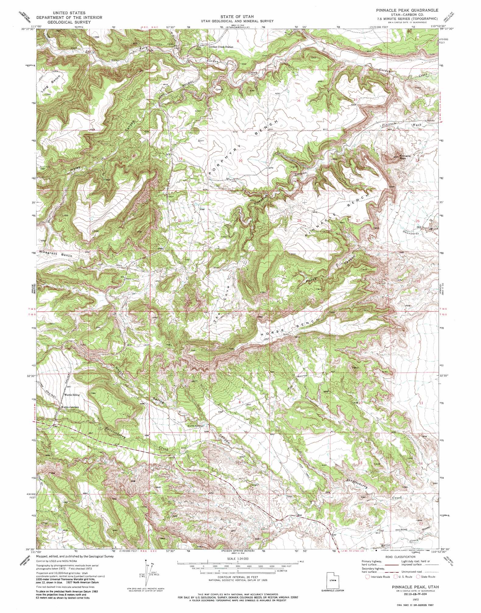
USGS Topo Quad 39110e8 - 1:24,000 scale
| Topo Map Name: | Pinnacle Peak |
| USGS Topo Quad ID: | 39110e8 |
| Print Size: | ca. 21 1/4" wide x 27" high |
| Southeast Coordinates: | 39.5° N latitude / 110.875° W longitude |
| Map Center Coordinates: | 39.5625° N latitude / 110.9375° W longitude |
| U.S. State: | UT |
| Filename: | o39110e8.jpg |
| Download Map JPG Image: | Pinnacle Peak topo map 1:24,000 scale |
| Map Type: | Topographic |
| Topo Series: | 7.5´ |
| Map Scale: | 1:24,000 |
| Source of Map Images: | United States Geological Survey (USGS) |
| Alternate Map Versions: |
Pinnacle Peak UT 1972, updated 1976 Download PDF Buy paper map Pinnacle Peak UT 1972, updated 1985 Download PDF Buy paper map Pinnacle Peak UT 2011 Download PDF Buy paper map Pinnacle Peak UT 2014 Download PDF Buy paper map |
1:24,000 Topo Quads surrounding Pinnacle Peak
Scofield Reservoir |
Colton |
Kyune |
Matts Summit |
Minnie Maud Creek West |
Scofield |
Jump Creek |
Standardville |
Helper |
Deadman Canyon |
Candland Mountain |
Wattis |
Pinnacle Peak |
Price |
Wellington |
Rilda Canyon |
Hiawatha |
Poison Spring Bench |
Elmo |
Olsen Reservoir |
Mahogany Point |
Red Point |
Huntington |
Cleveland |
Cow Flats |
> Back to 39110e1 at 1:100,000 scale
> Back to 39110a1 at 1:250,000 scale
> Back to U.S. Topo Maps home
Pinnacle Peak topo map: Gazetteer
Pinnacle Peak: Benches
Horse Bench elevation 2078m 6817′Pinnacle Bench elevation 1948m 6391′
Porphyry Bench elevation 1929m 6328′
Pinnacle Peak: Populated Places
Wattis Junction elevation 2136m 7007′Pinnacle Peak: Springs
North Spring elevation 1933m 6341′Pinnacle Peak: Streams
North Fork Gordon Creek elevation 1885m 6184′South Fork Gordon Creek elevation 1885m 6184′
Pinnacle Peak: Summits
Pinnacle Peak elevation 1877m 6158′Pinnacle Peak: Valleys
Haley Canyon elevation 1844m 6049′North Spring Canyon elevation 1851m 6072′
Pinnacle Canyon elevation 1778m 5833′
Serviceberry Canyon elevation 2019m 6624′
Trail Canyon elevation 1977m 6486′
Pinnacle Peak digital topo map on disk
Buy this Pinnacle Peak topo map showing relief, roads, GPS coordinates and other geographical features, as a high-resolution digital map file on DVD: