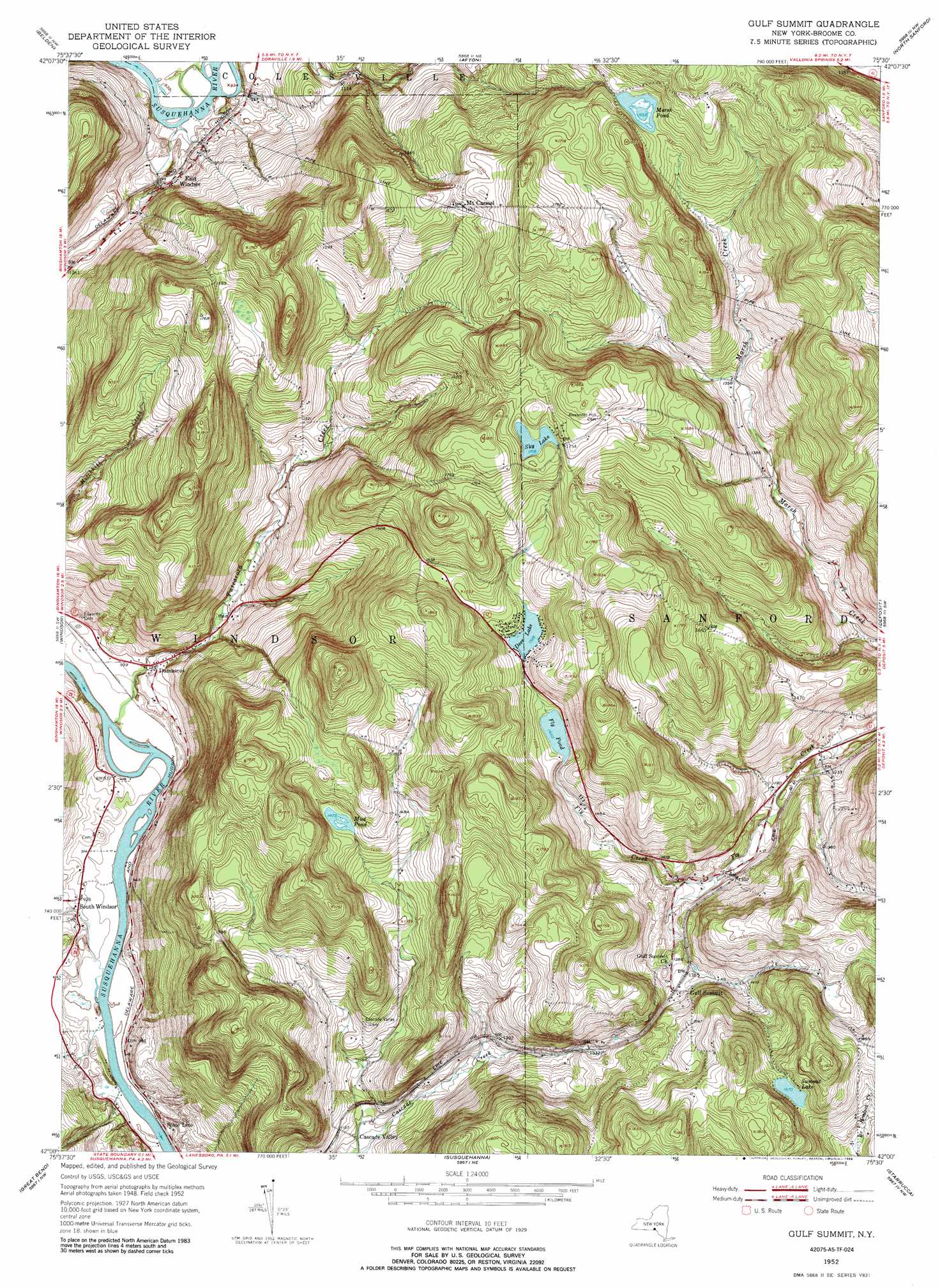
Gulf Summit Topo Map New York
To zoom in, hover over the map of Gulf Summit
USGS Topo Quad 42075a5 - 1:24,000 scale
| Topo Map Name: | Gulf Summit |
| USGS Topo Quad ID: | 42075a5 |
| Print Size: | ca. 21 1/4" wide x 27" high |
| Southeast Coordinates: | 42° N latitude / 75.5° W longitude |
| Map Center Coordinates: | 42.0625° N latitude / 75.5625° W longitude |
| U.S. State: | NY |
| Filename: | o42075a5.jpg |
| Download Map JPG Image: | Gulf Summit topo map 1:24,000 scale |
| Map Type: | Topographic |
| Topo Series: | 7.5´ |
| Map Scale: | 1:24,000 |
| Source of Map Images: | United States Geological Survey (USGS) |
| Alternate Map Versions: |
Gulf Summit NY 1952, updated 1954 Download PDF Buy paper map Gulf Summit NY 1952, updated 1966 Download PDF Buy paper map Gulf Summit NY 1952, updated 1976 Download PDF Buy paper map Gulf Summit NY 1952, updated 1988 Download PDF Buy paper map Gulf Summit NY 2010 Download PDF Buy paper map Gulf Summit NY 2013 Download PDF Buy paper map Gulf Summit NY 2016 Download PDF Buy paper map |
1:24,000 Topo Quads surrounding Gulf Summit
Greene |
Brisben |
West Bainbridge |
Sidney |
Unadilla |
Chenango Forks |
Belden |
Afton |
North Sanford |
Trout Creek |
Binghamton East |
Windsor |
Gulf Summit |
Deposit |
Cannonsville Reservoir |
Franklin Forks |
Great Bend |
Susquehanna |
Starrucca |
Hancock |
Montrose East |
Harford |
Thompson |
Orson |
Lake Como |
> Back to 42075a1 at 1:100,000 scale
> Back to 42074a1 at 1:250,000 scale
> Back to U.S. Topo Maps home
Gulf Summit topo map: Gazetteer
Gulf Summit: Lakes
Deer Lake elevation 463m 1519′Fly Pond elevation 442m 1450′
Marsh Pond elevation 504m 1653′
Mud Pond elevation 449m 1473′
Summit Lake elevation 509m 1669′
Gulf Summit: Populated Places
Cascade Valley elevation 347m 1138′Damascus elevation 297m 974′
East Windsor elevation 307m 1007′
Gulf Summit elevation 417m 1368′
Mount Carmel elevation 486m 1594′
South Windsor elevation 283m 928′
Gulf Summit: Reservoirs
Sky Lake elevation 523m 1715′Gulf Summit: Streams
Tuscarora Creek elevation 273m 895′Gulf Summit digital topo map on disk
Buy this Gulf Summit topo map showing relief, roads, GPS coordinates and other geographical features, as a high-resolution digital map file on DVD:
New York, Vermont, Connecticut & Western Massachusetts
Buy digital topo maps: New York, Vermont, Connecticut & Western Massachusetts