Fossil Canyon Topo Map Idaho
To zoom in, hover over the map of Fossil Canyon
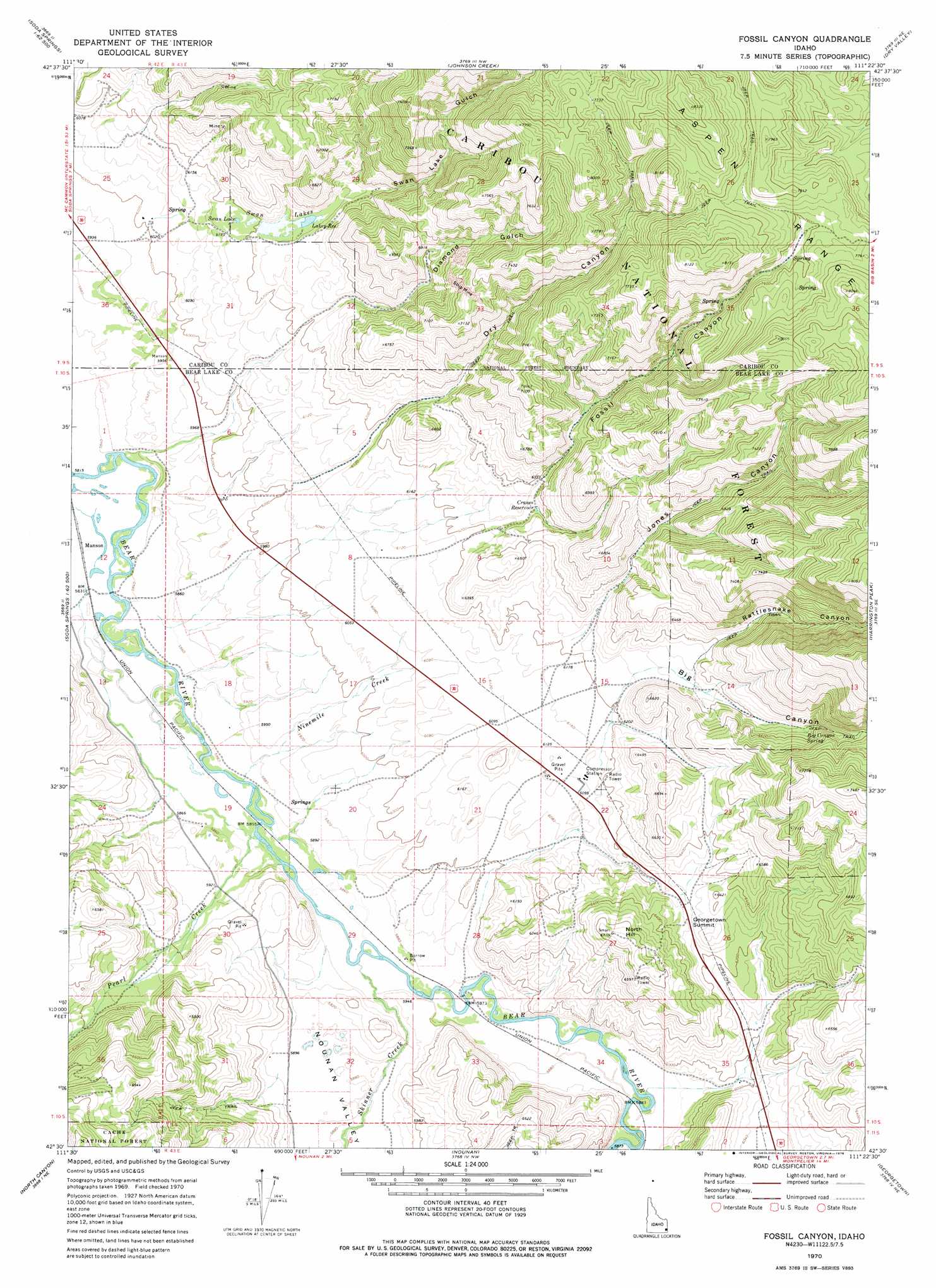
USGS Topo Quad 42111e4 - 1:24,000 scale
| Topo Map Name: | Fossil Canyon |
| USGS Topo Quad ID: | 42111e4 |
| Print Size: | ca. 21 1/4" wide x 27" high |
| Southeast Coordinates: | 42.5° N latitude / 111.375° W longitude |
| Map Center Coordinates: | 42.5625° N latitude / 111.4375° W longitude |
| U.S. State: | ID |
| Filename: | o42111e4.jpg |
| Download Map JPG Image: | Fossil Canyon topo map 1:24,000 scale |
| Map Type: | Topographic |
| Topo Series: | 7.5´ |
| Map Scale: | 1:24,000 |
| Source of Map Images: | United States Geological Survey (USGS) |
| Alternate Map Versions: |
Fossil Canyon ID 1970, updated 1973 Download PDF Buy paper map Fossil Canyon ID 2011 Download PDF Buy paper map Fossil Canyon ID 2013 Download PDF Buy paper map |
| FStopo: | US Forest Service topo Fossil Canyon is available: Download FStopo PDF Download FStopo TIF |
1:24,000 Topo Quads surrounding Fossil Canyon
The Dip |
China Hat |
Lower Valley |
Upper Valley |
Diamond Flat |
Alexander |
Soda Springs |
Johnson Creek |
Dry Valley |
Stewart Flat |
Grace |
Soda Peak |
Fossil Canyon |
Harrington Peak |
Snowdrift Mountain |
Thatcher |
North Canyon |
Nounan |
Georgetown |
Meade Peak |
Oneida Narrows Reservoir |
Midnight Mountain |
Ovid |
Montpelier |
Montpelier Canyon |
> Back to 42111e1 at 1:100,000 scale
> Back to 42110a1 at 1:250,000 scale
> Back to U.S. Topo Maps home
Fossil Canyon topo map: Gazetteer
Fossil Canyon: Dams
Stewart Ranch Dam elevation 1879m 6164′Fossil Canyon: Gaps
Georgetown Summit elevation 2040m 6692′Fossil Canyon: Lakes
Swan Lake elevation 1890m 6200′Swan Lakes elevation 1887m 6190′
Fossil Canyon: Populated Places
Manson elevation 1777m 5830′Fossil Canyon: Reservoirs
Cranes Reservoir elevation 1924m 6312′Lakey Reservoir elevation 1900m 6233′
Fossil Canyon: Springs
Big Canyon Spring elevation 2240m 7349′Fossil Canyon: Streams
Ninemile Creek elevation 1787m 5862′Pearl Creek elevation 1784m 5853′
Skinner Creek elevation 1788m 5866′
Fossil Canyon: Valleys
Bear Lake Valley elevation 1916m 6286′Big Canyon elevation 1890m 6200′
Diamond Gulch elevation 1783m 5849′
Dry Canyon elevation 1817m 5961′
Fossil Canyon elevation 1867m 6125′
Jones Canyon elevation 1898m 6227′
Nounan Valley elevation 1788m 5866′
Rattlesnake Canyon elevation 1930m 6332′
Swan Lake Gulch elevation 1892m 6207′
Fossil Canyon digital topo map on disk
Buy this Fossil Canyon topo map showing relief, roads, GPS coordinates and other geographical features, as a high-resolution digital map file on DVD: