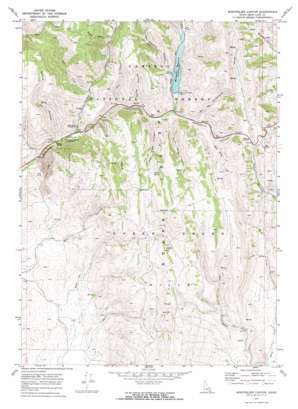
Montpelier Canyon Topo Map Idaho
To zoom in, hover over the map of Montpelier Canyon
USGS Topo Quad 42111c2 - 1:24,000 scale
| Topo Map Name: | Montpelier Canyon |
| USGS Topo Quad ID: | 42111c2 |
| Print Size: | ca. 21 1/4" wide x 27" high |
| Southeast Coordinates: | 42.25° N latitude / 111.125° W longitude |
| Map Center Coordinates: | 42.3125° N latitude / 111.1875° W longitude |
| U.S. State: | ID |
| Filename: | o42111c2.jpg |
| Download Map JPG Image: | Montpelier Canyon topo map 1:24,000 scale |
| Map Type: | Topographic |
| Topo Series: | 7.5´ |
| Map Scale: | 1:24,000 |
| Source of Map Images: | United States Geological Survey (USGS) |
| Alternate Map Versions: |
Montpelier Canyon ID 1970, updated 1973 Download PDF Buy paper map Montpelier Canyon ID 1970, updated 1973 Download PDF Buy paper map Montpelier Canyon ID 2011 Download PDF Buy paper map Montpelier Canyon ID 2013 Download PDF Buy paper map |
| FStopo: | US Forest Service topo Montpelier Canyon is available: Download FStopo PDF Download FStopo TIF |
1:24,000 Topo Quads surrounding Montpelier Canyon
> Back to 42111a1 at 1:100,000 scale
> Back to 42110a1 at 1:250,000 scale
> Back to U.S. Topo Maps home
Montpelier Canyon topo map: Gazetteer
Montpelier Canyon: Areas
Hellhole elevation 2180m 7152′Montpelier Canyon: Dams
Montpelier Creek Dam elevation 1988m 6522′Montpelier Canyon: Ranges
Preuss Range elevation 2235m 7332′Montpelier Canyon: Reservoirs
Montpelier Reservoir elevation 1988m 6522′Montpelier Canyon: Springs
Willow Spring elevation 2169m 7116′Montpelier Canyon: Streams
Left Fork elevation 2017m 6617′Twin Spring Creek elevation 2006m 6581′
Montpelier Canyon: Summits
Geneva Summit elevation 2117m 6945′Montpelier Canyon: Valleys
Aegetter Hollow elevation 1993m 6538′Banks Valley elevation 1898m 6227′
Bunney Gulch elevation 2177m 7142′
Gertch Canyon elevation 1917m 6289′
Home Canyon elevation 1913m 6276′
South Elbow Hollow elevation 1967m 6453′
Telephone Draw elevation 1981m 6499′
West Elbow Hollow elevation 1956m 6417′
Whitman Hollow elevation 1955m 6414′
Montpelier Canyon digital topo map on disk
Buy this Montpelier Canyon topo map showing relief, roads, GPS coordinates and other geographical features, as a high-resolution digital map file on DVD:


