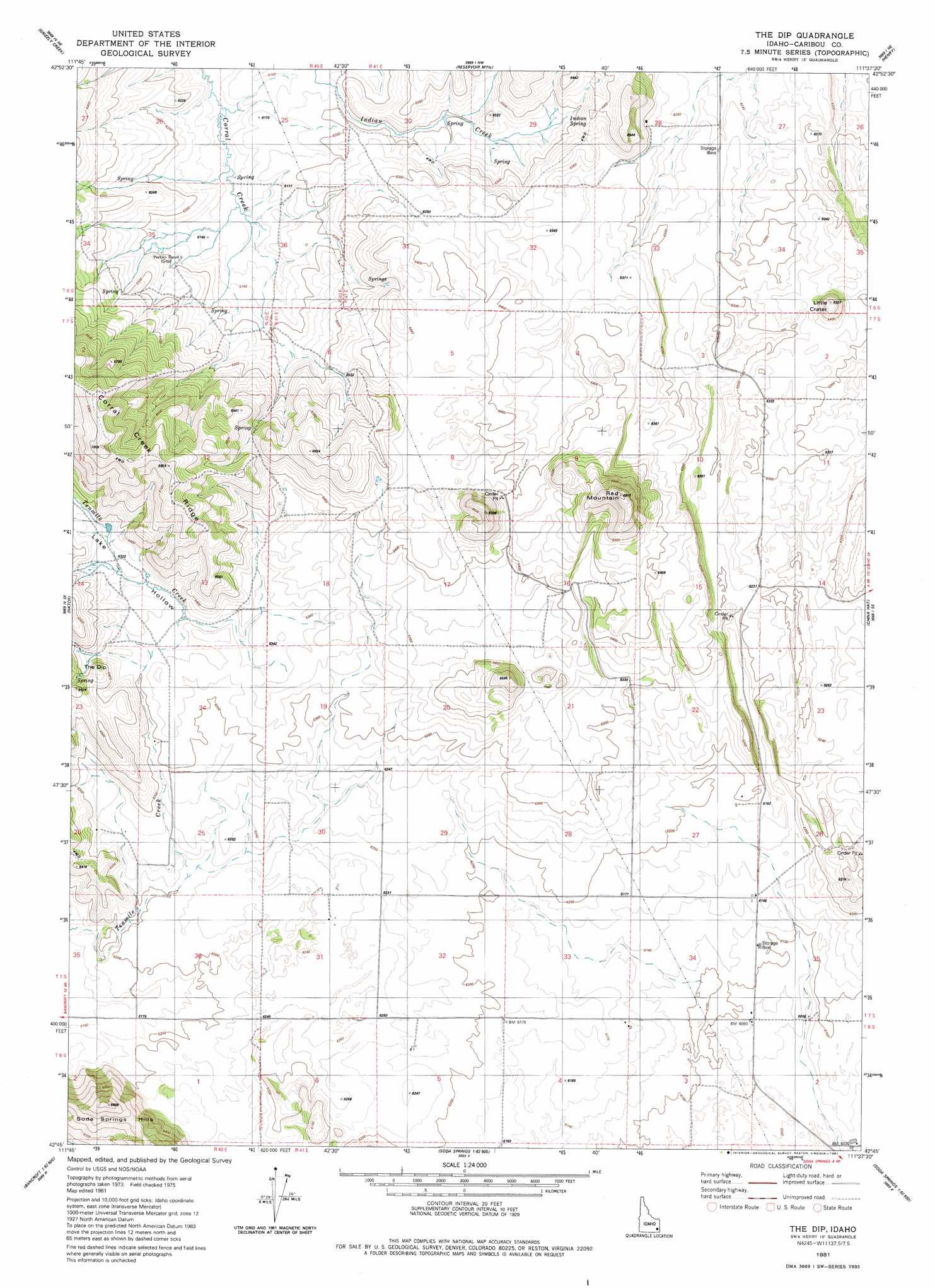
The Dip Topo Map Idaho
To zoom in, hover over the map of The Dip
USGS Topo Quad 42111g6 - 1:24,000 scale
| Topo Map Name: | The Dip |
| USGS Topo Quad ID: | 42111g6 |
| Print Size: | ca. 21 1/4" wide x 27" high |
| Southeast Coordinates: | 42.75° N latitude / 111.625° W longitude |
| Map Center Coordinates: | 42.8125° N latitude / 111.6875° W longitude |
| U.S. State: | ID |
| Filename: | o42111g6.jpg |
| Download Map JPG Image: | The Dip topo map 1:24,000 scale |
| Map Type: | Topographic |
| Topo Series: | 7.5´ |
| Map Scale: | 1:24,000 |
| Source of Map Images: | United States Geological Survey (USGS) |
| Alternate Map Versions: |
The Dip ID 1981, updated 1981 Download PDF Buy paper map The Dip ID 2010 Download PDF Buy paper map The Dip ID 2013 Download PDF Buy paper map |
1:24,000 Topo Quads surrounding The Dip
Dunn Basin |
Paradise Valley |
Meadow Creek Mountain |
Little Valley Hills |
Bear Island |
Chesterfield Res |
Grizzly Creek |
Reservoir Mountain |
Henry |
Wayan West |
Chesterfield |
Hatch |
The Dip |
China Hat |
Lower Valley |
Bancroft |
Talmage |
Alexander |
Soda Springs |
Johnson Creek |
Sedgwick Peak |
Grace Power Plant |
Grace |
Soda Peak |
Fossil Canyon |
> Back to 42111e1 at 1:100,000 scale
> Back to 42110a1 at 1:250,000 scale
> Back to U.S. Topo Maps home
The Dip topo map: Gazetteer
The Dip: Lavas
Blackfoot Lava Field elevation 1942m 6371′The Dip: Ranges
Chesterfield Range elevation 2121m 6958′The Dip: Ridges
Corral Creek Ridge elevation 2083m 6833′The Dip: Springs
Indian Spring elevation 1914m 6279′The Dip: Summits
Little Crater elevation 1972m 6469′Red Mountain elevation 2076m 6811′
The Dip: Valleys
Lake Hollow elevation 1935m 6348′The Dip digital topo map on disk
Buy this The Dip topo map showing relief, roads, GPS coordinates and other geographical features, as a high-resolution digital map file on DVD: