North Pownal Topo Map Maine
To zoom in, hover over the map of North Pownal
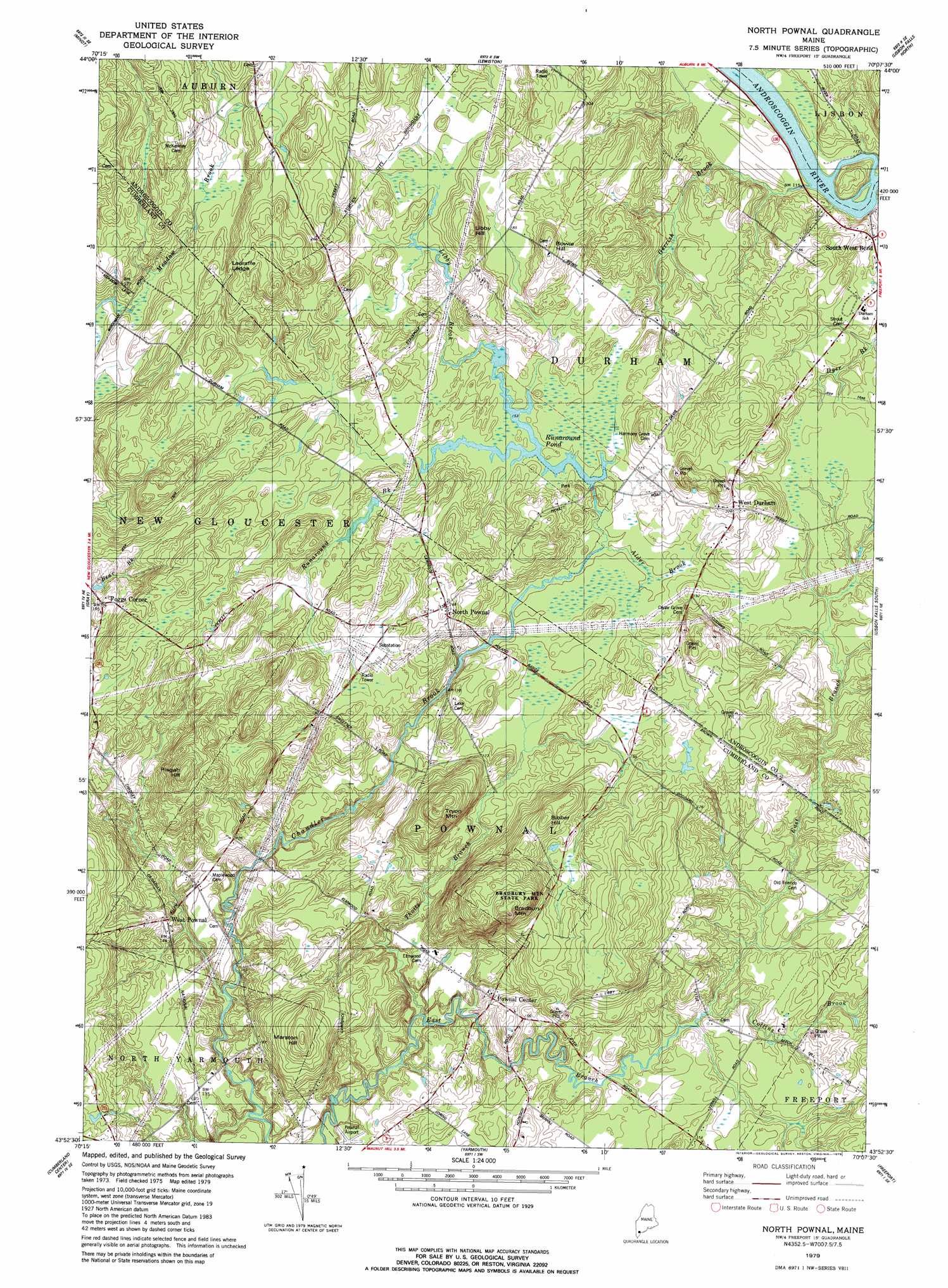
USGS Topo Quad 43070h2 - 1:24,000 scale
| Topo Map Name: | North Pownal |
| USGS Topo Quad ID: | 43070h2 |
| Print Size: | ca. 21 1/4" wide x 27" high |
| Southeast Coordinates: | 43.875° N latitude / 70.125° W longitude |
| Map Center Coordinates: | 43.9375° N latitude / 70.1875° W longitude |
| U.S. State: | ME |
| Filename: | o43070h2.jpg |
| Download Map JPG Image: | North Pownal topo map 1:24,000 scale |
| Map Type: | Topographic |
| Topo Series: | 7.5´ |
| Map Scale: | 1:24,000 |
| Source of Map Images: | United States Geological Survey (USGS) |
| Alternate Map Versions: |
North Pownal ME 1979, updated 1979 Download PDF Buy paper map North Pownal ME 1979, updated 1979 Download PDF Buy paper map North Pownal ME 2011 Download PDF Buy paper map North Pownal ME 2014 Download PDF Buy paper map |
1:24,000 Topo Quads surrounding North Pownal
Oxford |
Lake Auburn West |
Lake Auburn East |
Monmouth |
Purgatory |
Mechanic Falls |
Minot |
Lewiston |
Lisbon Falls North |
Bowdoinham |
Raymond |
Gray |
North Pownal |
Lisbon Falls South |
Brunswick |
North Windham |
Cumberland Center |
Yarmouth |
Freeport |
Orrs Island |
Gorham |
Portland West |
Portland East |
South Harpswell |
Bailey Island |
> Back to 43070e1 at 1:100,000 scale
> Back to 43070a1 at 1:250,000 scale
> Back to U.S. Topo Maps home
North Pownal topo map: Gazetteer
North Pownal: Airports
Margerison Airport elevation 56m 183′Pownal Airport elevation 37m 121′
North Pownal: Benches
Lauraffe Ledge elevation 95m 311′North Pownal: Dams
Runaround Pond Dam elevation 46m 150′North Pownal: Parks
Bradbury Mountain State Park elevation 124m 406′North Pownal: Populated Places
Foggs Corner elevation 57m 187′North Pownal elevation 80m 262′
Pownal Center elevation 41m 134′
South West Bend elevation 45m 147′
West Durham elevation 69m 226′
West Pownal elevation 42m 137′
North Pownal: Reservoirs
Runaround Pond elevation 46m 150′North Pownal: Streams
Alder Brook elevation 44m 144′Collins Brook elevation 32m 104′
Dyer Brook elevation 31m 101′
Gerrish Brook elevation 32m 104′
Libby Brook elevation 46m 150′
Runaround Brook elevation 44m 144′
Thoits Branch elevation 25m 82′
North Pownal: Summits
Bibber Hill elevation 105m 344′Bowie Hill elevation 86m 282′
Bradbury Mountain elevation 143m 469′
Libby Hill elevation 95m 311′
Marston Hill elevation 108m 354′
Pisgah Hill elevation 115m 377′
Tryon Mountain elevation 119m 390′
North Pownal digital topo map on disk
Buy this North Pownal topo map showing relief, roads, GPS coordinates and other geographical features, as a high-resolution digital map file on DVD:
Maine, New Hampshire, Rhode Island & Eastern Massachusetts
Buy digital topo maps: Maine, New Hampshire, Rhode Island & Eastern Massachusetts