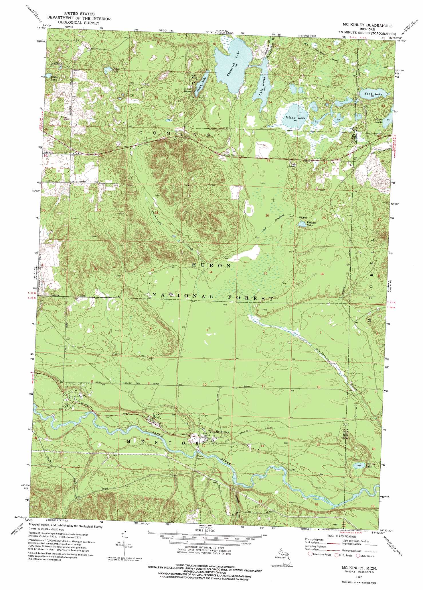
Mckinley Topo Map Michigan
To zoom in, hover over the map of Mckinley
USGS Topo Quad 44083f8 - 1:24,000 scale
| Topo Map Name: | Mckinley |
| USGS Topo Quad ID: | 44083f8 |
| Print Size: | ca. 21 1/4" wide x 27" high |
| Southeast Coordinates: | 44.625° N latitude / 83.875° W longitude |
| Map Center Coordinates: | 44.6875° N latitude / 83.9375° W longitude |
| U.S. State: | MI |
| Filename: | o44083f8.jpg |
| Download Map JPG Image: | Mckinley topo map 1:24,000 scale |
| Map Type: | Topographic |
| Topo Series: | 7.5´ |
| Map Scale: | 1:24,000 |
| Source of Map Images: | United States Geological Survey (USGS) |
| Alternate Map Versions: |
McKinley MI 1972, updated 1975 Download PDF Buy paper map McKinley MI 2012 Download PDF Buy paper map McKinley MI 2014 Download PDF Buy paper map McKinley MI 2017 Download PDF Buy paper map |
| FStopo: | US Forest Service topo McKinley is available: Download FStopo PDF Download FStopo TIF |
1:24,000 Topo Quads surrounding Mckinley
Crooked Lake |
Avery |
Rust |
Beaver Lake |
Evans Creek |
Oak Lake |
Comins |
Mccollum Lake |
Mcginn Creek |
Hubbard Lake Sw |
Mio |
Fairview |
Mckinley |
Curran |
Bucks Pond |
Island Lake |
Mack Lake |
Goodar |
Alcona Dam Pond |
Glennie |
Damon |
Rose City |
South Branch |
Hale |
Loud Dam |
> Back to 44083e1 at 1:100,000 scale
> Back to 44082a1 at 1:250,000 scale
> Back to U.S. Topo Maps home
Mckinley topo map: Gazetteer
Mckinley: Lakes
Dollar Lake elevation 306m 1003′Dutch Lake elevation 303m 994′
Island Lake elevation 296m 971′
Lake David elevation 294m 964′
Meyer Lake elevation 302m 990′
O'Brien Lake elevation 266m 872′
Penoger Lake elevation 297m 974′
Sand Lake elevation 294m 964′
Shamrock Lake elevation 294m 964′
Shear Lake elevation 298m 977′
Mckinley: Parks
Au Sable National Scenic River elevation 270m 885′Mckinley: Populated Places
McKinley elevation 281m 921′Mckinley: Post Offices
Hardy Post Office (historical) elevation 302m 990′McKinley Post Office (historical) elevation 280m 918′
Mckinley: Streams
Ninemile Creek elevation 265m 869′Mckinley digital topo map on disk
Buy this Mckinley topo map showing relief, roads, GPS coordinates and other geographical features, as a high-resolution digital map file on DVD:
 map DVD")