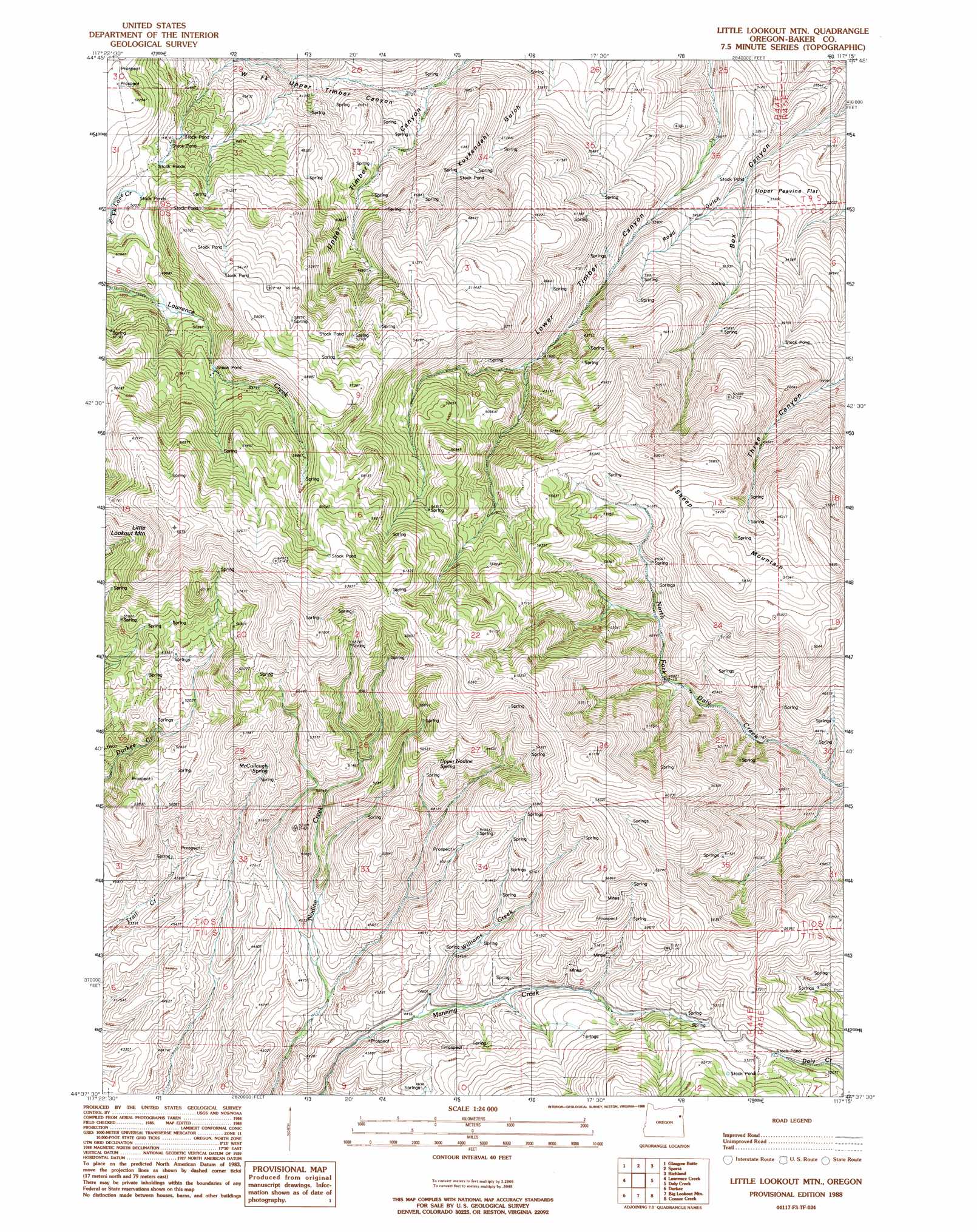
Little Lookout Mountain Topo Map Oregon
To zoom in, hover over the map of Little Lookout Mountain
USGS Topo Quad 44117f3 - 1:24,000 scale
| Topo Map Name: | Little Lookout Mountain |
| USGS Topo Quad ID: | 44117f3 |
| Print Size: | ca. 21 1/4" wide x 27" high |
| Southeast Coordinates: | 44.625° N latitude / 117.25° W longitude |
| Map Center Coordinates: | 44.6875° N latitude / 117.3125° W longitude |
| U.S. State: | OR |
| Filename: | o44117f3.jpg |
| Download Map JPG Image: | Little Lookout Mountain topo map 1:24,000 scale |
| Map Type: | Topographic |
| Topo Series: | 7.5´ |
| Map Scale: | 1:24,000 |
| Source of Map Images: | United States Geological Survey (USGS) |
| Alternate Map Versions: |
Little Lookout Mtn OR 1988, updated 1988 Download PDF Buy paper map Little Lookout Mountain OR 2011 Download PDF Buy paper map Little Lookout Mountain OR 2014 Download PDF Buy paper map |
1:24,000 Topo Quads surrounding Little Lookout Mountain
Sawtooth Ridge |
Balm Creek Reservoir |
Sparta Butte |
Jimtown |
Halfway |
Keating |
Glasgow Butte |
Sparta |
Richland |
Posy Valley |
Oxman |
Lawrence Creek |
Little Lookout Mountain |
Daly Creek |
Sturgill Creek |
Lost Basin |
Durkee |
Big Lookout Mountain |
Connor Creek |
Monroe Butte |
Mormon Basin |
Rye Valley |
Lime |
Henley Basin |
Olds Ferry Ne |
> Back to 44117e1 at 1:100,000 scale
> Back to 44116a1 at 1:250,000 scale
> Back to U.S. Topo Maps home
Little Lookout Mountain topo map: Gazetteer
Little Lookout Mountain: Flats
Upper Peavine Flat elevation 1043m 3421′Little Lookout Mountain: Springs
Buckley Spring elevation 1025m 3362′McCullough Spring elevation 1601m 5252′
Upper Nodine Spring elevation 1595m 5232′
Little Lookout Mountain: Streams
Williams Creek elevation 1348m 4422′Wood Creek elevation 1400m 4593′
Little Lookout Mountain: Summits
Little Lookout Mountain elevation 2029m 6656′Sheep Mountain elevation 1777m 5830′
Little Lookout Mountain: Valleys
Road Gulch elevation 940m 3083′West Fork Upper Timber Canyon elevation 1058m 3471′
Little Lookout Mountain digital topo map on disk
Buy this Little Lookout Mountain topo map showing relief, roads, GPS coordinates and other geographical features, as a high-resolution digital map file on DVD: