Pembine Topo Map Wisconsin
To zoom in, hover over the map of Pembine
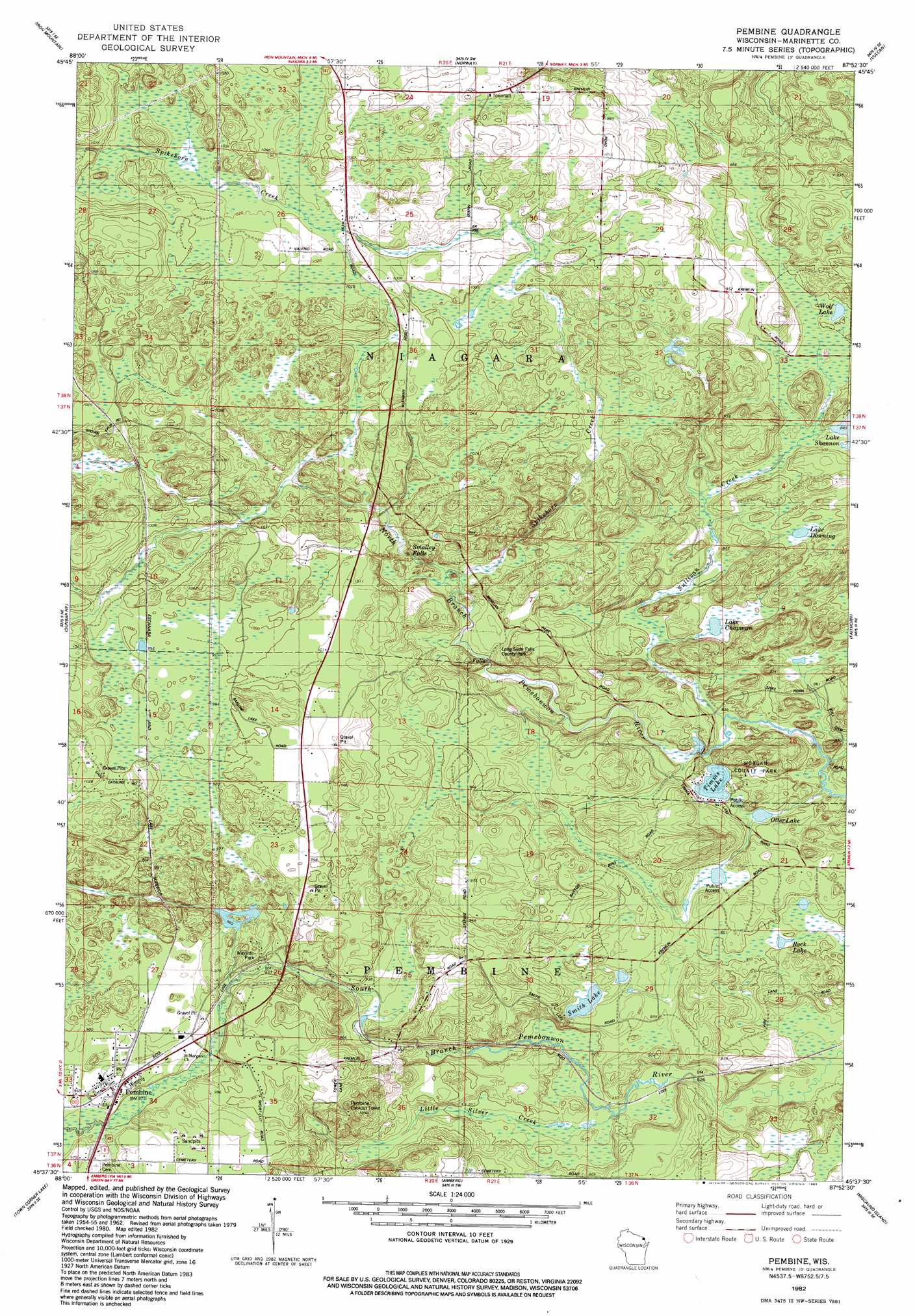
USGS Topo Quad 45087f8 - 1:24,000 scale
| Topo Map Name: | Pembine |
| USGS Topo Quad ID: | 45087f8 |
| Print Size: | ca. 21 1/4" wide x 27" high |
| Southeast Coordinates: | 45.625° N latitude / 87.875° W longitude |
| Map Center Coordinates: | 45.6875° N latitude / 87.9375° W longitude |
| U.S. State: | WI |
| Filename: | o45087f8.jpg |
| Download Map JPG Image: | Pembine topo map 1:24,000 scale |
| Map Type: | Topographic |
| Topo Series: | 7.5´ |
| Map Scale: | 1:24,000 |
| Source of Map Images: | United States Geological Survey (USGS) |
| Alternate Map Versions: |
Pembine WI 1982, updated 1983 Download PDF Buy paper map Pembine WI 2010 Download PDF Buy paper map Pembine WI 2013 Download PDF Buy paper map Pembine WI 2016 Download PDF Buy paper map |
1:24,000 Topo Quads surrounding Pembine
Florence East |
Randville |
Carney Lake |
Felch |
Foster City |
Iron Mountain Sw |
Iron Mountain |
Norway |
Vulcan |
Waucedah |
Dunbar |
Dunbar Ne |
Pembine |
Faithorn |
Cunard |
Twelvefoot Falls |
Town Corner Lake |
Amberg |
Miscauno Island |
Banat |
Lehman Lake |
Athelstane |
Wausaukee North |
Resort Lake |
Swanson |
> Back to 45087e1 at 1:100,000 scale
> Back to 45086a1 at 1:250,000 scale
> Back to U.S. Topo Maps home
Pembine topo map: Gazetteer
Pembine: Dams
Joe Panis, Jr E4083 Dam elevation 301m 987′Pembine: Falls
Long Slide Falls elevation 278m 912′Smalley Falls elevation 295m 967′
Pembine: Lakes
Lake Chapman elevation 258m 846′Lake Downing elevation 272m 892′
Otter Lake elevation 255m 836′
Rock Lake elevation 258m 846′
Smith Lake elevation 264m 866′
Timms Lake elevation 258m 846′
Wolf Lake elevation 273m 895′
Pembine: Parks
Long Slide Falls County Park elevation 281m 921′Morgan County Park elevation 269m 882′
Pembine: Populated Places
Pembine elevation 296m 971′Pembine: Reservoirs
1.35 Reservoir elevation 301m 987′Pembine: Streams
Little Silver Creek elevation 250m 820′Spikehorn Creek elevation 284m 931′
Sullivan Creek elevation 253m 830′
Pembine digital topo map on disk
Buy this Pembine topo map showing relief, roads, GPS coordinates and other geographical features, as a high-resolution digital map file on DVD: