Kirkpatrick Hill Topo Map Montana
To zoom in, hover over the map of Kirkpatrick Hill
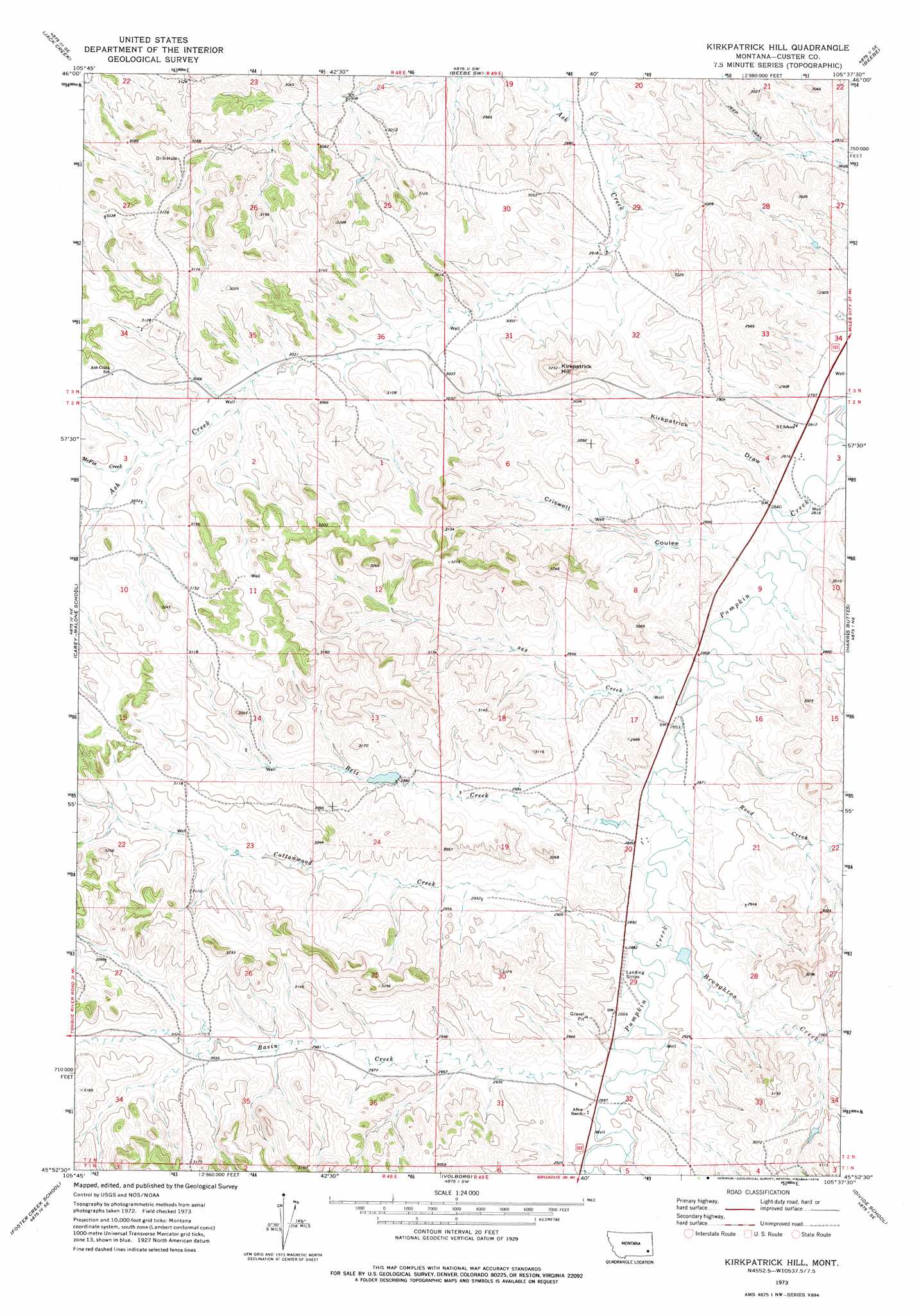
USGS Topo Quad 45105h6 - 1:24,000 scale
| Topo Map Name: | Kirkpatrick Hill |
| USGS Topo Quad ID: | 45105h6 |
| Print Size: | ca. 21 1/4" wide x 27" high |
| Southeast Coordinates: | 45.875° N latitude / 105.625° W longitude |
| Map Center Coordinates: | 45.9375° N latitude / 105.6875° W longitude |
| U.S. State: | MT |
| Filename: | o45105h6.jpg |
| Download Map JPG Image: | Kirkpatrick Hill topo map 1:24,000 scale |
| Map Type: | Topographic |
| Topo Series: | 7.5´ |
| Map Scale: | 1:24,000 |
| Source of Map Images: | United States Geological Survey (USGS) |
| Alternate Map Versions: |
Kirkpatrick Hill MT 1973, updated 1976 Download PDF Buy paper map Kirkpatrick Hill MT 2011 Download PDF Buy paper map Kirkpatrick Hill MT 2014 Download PDF Buy paper map |
1:24,000 Topo Quads surrounding Kirkpatrick Hill
Jack Creek Nw |
Circle L Creek |
Horse Creek |
First Creek |
Loaf Of Bread Butte |
Garland School |
Jack Creek |
Beebe Sw |
Beebe |
Miles City Creek |
Fourmile Creek |
Carey-Malone School |
Kirkpatrick Hill |
Harris Buttes |
Saddle Horse Butte |
North Stacey School |
Foster Creek School |
Volborg |
Divide School |
Witcher Reservoir |
Stacey |
Elk Ridge |
Box Elder Creek |
Coalwood |
Johnnie Creek |
> Back to 45105e1 at 1:100,000 scale
> Back to 45104a1 at 1:250,000 scale
> Back to U.S. Topo Maps home
Kirkpatrick Hill topo map: Gazetteer
Kirkpatrick Hill: Dams
Allan Number 2 Dam elevation 885m 2903′Allen Number 5 Dam elevation 908m 2979′
Kirkpatrick Hill: Streams
Basin Creek elevation 878m 2880′Betz Creek elevation 872m 2860′
Broughton Creek elevation 872m 2860′
Cottonwood Creek elevation 873m 2864′
Harris Creek elevation 860m 2821′
McFee Creek elevation 934m 3064′
Nine Hundred and Sixty Nine Creek elevation 867m 2844′
Road Creek elevation 871m 2857′
Kirkpatrick Hill: Summits
Kirkpatrick Hill elevation 993m 3257′Kirkpatrick Hill: Valleys
Criswell Coulee elevation 869m 2851′Kirkpatrick Draw elevation 866m 2841′
Kirkpatrick Hill: Wells
02N48E02BABA01 Well elevation 922m 3024′02N49E04AACD01 Well elevation 857m 2811′
02N49E04CADC01 Well elevation 880m 2887′
03N48E27CABD01 Well elevation 934m 3064′
Kirkpatrick Hill digital topo map on disk
Buy this Kirkpatrick Hill topo map showing relief, roads, GPS coordinates and other geographical features, as a high-resolution digital map file on DVD:
Eastern Montana & Western North Dakota
Buy digital topo maps: Eastern Montana & Western North Dakota